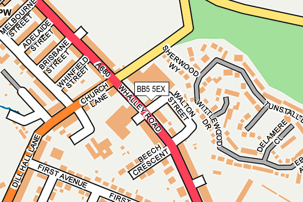
BB5 5EX is located in the Altham electoral ward, within the local authority district of Hyndburn and the English Parliamentary constituency of Hyndburn. The Sub Integrated Care Board (ICB) Location is NHS Lancashire and South Cumbria ICB - 01A and the police force is Lancashire. This postcode has been in use since June 1981.


GetTheData
Source: OS OpenMap – Local (Ordnance Survey)
Source: OS VectorMap District (Ordnance Survey)
Licence: Open Government Licence (requires attribution)
| Easting | 375410 |
| Northing | 430174 |
| Latitude | 53.767326 |
| Longitude | -2.374529 |
GetTheData
Source: Open Postcode Geo
Licence: Open Government Licence
| Country | England |
| Postcode District | BB5 |
➜ See where BB5 is on a map ➜ Where is Church? | |
GetTheData
Source: Land Registry Price Paid Data
Licence: Open Government Licence
Elevation or altitude of BB5 5EX as distance above sea level:
| Metres | Feet | |
|---|---|---|
| Elevation | 150m | 492ft |
Elevation is measured from the approximate centre of the postcode, to the nearest point on an OS contour line from OS Terrain 50, which has contour spacing of ten vertical metres.
➜ How high above sea level am I? Find the elevation of your current position using your device's GPS.
GetTheData
Source: Open Postcode Elevation
Licence: Open Government Licence
| Ward | Altham |
| Constituency | Hyndburn |
GetTheData
Source: ONS Postcode Database
Licence: Open Government Licence
| Whinney Hill Road (Whalley Road) | Enfield | 33m |
| Whalley Road (Church Lane) | Enfield | 135m |
| Whinney Hill Road (Whalley Road) | Enfield | 167m |
| First Avenue | Enfield | 210m |
| First Avenue | Enfield | 218m |
| Accrington Station | 1.6km |
| Huncoat Station | 1.8km |
| Church & Oswaldtwistle Station | 2.2km |
GetTheData
Source: NaPTAN
Licence: Open Government Licence
GetTheData
Source: ONS Postcode Database
Licence: Open Government Licence


➜ Get more ratings from the Food Standards Agency
GetTheData
Source: Food Standards Agency
Licence: FSA terms & conditions
| Last Collection | |||
|---|---|---|---|
| Location | Mon-Fri | Sat | Distance |
| Clayton Le Moors Post Office | 16:45 | 12:15 | 834m |
| 216 Willows Lane | 17:00 | 12:45 | 1,362m |
| 52 Lancaster Avenue | 16:15 | 11:15 | 2,500m |
GetTheData
Source: Dracos
Licence: Creative Commons Attribution-ShareAlike
The below table lists the International Territorial Level (ITL) codes (formerly Nomenclature of Territorial Units for Statistics (NUTS) codes) and Local Administrative Units (LAU) codes for BB5 5EX:
| ITL 1 Code | Name |
|---|---|
| TLD | North West (England) |
| ITL 2 Code | Name |
| TLD4 | Lancashire |
| ITL 3 Code | Name |
| TLD46 | East Lancashire |
| LAU 1 Code | Name |
| E07000120 | Hyndburn |
GetTheData
Source: ONS Postcode Directory
Licence: Open Government Licence
The below table lists the Census Output Area (OA), Lower Layer Super Output Area (LSOA), and Middle Layer Super Output Area (MSOA) for BB5 5EX:
| Code | Name | |
|---|---|---|
| OA | E00127063 | |
| LSOA | E01025033 | Hyndburn 002B |
| MSOA | E02005213 | Hyndburn 002 |
GetTheData
Source: ONS Postcode Directory
Licence: Open Government Licence
| BB5 5DS | Walton Street | 56m |
| BB5 5DB | Sherwood Way | 80m |
| BB5 5DP | Hallam Street | 86m |
| BB5 5EF | Whalley Road | 92m |
| BB5 5DJ | Wittlewood Drive | 107m |
| BB5 5EQ | Beech Crescent | 123m |
| BB5 5DH | Whalley Road | 130m |
| BB5 4DE | Church Lane | 136m |
| BB5 5EU | Ringwood Close | 161m |
| BB5 5DZ | Wareham Close | 180m |
GetTheData
Source: Open Postcode Geo; Land Registry Price Paid Data
Licence: Open Government Licence