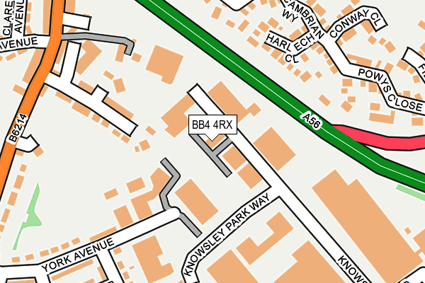
BB4 4RX is located in the Greenfield electoral ward, within the local authority district of Rossendale and the English Parliamentary constituency of Hyndburn. The Sub Integrated Care Board (ICB) Location is NHS Lancashire and South Cumbria ICB - 01A and the police force is Lancashire. This postcode has been in use since January 1983.


GetTheData
Source: OS OpenMap – Local (Ordnance Survey)
Source: OS VectorMap District (Ordnance Survey)
Licence: Open Government Licence (requires attribution)
| Easting | 378703 |
| Northing | 422021 |
| Latitude | 53.694193 |
| Longitude | -2.324008 |
GetTheData
Source: Open Postcode Geo
Licence: Open Government Licence
| Country | England |
| Postcode District | BB4 |
➜ See where BB4 is on a map ➜ Where is Haslingden? | |
GetTheData
Source: Land Registry Price Paid Data
Licence: Open Government Licence
Elevation or altitude of BB4 4RX as distance above sea level:
| Metres | Feet | |
|---|---|---|
| Elevation | 200m | 656ft |
Elevation is measured from the approximate centre of the postcode, to the nearest point on an OS contour line from OS Terrain 50, which has contour spacing of ten vertical metres.
➜ How high above sea level am I? Find the elevation of your current position using your device's GPS.
GetTheData
Source: Open Postcode Elevation
Licence: Open Government Licence
| Ward | Greenfield |
| Constituency | Hyndburn |
GetTheData
Source: ONS Postcode Database
Licence: Open Government Licence
| Knowsley Park Way | Broadway | 200m |
| Mayfield Avenue (Helmshore Road) | Flax Moss | 265m |
| Mayfield Avenue (Helmshore Road) | Flax Moss | 266m |
| Knowsley Road | Broadway | 299m |
| Knowsley Road | Broadway | 301m |
GetTheData
Source: NaPTAN
Licence: Open Government Licence
Estimated total energy consumption in BB4 4RX by fuel type, 2015.
| Consumption (kWh) | 66,786 |
|---|---|
| Meter count | 8 |
| Mean (kWh/meter) | 8,348 |
| Median (kWh/meter) | 6,753 |
GetTheData
Source: Postcode level gas estimates: 2015 (experimental)
Source: Postcode level electricity estimates: 2015 (experimental)
Licence: Open Government Licence
GetTheData
Source: ONS Postcode Database
Licence: Open Government Licence


➜ Get more ratings from the Food Standards Agency
GetTheData
Source: Food Standards Agency
Licence: FSA terms & conditions
| Last Collection | |||
|---|---|---|---|
| Location | Mon-Fri | Sat | Distance |
| Sidmouth Avenue | 17:30 | 12:15 | 728m |
| Haslingden Post Office | 17:15 | 12:00 | 1,161m |
| Railway Station | 16:45 | 12:30 | 2,307m |
GetTheData
Source: Dracos
Licence: Creative Commons Attribution-ShareAlike
The below table lists the International Territorial Level (ITL) codes (formerly Nomenclature of Territorial Units for Statistics (NUTS) codes) and Local Administrative Units (LAU) codes for BB4 4RX:
| ITL 1 Code | Name |
|---|---|
| TLD | North West (England) |
| ITL 2 Code | Name |
| TLD4 | Lancashire |
| ITL 3 Code | Name |
| TLD46 | East Lancashire |
| LAU 1 Code | Name |
| E07000125 | Rossendale |
GetTheData
Source: ONS Postcode Directory
Licence: Open Government Licence
The below table lists the Census Output Area (OA), Lower Layer Super Output Area (LSOA), and Middle Layer Super Output Area (MSOA) for BB4 4RX:
| Code | Name | |
|---|---|---|
| OA | E00128740 | |
| LSOA | E01025363 | Rossendale 002A |
| MSOA | E02005279 | Rossendale 002 |
GetTheData
Source: ONS Postcode Directory
Licence: Open Government Licence
| BB4 4DS | Dean Road | 167m |
| BB4 6TL | Harlech Close | 177m |
| BB4 4DL | Helmcroft | 184m |
| BB4 6TJ | Beaumaris Close | 201m |
| BB4 6TF | Rhuddlan Close | 210m |
| BB4 6TN | Cambrian Way | 230m |
| BB4 4DJ | Helmshore Road | 250m |
| BB4 6TG | Criccieth Close | 264m |
| BB4 4HE | Chester Crescent | 267m |
| BB4 4HG | York Avenue | 268m |
GetTheData
Source: Open Postcode Geo; Land Registry Price Paid Data
Licence: Open Government Licence