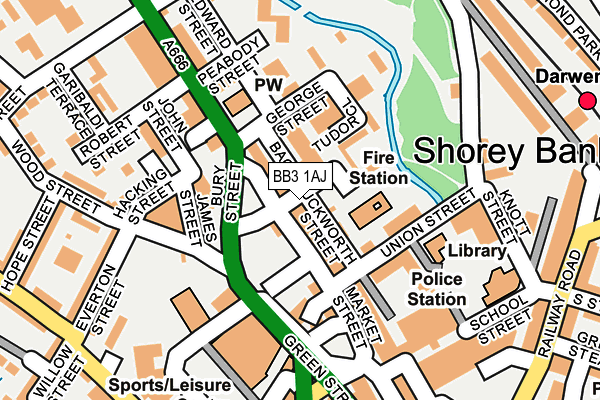
BB3 1AJ is located in the Darwen East electoral ward, within the unitary authority of Blackburn with Darwen and the English Parliamentary constituency of Rossendale and Darwen. The Sub Integrated Care Board (ICB) Location is NHS Lancashire and South Cumbria ICB - 00Q and the police force is Lancashire. This postcode has been in use since June 2017.


GetTheData
Source: OS OpenMap – Local (Ordnance Survey)
Source: OS VectorMap District (Ordnance Survey)
Licence: Open Government Licence (requires attribution)
| Easting | 369122 |
| Northing | 422433 |
| Latitude | 53.697431 |
| Longitude | -2.469141 |
GetTheData
Source: Open Postcode Geo
Licence: Open Government Licence
| Country | England |
| Postcode District | BB3 |
➜ See where BB3 is on a map ➜ Where is Darwen? | |
GetTheData
Source: Land Registry Price Paid Data
Licence: Open Government Licence
| Ward | Darwen East |
| Constituency | Rossendale And Darwen |
GetTheData
Source: ONS Postcode Database
Licence: Open Government Licence
| Duckworth Street (Market Street) | Darwen | 72m |
| Hacking Street (Bury Street) | Darwen | 81m |
| Circus (Market Street) | Darwen | 202m |
| Town Centre (Croft Street) | Darwen | 203m |
| Health Centre (Police Street) | Darwen | 217m |
| Darwen Station | 0.3km |
| Mill Hill (Lancs) Station | 4.7km |
| Cherry Tree Station | 5.1km |
GetTheData
Source: NaPTAN
Licence: Open Government Licence
| Percentage of properties with Next Generation Access | 100.0% |
| Percentage of properties with Superfast Broadband | 100.0% |
| Percentage of properties with Ultrafast Broadband | 0.0% |
| Percentage of properties with Full Fibre Broadband | 0.0% |
Superfast Broadband is between 30Mbps and 300Mbps
Ultrafast Broadband is > 300Mbps
| Percentage of properties unable to receive 2Mbps | 0.0% |
| Percentage of properties unable to receive 5Mbps | 0.0% |
| Percentage of properties unable to receive 10Mbps | 0.0% |
| Percentage of properties unable to receive 30Mbps | 0.0% |
GetTheData
Source: Ofcom
Licence: Ofcom Terms of Use (requires attribution)
GetTheData
Source: ONS Postcode Database
Licence: Open Government Licence


➜ Get more ratings from the Food Standards Agency
GetTheData
Source: Food Standards Agency
Licence: FSA terms & conditions
| Last Collection | |||
|---|---|---|---|
| Location | Mon-Fri | Sat | Distance |
| 68 Birch Hall Avenue | 16:30 | 11:00 | 354m |
| Royal Arms | 12:00 | 09:00 | 2,772m |
| Moorgate | 16:15 | 11:15 | 4,013m |
GetTheData
Source: Dracos
Licence: Creative Commons Attribution-ShareAlike
The below table lists the International Territorial Level (ITL) codes (formerly Nomenclature of Territorial Units for Statistics (NUTS) codes) and Local Administrative Units (LAU) codes for BB3 1AJ:
| ITL 1 Code | Name |
|---|---|
| TLD | North West (England) |
| ITL 2 Code | Name |
| TLD4 | Lancashire |
| ITL 3 Code | Name |
| TLD41 | Blackburn with Darwen |
| LAU 1 Code | Name |
| E06000008 | Blackburn with Darwen |
GetTheData
Source: ONS Postcode Directory
Licence: Open Government Licence
The below table lists the Census Output Area (OA), Lower Layer Super Output Area (LSOA), and Middle Layer Super Output Area (MSOA) for BB3 1AJ:
| Code | Name | |
|---|---|---|
| OA | E00063757 | |
| LSOA | E01012649 | Blackburn with Darwen 016A |
| MSOA | E02002630 | Blackburn with Darwen 016 |
GetTheData
Source: ONS Postcode Directory
Licence: Open Government Licence
| BB3 1AU | Duckworth Street | 14m |
| BB3 1DP | Stuart Close | 68m |
| BB3 0DA | Union Street | 75m |
| BB3 0GX | Back Duckworth Street | 79m |
| BB3 1PX | Duckworth Street | 108m |
| BB3 0DQ | George Street | 115m |
| BB3 1PU | Wellington Fold | 124m |
| BB3 1AF | Police Street | 158m |
| BB3 1AZ | Market Street | 161m |
| BB3 1BE | School Street | 176m |
GetTheData
Source: Open Postcode Geo; Land Registry Price Paid Data
Licence: Open Government Licence