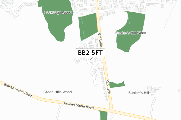
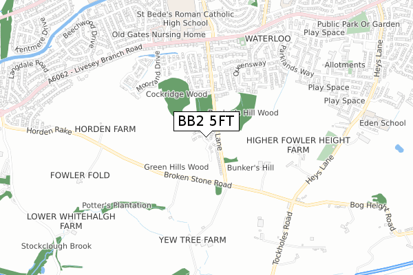
BB2 5FT is located in the Livesey with Pleasington electoral ward, within the unitary authority of Blackburn with Darwen and the English Parliamentary constituency of Blackburn. The Sub Integrated Care Board (ICB) Location is NHS Lancashire and South Cumbria ICB - 00Q and the police force is Lancashire. This postcode has been in use since December 2019.


GetTheData
Source: OS Open Zoomstack (Ordnance Survey)
Licence: Open Government Licence (requires attribution)
Attribution: Contains OS data © Crown copyright and database right 2024
Source: Open Postcode Geo
Licence: Open Government Licence (requires attribution)
Attribution: Contains OS data © Crown copyright and database right 2024; Contains Royal Mail data © Royal Mail copyright and database right 2024; Source: Office for National Statistics licensed under the Open Government Licence v.3.0
| Easting | 366103 |
| Northing | 425119 |
| Latitude | 53.721384 |
| Longitude | -2.515158 |
GetTheData
Source: Open Postcode Geo
Licence: Open Government Licence
| Country | England |
| Postcode District | BB2 |
➜ See where BB2 is on a map ➜ Where is Blackburn? | |
GetTheData
Source: Land Registry Price Paid Data
Licence: Open Government Licence
| Ward | Livesey With Pleasington |
| Constituency | Blackburn |
GetTheData
Source: ONS Postcode Database
Licence: Open Government Licence
20, HAWTHORN LANE, BLACKBURN, BB2 5FT 2021 30 JUN £399,995 |
22, HAWTHORN LANE, BLACKBURN, BB2 5FT 2021 28 JUN £254,995 |
18, HAWTHORN LANE, BLACKBURN, BB2 5FT 2021 25 JUN £306,995 |
21, HAWTHORN LANE, BLACKBURN, BB2 5FT 2021 11 JUN £299,995 |
19, HAWTHORN LANE, BLACKBURN, BB2 5FT 2021 12 APR £309,995 |
17, HAWTHORN LANE, BLACKBURN, BB2 5FT 2021 12 FEB £369,995 |
5, HAWTHORN LANE, BLACKBURN, BB2 5FT 2020 11 DEC £319,995 |
9, HAWTHORN LANE, BLACKBURN, BB2 5FT 2020 4 DEC £279,995 |
8, HAWTHORN LANE, BLACKBURN, BB2 5FT 2020 27 NOV £384,995 |
12, HAWTHORN LANE, BLACKBURN, BB2 5FT 2020 20 NOV £279,995 |
GetTheData
Source: HM Land Registry Price Paid Data
Licence: Contains HM Land Registry data © Crown copyright and database right 2024. This data is licensed under the Open Government Licence v3.0.
| Park Brow (Gib Lane) | Bank Hey | 172m |
| Gib Lane (Livesey Branch Road) | Waterloo | 577m |
| Gib Lane (Livesey Branch Road) | Waterloo | 600m |
| Pinewood (Livesey Branch Road) | Cherry Tree | 654m |
| Pinewood (Livesey Branch Road) | Cherry Tree | 659m |
| Cherry Tree Station | 1.3km |
| Mill Hill (Lancs) Station | 1.8km |
| Pleasington Station | 2.2km |
GetTheData
Source: NaPTAN
Licence: Open Government Licence
GetTheData
Source: ONS Postcode Database
Licence: Open Government Licence


➜ Get more ratings from the Food Standards Agency
GetTheData
Source: Food Standards Agency
Licence: FSA terms & conditions
| Last Collection | |||
|---|---|---|---|
| Location | Mon-Fri | Sat | Distance |
| Beechwood | 16:45 | 11:30 | 768m |
| Horden View | 16:45 | 11:45 | 1,129m |
| Woodlands Avenue | 17:00 | 12:00 | 1,218m |
GetTheData
Source: Dracos
Licence: Creative Commons Attribution-ShareAlike
The below table lists the International Territorial Level (ITL) codes (formerly Nomenclature of Territorial Units for Statistics (NUTS) codes) and Local Administrative Units (LAU) codes for BB2 5FT:
| ITL 1 Code | Name |
|---|---|
| TLD | North West (England) |
| ITL 2 Code | Name |
| TLD4 | Lancashire |
| ITL 3 Code | Name |
| TLD41 | Blackburn with Darwen |
| LAU 1 Code | Name |
| E06000008 | Blackburn with Darwen |
GetTheData
Source: ONS Postcode Directory
Licence: Open Government Licence
The below table lists the Census Output Area (OA), Lower Layer Super Output Area (LSOA), and Middle Layer Super Output Area (MSOA) for BB2 5FT:
| Code | Name | |
|---|---|---|
| OA | E00063578 | |
| LSOA | E01012609 | Blackburn with Darwen 010B |
| MSOA | E02002624 | Blackburn with Darwen 010 |
GetTheData
Source: ONS Postcode Directory
Licence: Open Government Licence
| BB2 5BP | Gib Lane | 316m |
| BB2 5BT | Risedale Grove | 359m |
| BB2 4RN | Higher House Close | 487m |
| BB2 4QP | Woodside Grove | 488m |
| BB2 4QT | Queensway | 533m |
| BB2 4QN | Meadowrise | 536m |
| BB3 0LL | Broken Stone Road | 543m |
| BB2 5BS | Ernlouen Close | 554m |
| BB2 5JP | Broken Stone Road | 563m |
| BB2 5BX | Livesey Branch Road | 574m |
GetTheData
Source: Open Postcode Geo; Land Registry Price Paid Data
Licence: Open Government Licence