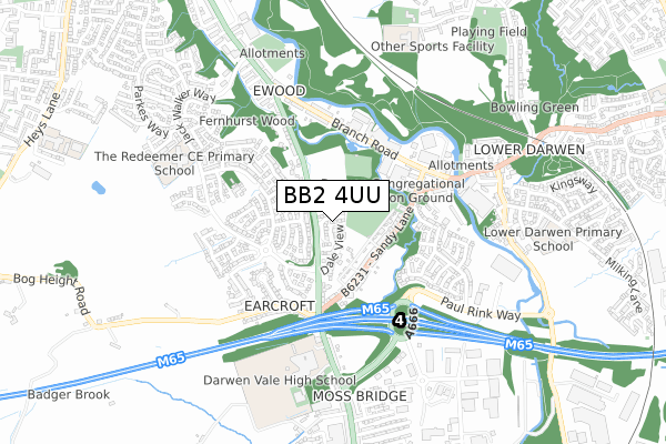
BB2 4UU is located in the Blackburn South & Lower Darwen electoral ward, within the unitary authority of Blackburn with Darwen and the English Parliamentary constituency of Rossendale and Darwen. The Sub Integrated Care Board (ICB) Location is NHS Lancashire and South Cumbria ICB - 00Q and the police force is Lancashire. This postcode has been in use since November 2017.


GetTheData
Source: OS Open Zoomstack (Ordnance Survey)
Licence: Open Government Licence (requires attribution)
Attribution: Contains OS data © Crown copyright and database right 2024
Source: Open Postcode Geo
Licence: Open Government Licence (requires attribution)
Attribution: Contains OS data © Crown copyright and database right 2024; Contains Royal Mail data © Royal Mail copyright and database right 2024; Source: Office for National Statistics licensed under the Open Government Licence v.3.0
| Easting | 368216 |
| Northing | 424929 |
| Latitude | 53.719810 |
| Longitude | -2.483119 |
GetTheData
Source: Open Postcode Geo
Licence: Open Government Licence
| Country | England |
| Postcode District | BB2 |
➜ See where BB2 is on a map ➜ Where is Blackburn? | |
GetTheData
Source: Land Registry Price Paid Data
Licence: Open Government Licence
| Ward | Blackburn South & Lower Darwen |
| Constituency | Rossendale And Darwen |
GetTheData
Source: ONS Postcode Database
Licence: Open Government Licence
28, FERGUS MANOR, BLACKBURN, BB2 4UU 2018 11 OCT £249,950 |
20, FERGUS MANOR, BLACKBURN, BB2 4UU 2018 14 SEP £244,950 |
27, FERGUS MANOR, BLACKBURN, BB2 4UU 2018 29 JUN £246,200 |
23, FERGUS MANOR, BLACKBURN, BB2 4UU 2018 29 JUN £234,950 |
25, FERGUS MANOR, BLACKBURN, BB2 4UU 2018 29 JUN £244,950 |
11, FERGUS MANOR, BLACKBURN, BB2 4UU 2018 18 JUN £219,950 |
17, FERGUS MANOR, BLACKBURN, BB2 4UU 2018 15 JUN £221,200 |
15, FERGUS MANOR, BLACKBURN, BB2 4UU 2018 8 JUN £244,950 |
18, FERGUS MANOR, BLACKBURN, BB2 4UU 2018 1 JUN £284,950 |
9, FERGUS MANOR, BLACKBURN, BB2 4UU 2018 18 MAY £246,200 |
GetTheData
Source: HM Land Registry Price Paid Data
Licence: Contains HM Land Registry data © Crown copyright and database right 2024. This data is licensed under the Open Government Licence v3.0.
| Oakdale (Bolton Road) | Ewood | 123m |
| Cravens Brow (Blackburn Road) | Ewood | 159m |
| Cravens Brow (Bolton Road) | Ewood | 209m |
| Boundary (Bolton Road) | Ewood | 239m |
| Boundary (Bolton Road) | Ewood | 270m |
| Mill Hill (Lancs) Station | 2.1km |
| Darwen Station | 2.7km |
| Cherry Tree Station | 2.7km |
GetTheData
Source: NaPTAN
Licence: Open Government Licence
| Percentage of properties with Next Generation Access | 100.0% |
| Percentage of properties with Superfast Broadband | 100.0% |
| Percentage of properties with Ultrafast Broadband | 100.0% |
| Percentage of properties with Full Fibre Broadband | 100.0% |
Superfast Broadband is between 30Mbps and 300Mbps
Ultrafast Broadband is > 300Mbps
| Percentage of properties unable to receive 2Mbps | 0.0% |
| Percentage of properties unable to receive 5Mbps | 0.0% |
| Percentage of properties unable to receive 10Mbps | 0.0% |
| Percentage of properties unable to receive 30Mbps | 0.0% |
GetTheData
Source: Ofcom
Licence: Ofcom Terms of Use (requires attribution)
GetTheData
Source: ONS Postcode Database
Licence: Open Government Licence


➜ Get more ratings from the Food Standards Agency
GetTheData
Source: Food Standards Agency
Licence: FSA terms & conditions
| Last Collection | |||
|---|---|---|---|
| Location | Mon-Fri | Sat | Distance |
| Moorgate | 16:15 | 11:15 | 1,440m |
| Old Bank Lane | 16:15 | 11:00 | 2,007m |
| 10 Bank Top | 16:45 | 13:15 | 2,055m |
GetTheData
Source: Dracos
Licence: Creative Commons Attribution-ShareAlike
The below table lists the International Territorial Level (ITL) codes (formerly Nomenclature of Territorial Units for Statistics (NUTS) codes) and Local Administrative Units (LAU) codes for BB2 4UU:
| ITL 1 Code | Name |
|---|---|
| TLD | North West (England) |
| ITL 2 Code | Name |
| TLD4 | Lancashire |
| ITL 3 Code | Name |
| TLD41 | Blackburn with Darwen |
| LAU 1 Code | Name |
| E06000008 | Blackburn with Darwen |
GetTheData
Source: ONS Postcode Directory
Licence: Open Government Licence
The below table lists the Census Output Area (OA), Lower Layer Super Output Area (LSOA), and Middle Layer Super Output Area (MSOA) for BB2 4UU:
| Code | Name | |
|---|---|---|
| OA | E00063520 | |
| LSOA | E01012599 | Blackburn with Darwen 013D |
| MSOA | E02002627 | Blackburn with Darwen 013 |
GetTheData
Source: ONS Postcode Directory
Licence: Open Government Licence
| BB2 4LE | Dale View | 118m |
| BB2 4HH | The Glade | 140m |
| BB2 4JB | Cravens Heath | 150m |
| BB2 4LB | Cravens Avenue | 179m |
| BB2 4HN | The Glen | 186m |
| BB3 0PN | Sandy Lane | 186m |
| BB2 4HQ | Lea Drive | 189m |
| BB2 4LH | Cravens Hollow | 199m |
| BB3 0PL | Sandy Lane | 217m |
| BB2 4LF | Arbour Drive | 250m |
GetTheData
Source: Open Postcode Geo; Land Registry Price Paid Data
Licence: Open Government Licence