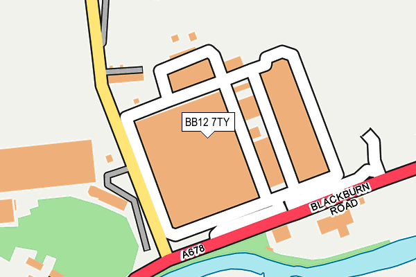
BB12 7TY is located in the East Whalley, Read & Simonstone electoral ward, within the local authority district of Ribble Valley and the English Parliamentary constituency of Ribble Valley. The Sub Integrated Care Board (ICB) Location is NHS Lancashire and South Cumbria ICB - 01A and the police force is Lancashire. This postcode has been in use since January 2006.


GetTheData
Source: OS OpenMap – Local (Ordnance Survey)
Source: OS VectorMap District (Ordnance Survey)
Licence: Open Government Licence (requires attribution)
| Easting | 377602 |
| Northing | 433424 |
| Latitude | 53.796650 |
| Longitude | -2.341513 |
GetTheData
Source: Open Postcode Geo
Licence: Open Government Licence
| Country | England |
| Postcode District | BB12 |
➜ See where BB12 is on a map ➜ Where is Simonstone? | |
GetTheData
Source: Land Registry Price Paid Data
Licence: Open Government Licence
Elevation or altitude of BB12 7TY as distance above sea level:
| Metres | Feet | |
|---|---|---|
| Elevation | 70m | 230ft |
Elevation is measured from the approximate centre of the postcode, to the nearest point on an OS contour line from OS Terrain 50, which has contour spacing of ten vertical metres.
➜ How high above sea level am I? Find the elevation of your current position using your device's GPS.
GetTheData
Source: Open Postcode Elevation
Licence: Open Government Licence
| Ward | East Whalley, Read & Simonstone |
| Constituency | Ribble Valley |
GetTheData
Source: ONS Postcode Database
Licence: Open Government Licence
| Simonstone Lane (Blackburn Road) | Altham | 148m |
| Sunnybank (Blackburn Road) | Altham | 149m |
| Simonstone Business Park (Blackburn Road) | Altham | 153m |
| Shuttleworth Mead (Blackburn Road) | Padiham | 488m |
| Shuttleworth Mead (Blackburn Road) | Padiham | 613m |
| Hapton Station | 2.3km |
| Huncoat Station | 2.8km |
| Rose Grove Station | 4km |
GetTheData
Source: NaPTAN
Licence: Open Government Licence
GetTheData
Source: ONS Postcode Database
Licence: Open Government Licence


➜ Get more ratings from the Food Standards Agency
GetTheData
Source: Food Standards Agency
Licence: FSA terms & conditions
| Last Collection | |||
|---|---|---|---|
| Location | Mon-Fri | Sat | Distance |
| Padiham Post Office | 18:00 | 11:00 | 1,874m |
| Burnley Road | 17:30 | 11:00 | 1,897m |
| 216 Willows Lane | 17:00 | 12:45 | 2,580m |
GetTheData
Source: Dracos
Licence: Creative Commons Attribution-ShareAlike
The below table lists the International Territorial Level (ITL) codes (formerly Nomenclature of Territorial Units for Statistics (NUTS) codes) and Local Administrative Units (LAU) codes for BB12 7TY:
| ITL 1 Code | Name |
|---|---|
| TLD | North West (England) |
| ITL 2 Code | Name |
| TLD4 | Lancashire |
| ITL 3 Code | Name |
| TLD45 | Mid Lancashire |
| LAU 1 Code | Name |
| E07000124 | Ribble Valley |
GetTheData
Source: ONS Postcode Directory
Licence: Open Government Licence
The below table lists the Census Output Area (OA), Lower Layer Super Output Area (LSOA), and Middle Layer Super Output Area (MSOA) for BB12 7TY:
| Code | Name | |
|---|---|---|
| OA | E00128615 | |
| LSOA | E01025340 | Ribble Valley 005B |
| MSOA | E02005274 | Ribble Valley 005 |
GetTheData
Source: ONS Postcode Directory
Licence: Open Government Licence
| BB12 7NN | Railway Terrace | 143m |
| BB12 7NQ | Blackburn Road | 143m |
| BB12 7NL | Altham Pumping Station | 287m |
| BB12 7NW | Bank Terrace | 320m |
| BB12 7NP | Simonstone Lane | 444m |
| BB12 7NR | Tunstead Avenue | 448m |
| BB5 5UP | Burnley Road | 459m |
| BB5 5UW | River Bank Terrace | 494m |
| BB5 5LE | Cornmill Court | 504m |
| BB5 5BY | Mercury Rise | 591m |
GetTheData
Source: Open Postcode Geo; Land Registry Price Paid Data
Licence: Open Government Licence