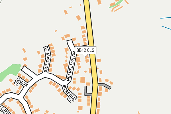
BB12 0LS lies on Ightenhill Park Lane in Burnley. BB12 0LS is located in the Whittlefield with Ightenhill electoral ward, within the local authority district of Burnley and the English Parliamentary constituency of Burnley. The Sub Integrated Care Board (ICB) Location is NHS Lancashire and South Cumbria ICB - 01A and the police force is Lancashire. This postcode has been in use since January 1980.


GetTheData
Source: OS OpenMap – Local (Ordnance Survey)
Source: OS VectorMap District (Ordnance Survey)
Licence: Open Government Licence (requires attribution)
| Easting | 382170 |
| Northing | 434053 |
| Latitude | 53.802467 |
| Longitude | -2.272202 |
GetTheData
Source: Open Postcode Geo
Licence: Open Government Licence
| Street | Ightenhill Park Lane |
| Town/City | Burnley |
| Country | England |
| Postcode District | BB12 |
➜ See where BB12 is on a map ➜ Where is Burnley? | |
GetTheData
Source: Land Registry Price Paid Data
Licence: Open Government Licence
Elevation or altitude of BB12 0LS as distance above sea level:
| Metres | Feet | |
|---|---|---|
| Elevation | 150m | 492ft |
Elevation is measured from the approximate centre of the postcode, to the nearest point on an OS contour line from OS Terrain 50, which has contour spacing of ten vertical metres.
➜ How high above sea level am I? Find the elevation of your current position using your device's GPS.
GetTheData
Source: Open Postcode Elevation
Licence: Open Government Licence
| Ward | Whittlefield With Ightenhill |
| Constituency | Burnley |
GetTheData
Source: ONS Postcode Database
Licence: Open Government Licence
2022 25 NOV £360,000 |
2014 2 JUN £235,000 |
2014 7 APR £224,950 |
2010 31 MAR £250,000 |
2007 15 JUN £250,000 |
2003 3 OCT £175,000 |
2000 16 FEB £117,500 |
GetTheData
Source: HM Land Registry Price Paid Data
Licence: Contains HM Land Registry data © Crown copyright and database right 2024. This data is licensed under the Open Government Licence v3.0.
| Dovedale Close (Lakeland Way) | Padiham Road | 378m |
| Castlerigg Drive (Lakeland Way) | Padiham Road | 469m |
| Castlerigg Drive (Lakeland Way) | Padiham Road | 469m |
| Westwood Road (Ighten Road) | Ightenhill | 563m |
| Grisedale Drive (Lakeland Way) | Padiham Road | 608m |
| Burnley Barracks Station | 1.6km |
| Rose Grove Station | 1.9km |
| Burnley Central Station | 2.1km |
GetTheData
Source: NaPTAN
Licence: Open Government Licence
| Percentage of properties with Next Generation Access | 100.0% |
| Percentage of properties with Superfast Broadband | 100.0% |
| Percentage of properties with Ultrafast Broadband | 100.0% |
| Percentage of properties with Full Fibre Broadband | 0.0% |
Superfast Broadband is between 30Mbps and 300Mbps
Ultrafast Broadband is > 300Mbps
| Percentage of properties unable to receive 2Mbps | 0.0% |
| Percentage of properties unable to receive 5Mbps | 0.0% |
| Percentage of properties unable to receive 10Mbps | 0.0% |
| Percentage of properties unable to receive 30Mbps | 0.0% |
GetTheData
Source: Ofcom
Licence: Ofcom Terms of Use (requires attribution)
GetTheData
Source: ONS Postcode Database
Licence: Open Government Licence


➜ Get more ratings from the Food Standards Agency
GetTheData
Source: Food Standards Agency
Licence: FSA terms & conditions
| Last Collection | |||
|---|---|---|---|
| Location | Mon-Fri | Sat | Distance |
| Padiham Bridge | 17:30 | 11:00 | 799m |
| 81 Rosegrove Lane | 16:00 | 11:00 | 1,670m |
| Brunshaw Top | 16:00 | 11:00 | 2,205m |
GetTheData
Source: Dracos
Licence: Creative Commons Attribution-ShareAlike
The below table lists the International Territorial Level (ITL) codes (formerly Nomenclature of Territorial Units for Statistics (NUTS) codes) and Local Administrative Units (LAU) codes for BB12 0LS:
| ITL 1 Code | Name |
|---|---|
| TLD | North West (England) |
| ITL 2 Code | Name |
| TLD4 | Lancashire |
| ITL 3 Code | Name |
| TLD46 | East Lancashire |
| LAU 1 Code | Name |
| E07000117 | Burnley |
GetTheData
Source: ONS Postcode Directory
Licence: Open Government Licence
The below table lists the Census Output Area (OA), Lower Layer Super Output Area (LSOA), and Middle Layer Super Output Area (MSOA) for BB12 0LS:
| Code | Name | |
|---|---|---|
| OA | E00126452 | |
| LSOA | E01024914 | Burnley 005E |
| MSOA | E02005180 | Burnley 005 |
GetTheData
Source: ONS Postcode Directory
Licence: Open Government Licence
| BB12 0LT | Ightenhill Park Lane | 89m |
| BB12 0RP | Ightenhill Park Lane | 93m |
| BB12 0TB | Yewbarrow Close | 101m |
| BB12 0TA | Helvellyn Drive | 116m |
| BB12 0TD | Scafell Close | 116m |
| BB12 0LW | Fairbairn Avenue | 123m |
| BB12 0LU | Skiddaw Close | 155m |
| BB12 8XA | Calva Close | 229m |
| BB12 7TP | Blea Close | 256m |
| BB12 0LL | Ightenhill Park Lane | 276m |
GetTheData
Source: Open Postcode Geo; Land Registry Price Paid Data
Licence: Open Government Licence