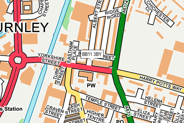
BB11 3BY is located in the Bank Hall electoral ward, within the local authority district of Burnley and the English Parliamentary constituency of Burnley. The Sub Integrated Care Board (ICB) Location is NHS Lancashire and South Cumbria ICB - 01A and the police force is Lancashire. This postcode has been in use since January 1980.


GetTheData
Source: OS OpenMap – Local (Ordnance Survey)
Source: OS VectorMap District (Ordnance Survey)
Licence: Open Government Licence (requires attribution)
| Easting | 384624 |
| Northing | 432560 |
| Latitude | 53.789127 |
| Longitude | -2.234867 |
GetTheData
Source: Open Postcode Geo
Licence: Open Government Licence
| Country | England |
| Postcode District | BB11 |
➜ See where BB11 is on a map ➜ Where is Burnley? | |
GetTheData
Source: Land Registry Price Paid Data
Licence: Open Government Licence
Elevation or altitude of BB11 3BY as distance above sea level:
| Metres | Feet | |
|---|---|---|
| Elevation | 120m | 394ft |
Elevation is measured from the approximate centre of the postcode, to the nearest point on an OS contour line from OS Terrain 50, which has contour spacing of ten vertical metres.
➜ How high above sea level am I? Find the elevation of your current position using your device's GPS.
GetTheData
Source: Open Postcode Elevation
Licence: Open Government Licence
| Ward | Bank Hall |
| Constituency | Burnley |
GetTheData
Source: ONS Postcode Database
Licence: Open Government Licence
| Blakey Street (Belvedere Road) | Queens Park | 84m |
| Blakey Street (Belvedere Road) | Queens Park | 101m |
| Harry Potts Way (Brunshaw Road) | Brunshaw | 113m |
| The Wellington (Todmorden Road) | Brunshaw | 129m |
| Harry Potts Way (Brunshaw Road) | Brunshaw | 130m |
| Burnley Central Station | 0.8km |
| Burnley Manchester Road Station | 1km |
| Burnley Barracks Station | 1.5km |
GetTheData
Source: NaPTAN
Licence: Open Government Licence
GetTheData
Source: ONS Postcode Database
Licence: Open Government Licence


➜ Get more ratings from the Food Standards Agency
GetTheData
Source: Food Standards Agency
Licence: FSA terms & conditions
| Last Collection | |||
|---|---|---|---|
| Location | Mon-Fri | Sat | Distance |
| Bank Top | 17:30 | 11:00 | 641m |
| Burnley Post Office | 18:30 | 11:00 | 666m |
| Burnley Post Office | 18:30 | 11:00 | 668m |
GetTheData
Source: Dracos
Licence: Creative Commons Attribution-ShareAlike
The below table lists the International Territorial Level (ITL) codes (formerly Nomenclature of Territorial Units for Statistics (NUTS) codes) and Local Administrative Units (LAU) codes for BB11 3BY:
| ITL 1 Code | Name |
|---|---|
| TLD | North West (England) |
| ITL 2 Code | Name |
| TLD4 | Lancashire |
| ITL 3 Code | Name |
| TLD46 | East Lancashire |
| LAU 1 Code | Name |
| E07000117 | Burnley |
GetTheData
Source: ONS Postcode Directory
Licence: Open Government Licence
The below table lists the Census Output Area (OA), Lower Layer Super Output Area (LSOA), and Middle Layer Super Output Area (MSOA) for BB11 3BY:
| Code | Name | |
|---|---|---|
| OA | E00126179 | |
| LSOA | E01024858 | Burnley 007C |
| MSOA | E02005182 | Burnley 007 |
GetTheData
Source: ONS Postcode Directory
Licence: Open Government Licence
| BB11 3BT | Yorkshire Street | 4m |
| BB11 3BS | Yorkshire Street | 64m |
| BB11 3DB | Albert Street | 94m |
| BB11 3DR | Leyland Road | 101m |
| BB11 3BN | Yorkshire Street | 103m |
| BB11 3BW | Yorkshire Street | 111m |
| BB10 4BD | Belvedere Road | 112m |
| BB11 3AA | Plumbe Street | 125m |
| BB10 4AY | Wellington Court | 152m |
| BB11 3DD | Ridge Road | 173m |
GetTheData
Source: Open Postcode Geo; Land Registry Price Paid Data
Licence: Open Government Licence