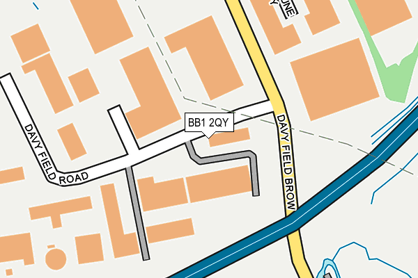
BB1 2QY lies on Davyfield Road in Blackburn. BB1 2QY is located in the Blackburn South & Lower Darwen electoral ward, within the unitary authority of Blackburn with Darwen and the English Parliamentary constituency of Blackburn. The Sub Integrated Care Board (ICB) Location is NHS Lancashire and South Cumbria ICB - 00Q and the police force is Lancashire. This postcode has been in use since January 2007.


GetTheData
Source: OS OpenMap – Local (Ordnance Survey)
Source: OS VectorMap District (Ordnance Survey)
Licence: Open Government Licence (requires attribution)
| Easting | 369773 |
| Northing | 424708 |
| Latitude | 53.717917 |
| Longitude | -2.459505 |
GetTheData
Source: Open Postcode Geo
Licence: Open Government Licence
| Street | Davyfield Road |
| Town/City | Blackburn |
| Country | England |
| Postcode District | BB1 |
➜ See where BB1 is on a map ➜ Where is Blackburn? | |
GetTheData
Source: Land Registry Price Paid Data
Licence: Open Government Licence
Elevation or altitude of BB1 2QY as distance above sea level:
| Metres | Feet | |
|---|---|---|
| Elevation | 150m | 492ft |
Elevation is measured from the approximate centre of the postcode, to the nearest point on an OS contour line from OS Terrain 50, which has contour spacing of ten vertical metres.
➜ How high above sea level am I? Find the elevation of your current position using your device's GPS.
GetTheData
Source: Open Postcode Elevation
Licence: Open Government Licence
| Ward | Blackburn South & Lower Darwen |
| Constituency | Blackburn |
GetTheData
Source: ONS Postcode Database
Licence: Open Government Licence
| Rectella (Roman Road) | Blackamoor | 322m |
| Industrial Estate (Roman Road) | Lower Darwen | 406m |
| Pickering Fold (Roman Road) | Blackamoor | 595m |
| Pickering Fold (Roman Road) | Blackamoor | 616m |
| St James Church (Stopes Brow) | Blackamoor | 671m |
| Darwen Station | 2.2km |
| Mill Hill (Lancs) Station | 3.4km |
| Blackburn Station | 3.4km |
GetTheData
Source: NaPTAN
Licence: Open Government Licence
| Median download speed | 54.6Mbps |
| Average download speed | 49.1Mbps |
| Maximum download speed | 67.53Mbps |
| Median upload speed | 8.5Mbps |
| Average upload speed | 8.1Mbps |
| Maximum upload speed | 12.87Mbps |
GetTheData
Source: Ofcom
Licence: Ofcom Terms of Use (requires attribution)
Estimated total energy consumption in BB1 2QY by fuel type, 2015.
| Consumption (kWh) | 172,285 |
|---|---|
| Meter count | 6 |
| Mean (kWh/meter) | 28,714 |
| Median (kWh/meter) | 23,618 |
GetTheData
Source: Postcode level gas estimates: 2015 (experimental)
Source: Postcode level electricity estimates: 2015 (experimental)
Licence: Open Government Licence
GetTheData
Source: ONS Postcode Database
Licence: Open Government Licence

➜ Get more ratings from the Food Standards Agency
GetTheData
Source: Food Standards Agency
Licence: FSA terms & conditions
| Last Collection | |||
|---|---|---|---|
| Location | Mon-Fri | Sat | Distance |
| Old Bank Lane | 16:15 | 11:00 | 2,065m |
| 68 Birch Hall Avenue | 16:30 | 11:00 | 2,625m |
| Moorgate | 16:15 | 11:15 | 2,849m |
GetTheData
Source: Dracos
Licence: Creative Commons Attribution-ShareAlike
The below table lists the International Territorial Level (ITL) codes (formerly Nomenclature of Territorial Units for Statistics (NUTS) codes) and Local Administrative Units (LAU) codes for BB1 2QY:
| ITL 1 Code | Name |
|---|---|
| TLD | North West (England) |
| ITL 2 Code | Name |
| TLD4 | Lancashire |
| ITL 3 Code | Name |
| TLD41 | Blackburn with Darwen |
| LAU 1 Code | Name |
| E06000008 | Blackburn with Darwen |
GetTheData
Source: ONS Postcode Directory
Licence: Open Government Licence
The below table lists the Census Output Area (OA), Lower Layer Super Output Area (LSOA), and Middle Layer Super Output Area (MSOA) for BB1 2QY:
| Code | Name | |
|---|---|---|
| OA | E00063546 | |
| LSOA | E01012602 | Blackburn with Darwen 011C |
| MSOA | E02002625 | Blackburn with Darwen 011 |
GetTheData
Source: ONS Postcode Directory
Licence: Open Government Licence
| BB3 0SR | Knight Crescent | 407m |
| BB3 0SU | Lords Crescent | 431m |
| BB3 0ST | Lady Close | 486m |
| BB3 0SS | Viscount Avenue | 503m |
| BB3 0RY | Moorcroft | 511m |
| BB3 0QB | Prunella Drive | 522m |
| BB3 0SX | Delphinium Way | 529m |
| BB3 0RT | Briarcroft | 533m |
| BB3 0RS | Leacroft | 561m |
| BB3 0SW | Primula Drive | 562m |
GetTheData
Source: Open Postcode Geo; Land Registry Price Paid Data
Licence: Open Government Licence