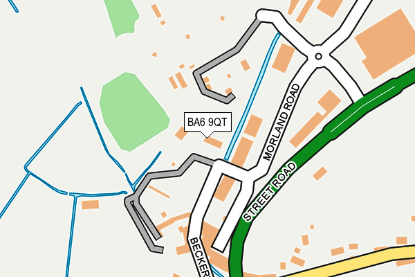
BA6 9QT is located in the Glastonbury electoral ward, within the unitary authority of Somerset and the English Parliamentary constituency of Wells. The Sub Integrated Care Board (ICB) Location is NHS Somerset ICB - 11X and the police force is Avon and Somerset. This postcode has been in use since April 2017.


GetTheData
Source: OS OpenMap – Local (Ordnance Survey)
Source: OS VectorMap District (Ordnance Survey)
Licence: Open Government Licence (requires attribution)
| Easting | 348593 |
| Northing | 138135 |
| Latitude | 51.140157 |
| Longitude | -2.736193 |
GetTheData
Source: Open Postcode Geo
Licence: Open Government Licence
| Country | England |
| Postcode District | BA6 |
➜ See where BA6 is on a map ➜ Where is Glastonbury? | |
GetTheData
Source: Land Registry Price Paid Data
Licence: Open Government Licence
| Ward | Glastonbury |
| Constituency | Wells |
GetTheData
Source: ONS Postcode Database
Licence: Open Government Licence
| Moorlands Factory (Street Road) | Glastonbury | 113m |
| Moorlands Factory | Glastonbury | 116m |
| Northover Bridge (Street Road) | Glastonbury | 272m |
| Wirral Park Roundabout (Street Road) | Glastonbury | 514m |
| Wirral Park Roundabout (Street Road) | Glastonbury | 533m |
GetTheData
Source: NaPTAN
Licence: Open Government Licence
GetTheData
Source: ONS Postcode Database
Licence: Open Government Licence


➜ Get more ratings from the Food Standards Agency
GetTheData
Source: Food Standards Agency
Licence: FSA terms & conditions
| Last Collection | |||
|---|---|---|---|
| Location | Mon-Fri | Sat | Distance |
| The Cross | 16:00 | 11:30 | 1,118m |
| Clarks Village | 16:00 | 11:30 | 1,335m |
| Benedict Street | 17:30 | 12:15 | 1,336m |
GetTheData
Source: Dracos
Licence: Creative Commons Attribution-ShareAlike
| Risk of BA6 9QT flooding from rivers and sea | Medium |
| ➜ BA6 9QT flood map | |
GetTheData
Source: Open Flood Risk by Postcode
Licence: Open Government Licence
The below table lists the International Territorial Level (ITL) codes (formerly Nomenclature of Territorial Units for Statistics (NUTS) codes) and Local Administrative Units (LAU) codes for BA6 9QT:
| ITL 1 Code | Name |
|---|---|
| TLK | South West (England) |
| ITL 2 Code | Name |
| TLK2 | Dorset and Somerset |
| ITL 3 Code | Name |
| TLK23 | Somerset CC |
| LAU 1 Code | Name |
| E07000187 | Mendip |
GetTheData
Source: ONS Postcode Directory
Licence: Open Government Licence
The below table lists the Census Output Area (OA), Lower Layer Super Output Area (LSOA), and Middle Layer Super Output Area (MSOA) for BA6 9QT:
| Code | Name | |
|---|---|---|
| OA | E00147918 | |
| LSOA | E01029047 | Mendip 012A |
| MSOA | E02006058 | Mendip 012 |
GetTheData
Source: ONS Postcode Directory
Licence: Open Government Licence
| BA6 9FW | Morland Road | 166m |
| BA6 8AA | Northover | 211m |
| BA6 8AD | The Roman Way | 383m |
| BA6 9NT | Beckery | 439m |
| BA6 9PN | Fawn Close | 680m |
| BA6 9FR | Wirral Park Road | 689m |
| BA6 8AB | The Roman Way | 691m |
| BA6 9PJ | Boundary Way | 715m |
| BA6 9PL | Antler Close | 722m |
| BA6 9PW | Ranger Road | 746m |
GetTheData
Source: Open Postcode Geo; Land Registry Price Paid Data
Licence: Open Government Licence