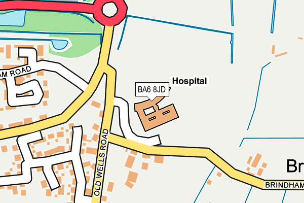
BA6 8JD is located in the Glastonbury electoral ward, within the unitary authority of Somerset and the English Parliamentary constituency of Wells. The Sub Integrated Care Board (ICB) Location is NHS Somerset ICB - 11X and the police force is Avon and Somerset. This postcode has been in use since March 2004.


GetTheData
Source: OS OpenMap – Local (Ordnance Survey)
Source: OS VectorMap District (Ordnance Survey)
Licence: Open Government Licence (requires attribution)
| Easting | 351200 |
| Northing | 140369 |
| Latitude | 51.160478 |
| Longitude | -2.699231 |
GetTheData
Source: Open Postcode Geo
Licence: Open Government Licence
| Country | England |
| Postcode District | BA6 |
➜ See where BA6 is on a map ➜ Where is Glastonbury? | |
GetTheData
Source: Land Registry Price Paid Data
Licence: Open Government Licence
Elevation or altitude of BA6 8JD as distance above sea level:
| Metres | Feet | |
|---|---|---|
| Elevation | 10m | 33ft |
Elevation is measured from the approximate centre of the postcode, to the nearest point on an OS contour line from OS Terrain 50, which has contour spacing of ten vertical metres.
➜ How high above sea level am I? Find the elevation of your current position using your device's GPS.
GetTheData
Source: Open Postcode Elevation
Licence: Open Government Licence
| Ward | Glastonbury |
| Constituency | Wells |
GetTheData
Source: ONS Postcode Database
Licence: Open Government Licence
| West Mendip Hospital (Hospital Road) | Brindham | 76m |
| Community Hospital | Brindham | 83m |
| Community Hospital (Old Wells Road) | Brindham | 95m |
| Old Wells Road | Glastonbury | 120m |
| Old Wells Road | Glastonbury | 134m |
GetTheData
Source: NaPTAN
Licence: Open Government Licence
GetTheData
Source: ONS Postcode Database
Licence: Open Government Licence


➜ Get more ratings from the Food Standards Agency
GetTheData
Source: Food Standards Agency
Licence: FSA terms & conditions
| Last Collection | |||
|---|---|---|---|
| Location | Mon-Fri | Sat | Distance |
| Glastonbury Post Office | 18:00 | 12:45 | 1,765m |
| Coursing Batch | 17:00 | 12:00 | 2,089m |
| Benedict Street | 17:30 | 12:15 | 2,119m |
GetTheData
Source: Dracos
Licence: Creative Commons Attribution-ShareAlike
The below table lists the International Territorial Level (ITL) codes (formerly Nomenclature of Territorial Units for Statistics (NUTS) codes) and Local Administrative Units (LAU) codes for BA6 8JD:
| ITL 1 Code | Name |
|---|---|
| TLK | South West (England) |
| ITL 2 Code | Name |
| TLK2 | Dorset and Somerset |
| ITL 3 Code | Name |
| TLK23 | Somerset CC |
| LAU 1 Code | Name |
| E07000187 | Mendip |
GetTheData
Source: ONS Postcode Directory
Licence: Open Government Licence
The below table lists the Census Output Area (OA), Lower Layer Super Output Area (LSOA), and Middle Layer Super Output Area (MSOA) for BA6 8JD:
| Code | Name | |
|---|---|---|
| OA | E00147928 | |
| LSOA | E01032627 | Mendip 011F |
| MSOA | E02006057 | Mendip 011 |
GetTheData
Source: ONS Postcode Directory
Licence: Open Government Licence
| BA6 8EA | Old Wells Road | 213m |
| BA6 9AW | Wells Road | 260m |
| BA6 8FD | Watts Corner | 261m |
| BA6 9GA | Godney Close | 265m |
| BA6 9GF | Hartlake Close | 288m |
| BA6 9AH | Wells Road | 308m |
| BA6 9FL | Normans Terrace | 390m |
| BA6 9GH | Compton Close | 422m |
| BA6 9GG | Compton Close | 430m |
| BA6 9AN | Wells Road | 443m |
GetTheData
Source: Open Postcode Geo; Land Registry Price Paid Data
Licence: Open Government Licence