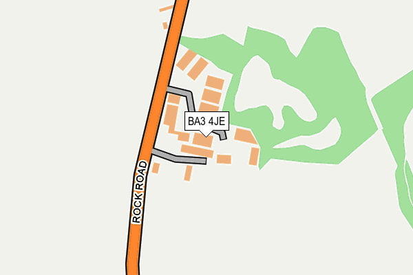
BA3 4JE lies on New Rock Industrial Estate in Chilcompton, Radstock. BA3 4JE is located in the Mendip Hills electoral ward, within the unitary authority of Somerset and the English Parliamentary constituency of Wells. The Sub Integrated Care Board (ICB) Location is NHS Somerset ICB - 11X and the police force is Avon and Somerset. This postcode has been in use since January 1993.


GetTheData
Source: OS OpenMap – Local (Ordnance Survey)
Source: OS VectorMap District (Ordnance Survey)
Licence: Open Government Licence (requires attribution)
| Easting | 364793 |
| Northing | 150592 |
| Latitude | 51.253395 |
| Longitude | -2.505865 |
GetTheData
Source: Open Postcode Geo
Licence: Open Government Licence
| Street | New Rock Industrial Estate |
| Locality | Chilcompton |
| Town/City | Radstock |
| Country | England |
| Postcode District | BA3 |
➜ See where BA3 is on a map ➜ Where is Chilcompton? | |
GetTheData
Source: Land Registry Price Paid Data
Licence: Open Government Licence
Elevation or altitude of BA3 4JE as distance above sea level:
| Metres | Feet | |
|---|---|---|
| Elevation | 200m | 656ft |
Elevation is measured from the approximate centre of the postcode, to the nearest point on an OS contour line from OS Terrain 50, which has contour spacing of ten vertical metres.
➜ How high above sea level am I? Find the elevation of your current position using your device's GPS.
GetTheData
Source: Open Postcode Elevation
Licence: Open Government Licence
| Ward | Mendip Hills |
| Constituency | Wells |
GetTheData
Source: ONS Postcode Database
Licence: Open Government Licence
| New Rock Ind Estate | Chilcompton | 104m |
| New Rock Ind Estate | Chilcompton | 105m |
| Greenway Garages (Greenways) | Bowden Hill | 581m |
| Co-op (Wells Road) | Chilcompton | 685m |
| Co-op (Wells Road) | Chilcompton | 692m |
GetTheData
Source: NaPTAN
Licence: Open Government Licence
| Median download speed | 80.0Mbps |
| Average download speed | 67.3Mbps |
| Maximum download speed | 80.00Mbps |
| Median upload speed | 20.0Mbps |
| Average upload speed | 16.9Mbps |
| Maximum upload speed | 20.00Mbps |
GetTheData
Source: Ofcom
Licence: Ofcom Terms of Use (requires attribution)
GetTheData
Source: ONS Postcode Database
Licence: Open Government Licence


➜ Get more ratings from the Food Standards Agency
GetTheData
Source: Food Standards Agency
Licence: FSA terms & conditions
| Last Collection | |||
|---|---|---|---|
| Location | Mon-Fri | Sat | Distance |
| Holcombe Post Office | 16:45 | 12:00 | 2,552m |
| Clevedon Road | 17:00 | 11:30 | 4,219m |
| Midsomer Norton P.o. | 17:30 | 12:00 | 4,302m |
GetTheData
Source: Dracos
Licence: Creative Commons Attribution-ShareAlike
The below table lists the International Territorial Level (ITL) codes (formerly Nomenclature of Territorial Units for Statistics (NUTS) codes) and Local Administrative Units (LAU) codes for BA3 4JE:
| ITL 1 Code | Name |
|---|---|
| TLK | South West (England) |
| ITL 2 Code | Name |
| TLK2 | Dorset and Somerset |
| ITL 3 Code | Name |
| TLK23 | Somerset CC |
| LAU 1 Code | Name |
| E07000187 | Mendip |
GetTheData
Source: ONS Postcode Directory
Licence: Open Government Licence
The below table lists the Census Output Area (OA), Lower Layer Super Output Area (LSOA), and Middle Layer Super Output Area (MSOA) for BA3 4JE:
| Code | Name | |
|---|---|---|
| OA | E00147818 | |
| LSOA | E01029024 | Mendip 002A |
| MSOA | E02006048 | Mendip 002 |
GetTheData
Source: ONS Postcode Directory
Licence: Open Government Licence
| BA3 4GE | New Rock | 61m |
| BA3 4HY | Abbey Road | 288m |
| BA3 4JA | 394m | |
| BA3 4WQ | Strawbridge Close | 433m |
| BA3 4HX | Rock Road | 467m |
| BA3 4JL | Stockhill Road | 493m |
| BA3 4HU | Hoecroft Gardens | 495m |
| BA3 4JJ | Stockhill Road | 520m |
| BA3 4LT | Mendip Fields | 534m |
| BA3 4JH | Stockhill Road | 552m |
GetTheData
Source: Open Postcode Geo; Land Registry Price Paid Data
Licence: Open Government Licence