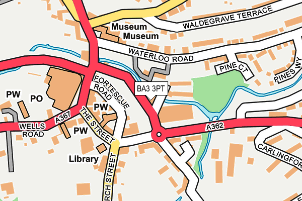
BA3 3PT is located in the Radstock electoral ward, within the unitary authority of Bath and North East Somerset and the English Parliamentary constituency of North East Somerset. The Sub Integrated Care Board (ICB) Location is NHS Bath and North East Somerset, Swindon and Wiltshire ICB - 92 and the police force is Avon and Somerset. This postcode has been in use since January 1980.


GetTheData
Source: OS OpenMap – Local (Ordnance Survey)
Source: OS VectorMap District (Ordnance Survey)
Licence: Open Government Licence (requires attribution)
| Easting | 369026 |
| Northing | 154842 |
| Latitude | 51.291856 |
| Longitude | -2.445582 |
GetTheData
Source: Open Postcode Geo
Licence: Open Government Licence
| Country | England |
| Postcode District | BA3 |
➜ See where BA3 is on a map ➜ Where is Radstock? | |
GetTheData
Source: Land Registry Price Paid Data
Licence: Open Government Licence
Elevation or altitude of BA3 3PT as distance above sea level:
| Metres | Feet | |
|---|---|---|
| Elevation | 70m | 230ft |
Elevation is measured from the approximate centre of the postcode, to the nearest point on an OS contour line from OS Terrain 50, which has contour spacing of ten vertical metres.
➜ How high above sea level am I? Find the elevation of your current position using your device's GPS.
GetTheData
Source: Open Postcode Elevation
Licence: Open Government Licence
| Ward | Radstock |
| Constituency | North East Somerset |
GetTheData
Source: ONS Postcode Database
Licence: Open Government Licence
| Victoria Hall (The Street) | Radstock | 71m |
| Victoria Hall (The Street) | Radstock | 87m |
| Morley Terrace (Woodborough Road) | Tyning | 385m |
| Radstock College (Wells Road) | Radstock | 587m |
| Radstock College (Wells Road) | Radstock | 591m |
GetTheData
Source: NaPTAN
Licence: Open Government Licence
GetTheData
Source: ONS Postcode Database
Licence: Open Government Licence


➜ Get more ratings from the Food Standards Agency
GetTheData
Source: Food Standards Agency
Licence: FSA terms & conditions
| Last Collection | |||
|---|---|---|---|
| Location | Mon-Fri | Sat | Distance |
| Radstock Post Office Radco | 17:30 | 12:00 | 203m |
| Midsomer Norton P.o. | 17:30 | 12:00 | 1,845m |
| Frederick Avenue | 17:30 | 10:00 | 2,409m |
GetTheData
Source: Dracos
Licence: Creative Commons Attribution-ShareAlike
The below table lists the International Territorial Level (ITL) codes (formerly Nomenclature of Territorial Units for Statistics (NUTS) codes) and Local Administrative Units (LAU) codes for BA3 3PT:
| ITL 1 Code | Name |
|---|---|
| TLK | South West (England) |
| ITL 2 Code | Name |
| TLK1 | Gloucestershire, Wiltshire and Bath/Bristol area |
| ITL 3 Code | Name |
| TLK12 | Bath and North East Somerset, North Somerset and South Gloucestershire |
| LAU 1 Code | Name |
| E06000022 | Bath and North East Somerset |
GetTheData
Source: ONS Postcode Directory
Licence: Open Government Licence
The below table lists the Census Output Area (OA), Lower Layer Super Output Area (LSOA), and Middle Layer Super Output Area (MSOA) for BA3 3PT:
| Code | Name | |
|---|---|---|
| OA | E00072979 | |
| LSOA | E01014451 | Bath and North East Somerset 024D |
| MSOA | E02003008 | Bath and North East Somerset 024 |
GetTheData
Source: ONS Postcode Directory
Licence: Open Government Licence
| BA3 3PS | Riverside Cottages | 39m |
| BA3 3FL | Frome Road | 61m |
| BA3 3FN | Frome Road | 73m |
| BA3 3FP | Nelson Ward Drive | 119m |
| BA3 3PJ | Fortescue Road | 126m |
| BA3 3EP | Waterloo Road | 147m |
| BA3 3PL | The Street | 154m |
| BA3 3PW | Frome Road | 167m |
| BA3 3QG | Church Street | 170m |
| BA3 3HA | Bath Old Road | 195m |
GetTheData
Source: Open Postcode Geo; Land Registry Price Paid Data
Licence: Open Government Licence