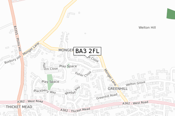
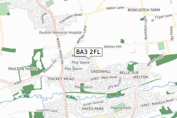
BA3 2FL is located in the Midsomer Norton North electoral ward, within the unitary authority of Bath and North East Somerset and the English Parliamentary constituency of North East Somerset. The Sub Integrated Care Board (ICB) Location is NHS Bath and North East Somerset, Swindon and Wiltshire ICB - 92 and the police force is Avon and Somerset. This postcode has been in use since July 2018.


GetTheData
Source: OS Open Zoomstack (Ordnance Survey)
Licence: Open Government Licence (requires attribution)
Attribution: Contains OS data © Crown copyright and database right 2025
Source: Open Postcode Geo
Licence: Open Government Licence (requires attribution)
Attribution: Contains OS data © Crown copyright and database right 2025; Contains Royal Mail data © Royal Mail copyright and database right 2025; Source: Office for National Statistics licensed under the Open Government Licence v.3.0
| Easting | 366098 |
| Northing | 155265 |
| Latitude | 51.295492 |
| Longitude | -2.487612 |
GetTheData
Source: Open Postcode Geo
Licence: Open Government Licence
| Country | England |
| Postcode District | BA3 |
➜ See where BA3 is on a map ➜ Where is Midsomer Norton? | |
GetTheData
Source: Land Registry Price Paid Data
Licence: Open Government Licence
| Ward | Midsomer Norton North |
| Constituency | North East Somerset |
GetTheData
Source: ONS Postcode Database
Licence: Open Government Licence
2024 18 JUL £355,000 |
2023 8 DEC £350,000 |
2022 27 APR £455,000 |
14, VOAKE CLOSE, MIDSOMER NORTON, RADSTOCK, BA3 2FL 2019 5 DEC £430,000 |
8, VOAKE CLOSE, MIDSOMER NORTON, RADSTOCK, BA3 2FL 2019 20 NOV £383,000 |
9, VOAKE CLOSE, MIDSOMER NORTON, RADSTOCK, BA3 2FL 2019 1 NOV £318,000 |
2019 1 NOV £305,000 |
2019 6 SEP £275,000 |
7, VOAKE CLOSE, MIDSOMER NORTON, RADSTOCK, BA3 2FL 2019 21 JAN £350,000 |
2018 30 NOV £347,000 |
➜ Midsomer Norton house prices
GetTheData
Source: HM Land Registry Price Paid Data
Licence: Contains HM Land Registry data © Crown copyright and database right 2025. This data is licensed under the Open Government Licence v3.0.
| Monger Lane (West Road) | Thicket Mead | 287m |
| Monger Lane (West Road) | Thicket Mead | 295m |
| Sunnymead (West Road) | Thicket Mead | 326m |
| Sunnymead (West Road) | Thicket Mead | 336m |
| Phillis Hill Bottom (Phillis Hill) | Thicket Mead | 401m |
GetTheData
Source: NaPTAN
Licence: Open Government Licence
| Percentage of properties with Next Generation Access | 100.0% |
| Percentage of properties with Superfast Broadband | 100.0% |
| Percentage of properties with Ultrafast Broadband | 100.0% |
| Percentage of properties with Full Fibre Broadband | 100.0% |
Superfast Broadband is between 30Mbps and 300Mbps
Ultrafast Broadband is > 300Mbps
| Median download speed | 360.0Mbps |
| Average download speed | 360.0Mbps |
| Maximum download speed | 360.00Mbps |
| Median upload speed | 360.0Mbps |
| Average upload speed | 360.0Mbps |
| Maximum upload speed | 360.00Mbps |
| Percentage of properties unable to receive 2Mbps | 0.0% |
| Percentage of properties unable to receive 5Mbps | 0.0% |
| Percentage of properties unable to receive 10Mbps | 0.0% |
| Percentage of properties unable to receive 30Mbps | 0.0% |
GetTheData
Source: Ofcom
Licence: Ofcom Terms of Use (requires attribution)
GetTheData
Source: ONS Postcode Database
Licence: Open Government Licence


➜ Get more ratings from the Food Standards Agency
GetTheData
Source: Food Standards Agency
Licence: FSA terms & conditions
| Last Collection | |||
|---|---|---|---|
| Location | Mon-Fri | Sat | Distance |
| Clevedon Road | 17:00 | 11:30 | 822m |
| Midsomer Norton P.o. | 17:30 | 12:00 | 1,760m |
| Paulton Post Office | 17:15 | 11:30 | 1,794m |
GetTheData
Source: Dracos
Licence: Creative Commons Attribution-ShareAlike
The below table lists the International Territorial Level (ITL) codes (formerly Nomenclature of Territorial Units for Statistics (NUTS) codes) and Local Administrative Units (LAU) codes for BA3 2FL:
| ITL 1 Code | Name |
|---|---|
| TLK | South West (England) |
| ITL 2 Code | Name |
| TLK1 | Gloucestershire, Wiltshire and Bath/Bristol area |
| ITL 3 Code | Name |
| TLK12 | Bath and North East Somerset, North Somerset and South Gloucestershire |
| LAU 1 Code | Name |
| E06000022 | Bath and North East Somerset |
GetTheData
Source: ONS Postcode Directory
Licence: Open Government Licence
The below table lists the Census Output Area (OA), Lower Layer Super Output Area (LSOA), and Middle Layer Super Output Area (MSOA) for BA3 2FL:
| Code | Name | |
|---|---|---|
| OA | E00072838 | |
| LSOA | E01014421 | Bath and North East Somerset 025B |
| MSOA | E02003009 | Bath and North East Somerset 025 |
GetTheData
Source: ONS Postcode Directory
Licence: Open Government Licence
| BA3 2SP | Monger Lane | 165m |
| BA3 2TF | Greenhill Place | 172m |
| BA3 2RR | Bluebell Rise | 180m |
| BA3 2FB | Somer Ridge | 185m |
| BA3 2TE | Greenhill Road | 233m |
| BA3 2RP | Greenfield Walk | 243m |
| BS39 7SJ | Monger Lane | 273m |
| BA3 2RN | Blackberry Way | 278m |
| BA3 2TB | Hillside View | 282m |
| BA3 2SR | Monger Lane | 286m |
GetTheData
Source: Open Postcode Geo; Land Registry Price Paid Data
Licence: Open Government Licence