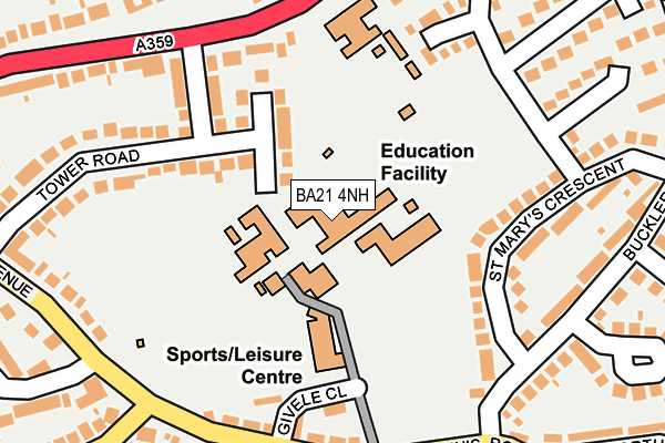
BA21 4NH is located in the Yeovil Central electoral ward, within the unitary authority of Somerset and the English Parliamentary constituency of Yeovil. The Sub Integrated Care Board (ICB) Location is NHS Somerset ICB - 11X and the police force is Avon and Somerset. This postcode has been in use since January 1980.


GetTheData
Source: OS OpenMap – Local (Ordnance Survey)
Source: OS VectorMap District (Ordnance Survey)
Licence: Open Government Licence (requires attribution)
| Easting | 356268 |
| Northing | 117669 |
| Latitude | 50.956779 |
| Longitude | -2.624012 |
GetTheData
Source: Open Postcode Geo
Licence: Open Government Licence
| Country | England |
| Postcode District | BA21 |
➜ See where BA21 is on a map ➜ Where is Yeovil? | |
GetTheData
Source: Land Registry Price Paid Data
Licence: Open Government Licence
Elevation or altitude of BA21 4NH as distance above sea level:
| Metres | Feet | |
|---|---|---|
| Elevation | 90m | 295ft |
Elevation is measured from the approximate centre of the postcode, to the nearest point on an OS contour line from OS Terrain 50, which has contour spacing of ten vertical metres.
➜ How high above sea level am I? Find the elevation of your current position using your device's GPS.
GetTheData
Source: Open Postcode Elevation
Licence: Open Government Licence
| Ward | Yeovil Central |
| Constituency | Yeovil |
GetTheData
Source: ONS Postcode Database
Licence: Open Government Licence
| Tower Road (Mudford Road) | Yeovil | 200m |
| Tower Road (Mudford Road) | Yeovil | 211m |
| St Marys Crescent (Bucklers Mead Road) | Yeovil | 217m |
| Bucklers Mead School (St Michaels Avenue) | Yeovil | 217m |
| St Michaels Avenue (St John's Road) | Yeovil | 222m |
| Yeovil Pen Mill Station | 1.6km |
| Yeovil Junction Station | 3.7km |
GetTheData
Source: NaPTAN
Licence: Open Government Licence
GetTheData
Source: ONS Postcode Database
Licence: Open Government Licence


➜ Get more ratings from the Food Standards Agency
GetTheData
Source: Food Standards Agency
Licence: FSA terms & conditions
| Last Collection | |||
|---|---|---|---|
| Location | Mon-Fri | Sat | Distance |
| Mudford Post Office | 17:30 | 11:00 | 1,087m |
| Sparrow Road | 17:30 | 12:00 | 1,575m |
| Middle Street Post Office | 17:30 | 12:00 | 1,658m |
GetTheData
Source: Dracos
Licence: Creative Commons Attribution-ShareAlike
The below table lists the International Territorial Level (ITL) codes (formerly Nomenclature of Territorial Units for Statistics (NUTS) codes) and Local Administrative Units (LAU) codes for BA21 4NH:
| ITL 1 Code | Name |
|---|---|
| TLK | South West (England) |
| ITL 2 Code | Name |
| TLK2 | Dorset and Somerset |
| ITL 3 Code | Name |
| TLK23 | Somerset CC |
| LAU 1 Code | Name |
| E07000189 | South Somerset |
GetTheData
Source: ONS Postcode Directory
Licence: Open Government Licence
The below table lists the Census Output Area (OA), Lower Layer Super Output Area (LSOA), and Middle Layer Super Output Area (MSOA) for BA21 4NH:
| Code | Name | |
|---|---|---|
| OA | E00149023 | |
| LSOA | E01029254 | South Somerset 011D |
| MSOA | E02006085 | South Somerset 011 |
GetTheData
Source: ONS Postcode Directory
Licence: Open Government Licence
| BA21 4NQ | Tower Road | 138m |
| BA21 4NZ | Mudford Road | 167m |
| BA21 5RP | St Marys Crescent | 167m |
| BA21 4NE | St Michaels Avenue | 207m |
| BA21 5SG | Fairmead Road | 209m |
| BA21 4NA | St Michaels Avenue | 228m |
| BA21 5RA | Bucklers Mead Road | 233m |
| BA21 4NG | Tower Road | 238m |
| BA21 5RR | St Marys Crescent | 255m |
| BA21 4SA | Allingham Road | 264m |
GetTheData
Source: Open Postcode Geo; Land Registry Price Paid Data
Licence: Open Government Licence