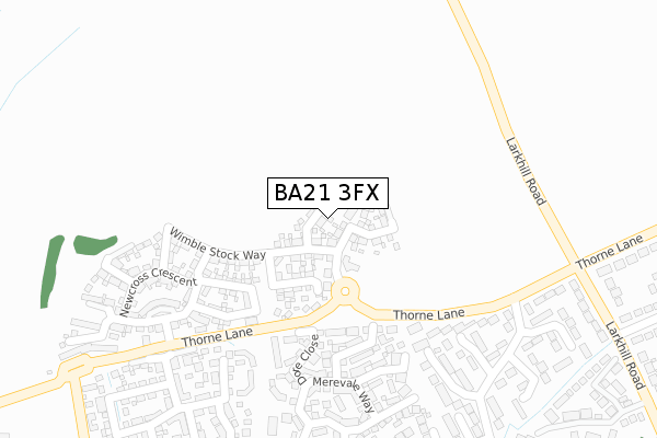
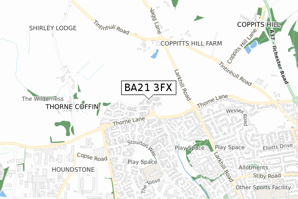
BA21 3FX is located in the Yeovil West electoral ward, within the unitary authority of Somerset and the English Parliamentary constituency of Yeovil. The Sub Integrated Care Board (ICB) Location is NHS Somerset ICB - 11X and the police force is Avon and Somerset. This postcode has been in use since March 2019.


GetTheData
Source: OS Open Zoomstack (Ordnance Survey)
Licence: Open Government Licence (requires attribution)
Attribution: Contains OS data © Crown copyright and database right 2025
Source: Open Postcode Geo
Licence: Open Government Licence (requires attribution)
Attribution: Contains OS data © Crown copyright and database right 2025; Contains Royal Mail data © Royal Mail copyright and database right 2025; Source: Office for National Statistics licensed under the Open Government Licence v.3.0
| Easting | 353255 |
| Northing | 117679 |
| Latitude | 50.956625 |
| Longitude | -2.666909 |
GetTheData
Source: Open Postcode Geo
Licence: Open Government Licence
| Country | England |
| Postcode District | BA21 |
➜ See where BA21 is on a map ➜ Where is Yeovil? | |
GetTheData
Source: Land Registry Price Paid Data
Licence: Open Government Licence
| Ward | Yeovil West |
| Constituency | Yeovil |
GetTheData
Source: ONS Postcode Database
Licence: Open Government Licence
| Tintagel Road (Thorne Lane) | Yeovil Without | 371m |
| Tintagel Road (Thorne Lane) | Yeovil Without | 376m |
| Forde Park (Stourton Way) | Preston Plucknett | 422m |
| Larkhill Road (Thorne Lane) | Houndstone | 427m |
| Ford Park (Western Avenue) | Houndstone | 428m |
| Yeovil Pen Mill Station | 4km |
| Yeovil Junction Station | 5.2km |
GetTheData
Source: NaPTAN
Licence: Open Government Licence
| Percentage of properties with Next Generation Access | 100.0% |
| Percentage of properties with Superfast Broadband | 100.0% |
| Percentage of properties with Ultrafast Broadband | 100.0% |
| Percentage of properties with Full Fibre Broadband | 100.0% |
Superfast Broadband is between 30Mbps and 300Mbps
Ultrafast Broadband is > 300Mbps
| Percentage of properties unable to receive 2Mbps | 0.0% |
| Percentage of properties unable to receive 5Mbps | 0.0% |
| Percentage of properties unable to receive 10Mbps | 0.0% |
| Percentage of properties unable to receive 30Mbps | 0.0% |
GetTheData
Source: Ofcom
Licence: Ofcom Terms of Use (requires attribution)
GetTheData
Source: ONS Postcode Database
Licence: Open Government Licence


➜ Get more ratings from the Food Standards Agency
GetTheData
Source: Food Standards Agency
Licence: FSA terms & conditions
| Last Collection | |||
|---|---|---|---|
| Location | Mon-Fri | Sat | Distance |
| Westfield Post Office | 17:30 | 12:00 | 908m |
| Westfield Road | 17:30 | 12:00 | 972m |
| Grove Avenue | 16:00 | 12:00 | 1,277m |
GetTheData
Source: Dracos
Licence: Creative Commons Attribution-ShareAlike
The below table lists the International Territorial Level (ITL) codes (formerly Nomenclature of Territorial Units for Statistics (NUTS) codes) and Local Administrative Units (LAU) codes for BA21 3FX:
| ITL 1 Code | Name |
|---|---|
| TLK | South West (England) |
| ITL 2 Code | Name |
| TLK2 | Dorset and Somerset |
| ITL 3 Code | Name |
| TLK23 | Somerset CC |
| LAU 1 Code | Name |
| E07000189 | South Somerset |
GetTheData
Source: ONS Postcode Directory
Licence: Open Government Licence
The below table lists the Census Output Area (OA), Lower Layer Super Output Area (LSOA), and Middle Layer Super Output Area (MSOA) for BA21 3FX:
| Code | Name | |
|---|---|---|
| OA | E00149022 | |
| LSOA | E01029251 | South Somerset 012D |
| MSOA | E02006086 | South Somerset 012 |
GetTheData
Source: ONS Postcode Directory
Licence: Open Government Licence
| BA21 3UR | Roche Close | 195m |
| BA21 3FL | Hillrick Crescent | 199m |
| BA21 3UP | Dore Close | 219m |
| BA21 3UT | Stoneleigh Mews | 257m |
| BA21 3LY | Thorne Lane | 265m |
| BA21 3UN | Merevale Way | 297m |
| BA21 3UX | Biddlesden Road | 302m |
| BA21 3RF | Tintagel Road | 309m |
| BA21 3FJ | Southfield Drive | 312m |
| BA21 3RG | Thorne Gardens | 314m |
GetTheData
Source: Open Postcode Geo; Land Registry Price Paid Data
Licence: Open Government Licence