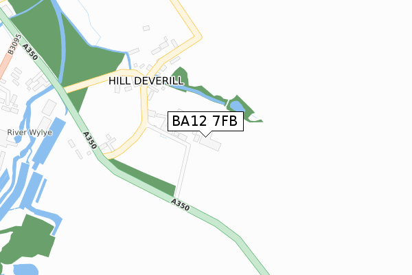
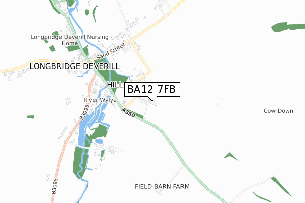
BA12 7FB is located in the Wylye Valley electoral ward, within the unitary authority of Wiltshire and the English Parliamentary constituency of South West Wiltshire. The Sub Integrated Care Board (ICB) Location is NHS Bath and North East Somerset, Swindon and Wiltshire ICB - 92 and the police force is Wiltshire. This postcode has been in use since June 2018.


GetTheData
Source: OS Open Zoomstack (Ordnance Survey)
Licence: Open Government Licence (requires attribution)
Attribution: Contains OS data © Crown copyright and database right 2025
Source: Open Postcode Geo
Licence: Open Government Licence (requires attribution)
Attribution: Contains OS data © Crown copyright and database right 2025; Contains Royal Mail data © Royal Mail copyright and database right 2025; Source: Office for National Statistics licensed under the Open Government Licence v.3.0
| Easting | 387409 |
| Northing | 140533 |
| Latitude | 51.163897 |
| Longitude | -2.181441 |
GetTheData
Source: Open Postcode Geo
Licence: Open Government Licence
| Country | England |
| Postcode District | BA12 |
➜ See where BA12 is on a map ➜ Where is Hill Deverill? | |
GetTheData
Source: Land Registry Price Paid Data
Licence: Open Government Licence
| Ward | Wylye Valley |
| Constituency | South West Wiltshire |
GetTheData
Source: ONS Postcode Database
Licence: Open Government Licence
| Watercress Farm (B3095) | Hill Deverill | 564m |
| The George (Church Street) | Longbridge Deverill | 571m |
| Watercress Farm (B3095) | Hill Deverill | 573m |
| Filling Station (Sand Street) | Longbridge Deverill | 600m |
| Filling Station (Sand Street) | Longbridge Deverill | 607m |
| Warminster Station | 4.8km |
GetTheData
Source: NaPTAN
Licence: Open Government Licence
GetTheData
Source: ONS Postcode Database
Licence: Open Government Licence


➜ Get more ratings from the Food Standards Agency
GetTheData
Source: Food Standards Agency
Licence: FSA terms & conditions
| Last Collection | |||
|---|---|---|---|
| Location | Mon-Fri | Sat | Distance |
| Longbridge Deverill P.o. | 17:15 | 10:45 | 571m |
| Hill Deverill | 12:00 | 10:45 | 741m |
| Bath Arms | 15:55 | 11:15 | 2,015m |
GetTheData
Source: Dracos
Licence: Creative Commons Attribution-ShareAlike
The below table lists the International Territorial Level (ITL) codes (formerly Nomenclature of Territorial Units for Statistics (NUTS) codes) and Local Administrative Units (LAU) codes for BA12 7FB:
| ITL 1 Code | Name |
|---|---|
| TLK | South West (England) |
| ITL 2 Code | Name |
| TLK1 | Gloucestershire, Wiltshire and Bath/Bristol area |
| ITL 3 Code | Name |
| TLK15 | Wiltshire |
| LAU 1 Code | Name |
| E06000054 | Wiltshire |
GetTheData
Source: ONS Postcode Directory
Licence: Open Government Licence
The below table lists the Census Output Area (OA), Lower Layer Super Output Area (LSOA), and Middle Layer Super Output Area (MSOA) for BA12 7FB:
| Code | Name | |
|---|---|---|
| OA | E00163629 | |
| LSOA | E01032082 | Wiltshire 047E |
| MSOA | E02006695 | Wiltshire 047 |
GetTheData
Source: ONS Postcode Directory
Licence: Open Government Licence
| BA12 7EA | The Marsh | 215m |
| BA12 7DZ | The Marsh | 315m |
| BA12 7EB | The Marsh | 419m |
| BA12 7EE | Mill Close | 470m |
| BA12 7ED | The Marsh | 486m |
| BA12 7DR | Sand Street | 505m |
| BA12 7EF | 510m | |
| BA12 7DS | Sand Street | 539m |
| BA12 7EQ | Manor Farm Cottages | 589m |
| BA12 7DN | 603m |
GetTheData
Source: Open Postcode Geo; Land Registry Price Paid Data
Licence: Open Government Licence