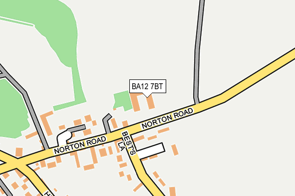
BA12 7BT lies on Pound Barton in Sutton Veny, Warminster. BA12 7BT is located in the Wylye Valley electoral ward, within the unitary authority of Wiltshire and the English Parliamentary constituency of South West Wiltshire. The Sub Integrated Care Board (ICB) Location is NHS Bath and North East Somerset, Swindon and Wiltshire ICB - 92 and the police force is Wiltshire. This postcode has been in use since January 1983.


GetTheData
Source: OS OpenMap – Local (Ordnance Survey)
Source: OS VectorMap District (Ordnance Survey)
Licence: Open Government Licence (requires attribution)
| Easting | 390024 |
| Northing | 142306 |
| Latitude | 51.179898 |
| Longitude | -2.144099 |
GetTheData
Source: Open Postcode Geo
Licence: Open Government Licence
| Street | Pound Barton |
| Locality | Sutton Veny |
| Town/City | Warminster |
| Country | England |
| Postcode District | BA12 |
➜ See where BA12 is on a map ➜ Where is Sutton Veny? | |
GetTheData
Source: Land Registry Price Paid Data
Licence: Open Government Licence
Elevation or altitude of BA12 7BT as distance above sea level:
| Metres | Feet | |
|---|---|---|
| Elevation | 110m | 361ft |
Elevation is measured from the approximate centre of the postcode, to the nearest point on an OS contour line from OS Terrain 50, which has contour spacing of ten vertical metres.
➜ How high above sea level am I? Find the elevation of your current position using your device's GPS.
GetTheData
Source: Open Postcode Elevation
Licence: Open Government Licence
| Ward | Wylye Valley |
| Constituency | South West Wiltshire |
GetTheData
Source: ONS Postcode Database
Licence: Open Government Licence
| Greenhill Gardens (Norton Road) | Sutton Veny | 226m |
| Geenhill Gardens (Norton Road) | Sutton Veny | 240m |
| The Woolpack (High Street) | Sutton Veny | 281m |
| The Woolpack (High Street) | Sutton Veny | 293m |
| Dymocks Lane (High Street) | Sutton Veny | 376m |
| Warminster Station | 3.8km |
GetTheData
Source: NaPTAN
Licence: Open Government Licence
GetTheData
Source: ONS Postcode Database
Licence: Open Government Licence


➜ Get more ratings from the Food Standards Agency
GetTheData
Source: Food Standards Agency
Licence: FSA terms & conditions
| Last Collection | |||
|---|---|---|---|
| Location | Mon-Fri | Sat | Distance |
| Bavant Road | 17:10 | 11:15 | 210m |
| Duck Street | 12:00 | 11:15 | 892m |
| Norton Bavant | 16:00 | 10:00 | 1,282m |
GetTheData
Source: Dracos
Licence: Creative Commons Attribution-ShareAlike
The below table lists the International Territorial Level (ITL) codes (formerly Nomenclature of Territorial Units for Statistics (NUTS) codes) and Local Administrative Units (LAU) codes for BA12 7BT:
| ITL 1 Code | Name |
|---|---|
| TLK | South West (England) |
| ITL 2 Code | Name |
| TLK1 | Gloucestershire, Wiltshire and Bath/Bristol area |
| ITL 3 Code | Name |
| TLK15 | Wiltshire |
| LAU 1 Code | Name |
| E06000054 | Wiltshire |
GetTheData
Source: ONS Postcode Directory
Licence: Open Government Licence
The below table lists the Census Output Area (OA), Lower Layer Super Output Area (LSOA), and Middle Layer Super Output Area (MSOA) for BA12 7BT:
| Code | Name | |
|---|---|---|
| OA | E00163634 | |
| LSOA | E01032082 | Wiltshire 047E |
| MSOA | E02006695 | Wiltshire 047 |
GetTheData
Source: ONS Postcode Directory
Licence: Open Government Licence
| BA12 7AZ | Sandfield | 80m |
| BA12 7AY | Greenhill Gardens | 120m |
| BA12 7SA | Campbell Place | 154m |
| BA12 7BR | Greenhill | 193m |
| BA12 7AU | Bests Lane | 222m |
| BA12 7AW | High Street | 336m |
| BA12 7AR | High Street | 341m |
| BA12 7BJ | 364m | |
| BA12 7AX | Dymocks Lane | 397m |
| BA12 7BX | Sheppards Forge | 406m |
GetTheData
Source: Open Postcode Geo; Land Registry Price Paid Data
Licence: Open Government Licence