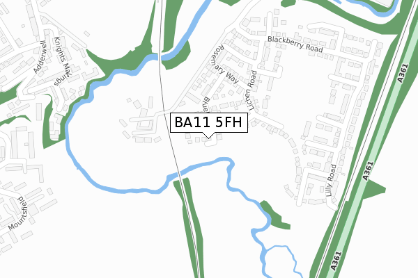
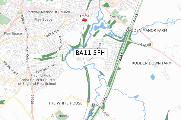
BA11 5FH is located in the Frome East electoral ward, within the unitary authority of Somerset and the English Parliamentary constituency of Somerton and Frome. The Sub Integrated Care Board (ICB) Location is NHS Somerset ICB - 11X and the police force is Avon and Somerset. This postcode has been in use since July 2019.


GetTheData
Source: OS Open Zoomstack (Ordnance Survey)
Licence: Open Government Licence (requires attribution)
Attribution: Contains OS data © Crown copyright and database right 2025
Source: Open Postcode Geo
Licence: Open Government Licence (requires attribution)
Attribution: Contains OS data © Crown copyright and database right 2025; Contains Royal Mail data © Royal Mail copyright and database right 2025; Source: Office for National Statistics licensed under the Open Government Licence v.3.0
| Easting | 378557 |
| Northing | 147051 |
| Latitude | 51.222241 |
| Longitude | -2.308427 |
GetTheData
Source: Open Postcode Geo
Licence: Open Government Licence
| Country | England |
| Postcode District | BA11 |
➜ See where BA11 is on a map ➜ Where is Frome? | |
GetTheData
Source: Land Registry Price Paid Data
Licence: Open Government Licence
| Ward | Frome East |
| Constituency | Somerton And Frome |
GetTheData
Source: ONS Postcode Database
Licence: Open Government Licence
7, IRIS ROAD, FROME, BA11 5FH 2020 18 DEC £344,995 |
9, IRIS ROAD, FROME, BA11 5FH 2020 18 DEC £439,995 |
11, IRIS ROAD, FROME, BA11 5FH 2020 18 DEC £449,995 |
5, IRIS ROAD, FROME, BA11 5FH 2020 18 DEC £344,995 |
1, IRIS ROAD, FROME, BA11 5FH 2019 31 OCT £414,995 |
3, IRIS ROAD, FROME, BA11 5FH 2019 6 SEP £419,995 |
6, IRIS ROAD, FROME, BA11 5FH 2019 28 JUN £424,995 |
4, IRIS ROAD, FROME, BA11 5FH 2019 28 JUN £414,995 |
2, IRIS ROAD, FROME, BA11 5FH 2019 28 JUN £417,495 |
GetTheData
Source: HM Land Registry Price Paid Data
Licence: Contains HM Land Registry data © Crown copyright and database right 2025. This data is licensed under the Open Government Licence v3.0.
| Southfields (Feltham Drive) | Keyford | 505m |
| Frome Station (Station Approach) | Keyford | 571m |
| Caxton Road (Lock's Hill) | Keyford | 623m |
| Butler's Gardens (Lock's Hill) | Keyford | 649m |
| Station Approach Bottom (Wallbridge) | Frome | 650m |
| Frome Station | 0.6km |
GetTheData
Source: NaPTAN
Licence: Open Government Licence
| Percentage of properties with Next Generation Access | 100.0% |
| Percentage of properties with Superfast Broadband | 0.0% |
| Percentage of properties with Ultrafast Broadband | 0.0% |
| Percentage of properties with Full Fibre Broadband | 0.0% |
Superfast Broadband is between 30Mbps and 300Mbps
Ultrafast Broadband is > 300Mbps
| Percentage of properties unable to receive 2Mbps | 0.0% |
| Percentage of properties unable to receive 5Mbps | 0.0% |
| Percentage of properties unable to receive 10Mbps | 0.0% |
| Percentage of properties unable to receive 30Mbps | 100.0% |
GetTheData
Source: Ofcom
Licence: Ofcom Terms of Use (requires attribution)
GetTheData
Source: ONS Postcode Database
Licence: Open Government Licence


➜ Get more ratings from the Food Standards Agency
GetTheData
Source: Food Standards Agency
Licence: FSA terms & conditions
| Last Collection | |||
|---|---|---|---|
| Location | Mon-Fri | Sat | Distance |
| Wallbridge Post Office | 16:45 | 12:00 | 548m |
| Locks Hill | 17:30 | 12:00 | 668m |
| Portway Post Office | 17:15 | 12:00 | 889m |
GetTheData
Source: Dracos
Licence: Creative Commons Attribution-ShareAlike
The below table lists the International Territorial Level (ITL) codes (formerly Nomenclature of Territorial Units for Statistics (NUTS) codes) and Local Administrative Units (LAU) codes for BA11 5FH:
| ITL 1 Code | Name |
|---|---|
| TLK | South West (England) |
| ITL 2 Code | Name |
| TLK2 | Dorset and Somerset |
| ITL 3 Code | Name |
| TLK23 | Somerset CC |
| LAU 1 Code | Name |
| E07000187 | Mendip |
GetTheData
Source: ONS Postcode Directory
Licence: Open Government Licence
The below table lists the Census Output Area (OA), Lower Layer Super Output Area (LSOA), and Middle Layer Super Output Area (MSOA) for BA11 5FH:
| Code | Name | |
|---|---|---|
| OA | E00147871 | |
| LSOA | E01029035 | Mendip 007B |
| MSOA | E02006053 | Mendip 007 |
GetTheData
Source: ONS Postcode Directory
Licence: Open Government Licence
| BA11 5LB | 178m | |
| BA11 1FS | Providence Court | 354m |
| BA11 1FJ | Knights Maltings | 395m |
| BA11 1FL | Southfield Way | 446m |
| BA11 5AW | Southfields | 455m |
| BA11 5AN | Southfields | 461m |
| BA11 1NE | Caxton Road | 465m |
| BA11 1NP | Adderwell | 479m |
| BA11 1NN | Adderwell Road | 485m |
| BA11 5AQ | Feltham Drive | 491m |
GetTheData
Source: Open Postcode Geo; Land Registry Price Paid Data
Licence: Open Government Licence