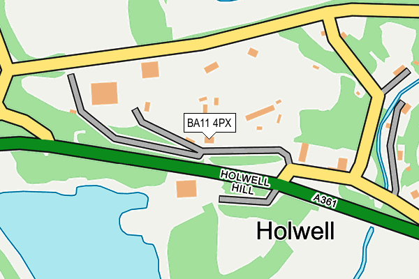
BA11 4PX is located in the Mendip Central and East electoral ward, within the unitary authority of Somerset and the English Parliamentary constituency of Somerton and Frome. The Sub Integrated Care Board (ICB) Location is NHS Somerset ICB - 11X and the police force is Avon and Somerset. This postcode has been in use since January 1980.


GetTheData
Source: OS OpenMap – Local (Ordnance Survey)
Source: OS VectorMap District (Ordnance Survey)
Licence: Open Government Licence (requires attribution)
| Easting | 372628 |
| Northing | 145034 |
| Latitude | 51.203855 |
| Longitude | -2.393173 |
GetTheData
Source: Open Postcode Geo
Licence: Open Government Licence
| Country | England |
| Postcode District | BA11 |
➜ See where BA11 is on a map | |
GetTheData
Source: Land Registry Price Paid Data
Licence: Open Government Licence
Elevation or altitude of BA11 4PX as distance above sea level:
| Metres | Feet | |
|---|---|---|
| Elevation | 130m | 427ft |
Elevation is measured from the approximate centre of the postcode, to the nearest point on an OS contour line from OS Terrain 50, which has contour spacing of ten vertical metres.
➜ How high above sea level am I? Find the elevation of your current position using your device's GPS.
GetTheData
Source: Open Postcode Elevation
Licence: Open Government Licence
| Ward | Mendip Central And East |
| Constituency | Somerton And Frome |
GetTheData
Source: ONS Postcode Database
Licence: Open Government Licence
| Nunney School (Main Road) | Nunney | 1,044m |
| Dallimore Mead (High Street) | Nunney | 1,055m |
| Nunney School (Main Road) | Nunney | 1,057m |
| Dallimore Mead (High Street) | Nunney | 1,063m |
| Bus Shelter | Nunney | 1,163m |
GetTheData
Source: NaPTAN
Licence: Open Government Licence
GetTheData
Source: ONS Postcode Database
Licence: Open Government Licence


➜ Get more ratings from the Food Standards Agency
GetTheData
Source: Food Standards Agency
Licence: FSA terms & conditions
| Last Collection | |||
|---|---|---|---|
| Location | Mon-Fri | Sat | Distance |
| Witham Friary | 15:45 | 10:30 | 4,336m |
GetTheData
Source: Dracos
Licence: Creative Commons Attribution-ShareAlike
The below table lists the International Territorial Level (ITL) codes (formerly Nomenclature of Territorial Units for Statistics (NUTS) codes) and Local Administrative Units (LAU) codes for BA11 4PX:
| ITL 1 Code | Name |
|---|---|
| TLK | South West (England) |
| ITL 2 Code | Name |
| TLK2 | Dorset and Somerset |
| ITL 3 Code | Name |
| TLK23 | Somerset CC |
| LAU 1 Code | Name |
| E07000187 | Mendip |
GetTheData
Source: ONS Postcode Directory
Licence: Open Government Licence
The below table lists the Census Output Area (OA), Lower Layer Super Output Area (LSOA), and Middle Layer Super Output Area (MSOA) for BA11 4PX:
| Code | Name | |
|---|---|---|
| OA | E00147993 | |
| LSOA | E01029058 | Mendip 010E |
| MSOA | E02006056 | Mendip 010 |
GetTheData
Source: ONS Postcode Directory
Licence: Open Government Licence
| BA11 4PZ | Holwell | 281m |
| BA11 4PP | 452m | |
| BA11 4PU | Holwell | 556m |
| BA11 4NN | Westover | 954m |
| BA11 4NW | Green Pits Lane | 982m |
| BA11 4NP | Horn Street | 1007m |
| BA11 4ND | Sunnyhill | 1008m |
| BA11 4NQ | Glebelands | 1014m |
| BA11 4NF | Flowerfield | 1063m |
| BA11 4NE | Catch Road | 1092m |
GetTheData
Source: Open Postcode Geo; Land Registry Price Paid Data
Licence: Open Government Licence