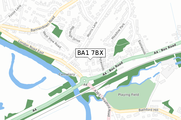
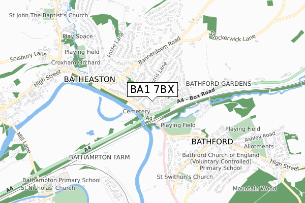
BA1 7BX is located in the Bathavon North electoral ward, within the unitary authority of Bath and North East Somerset and the English Parliamentary constituency of North East Somerset. The Sub Integrated Care Board (ICB) Location is NHS Bath and North East Somerset, Swindon and Wiltshire ICB - 92 and the police force is Avon and Somerset. This postcode has been in use since May 2018.


GetTheData
Source: OS Open Zoomstack (Ordnance Survey)
Licence: Open Government Licence (requires attribution)
Attribution: Contains OS data © Crown copyright and database right 2024
Source: Open Postcode Geo
Licence: Open Government Licence (requires attribution)
Attribution: Contains OS data © Crown copyright and database right 2024; Contains Royal Mail data © Royal Mail copyright and database right 2024; Source: Office for National Statistics licensed under the Open Government Licence v.3.0
| Easting | 378570 |
| Northing | 167214 |
| Latitude | 51.403542 |
| Longitude | -2.309461 |
GetTheData
Source: Open Postcode Geo
Licence: Open Government Licence
| Country | England |
| Postcode District | BA1 |
➜ See where BA1 is on a map ➜ Where is Batheaston? | |
GetTheData
Source: Land Registry Price Paid Data
Licence: Open Government Licence
| Ward | Bathavon North |
| Constituency | North East Somerset |
GetTheData
Source: ONS Postcode Database
Licence: Open Government Licence
ASH HOUSE, BEECH LANE, BATH, BA1 7BX 2019 2 AUG £850,000 |
OAK HOUSE, BEECH LANE, BATH, BA1 7BX 2018 16 NOV £835,000 |
CEDAR HOUSE, BEECH LANE, BATH, BA1 7BX 2018 16 NOV £727,500 |
PINE HOUSE, BEECH LANE, BATH, BA1 7BX 2018 17 MAY £880,000 |
GetTheData
Source: HM Land Registry Price Paid Data
Licence: Contains HM Land Registry data © Crown copyright and database right 2024. This data is licensed under the Open Government Licence v3.0.
| Westwoods (Box Road) | Batheaston | 110m |
| Westwoods (Box Road) | Batheaston | 145m |
| Bathford Bridge (Bradford Road) | Bathford | 169m |
| Morris Lane (London Road East) | Batheaston | 199m |
| Morris Lane (London Road East) | Batheaston | 258m |
| Bath Spa Station | 4.4km |
| Oldfield Park Station | 5.6km |
GetTheData
Source: NaPTAN
Licence: Open Government Licence
| Percentage of properties with Next Generation Access | 100.0% |
| Percentage of properties with Superfast Broadband | 0.0% |
| Percentage of properties with Ultrafast Broadband | 0.0% |
| Percentage of properties with Full Fibre Broadband | 0.0% |
Superfast Broadband is between 30Mbps and 300Mbps
Ultrafast Broadband is > 300Mbps
| Percentage of properties unable to receive 2Mbps | 0.0% |
| Percentage of properties unable to receive 5Mbps | 0.0% |
| Percentage of properties unable to receive 10Mbps | 0.0% |
| Percentage of properties unable to receive 30Mbps | 100.0% |
GetTheData
Source: Ofcom
Licence: Ofcom Terms of Use (requires attribution)
GetTheData
Source: ONS Postcode Database
Licence: Open Government Licence


➜ Get more ratings from the Food Standards Agency
GetTheData
Source: Food Standards Agency
Licence: FSA terms & conditions
| Last Collection | |||
|---|---|---|---|
| Location | Mon-Fri | Sat | Distance |
| Box Road | 17:30 | 12:15 | 160m |
| Meadow Park | 17:30 | 12:15 | 303m |
| Barnfield Way | 17:30 | 12:15 | 350m |
GetTheData
Source: Dracos
Licence: Creative Commons Attribution-ShareAlike
The below table lists the International Territorial Level (ITL) codes (formerly Nomenclature of Territorial Units for Statistics (NUTS) codes) and Local Administrative Units (LAU) codes for BA1 7BX:
| ITL 1 Code | Name |
|---|---|
| TLK | South West (England) |
| ITL 2 Code | Name |
| TLK1 | Gloucestershire, Wiltshire and Bath/Bristol area |
| ITL 3 Code | Name |
| TLK12 | Bath and North East Somerset, North Somerset and South Gloucestershire |
| LAU 1 Code | Name |
| E06000022 | Bath and North East Somerset |
GetTheData
Source: ONS Postcode Directory
Licence: Open Government Licence
The below table lists the Census Output Area (OA), Lower Layer Super Output Area (LSOA), and Middle Layer Super Output Area (MSOA) for BA1 7BX:
| Code | Name | |
|---|---|---|
| OA | E00072604 | |
| LSOA | E01014376 | Bath and North East Somerset 010D |
| MSOA | E02002994 | Bath and North East Somerset 010 |
GetTheData
Source: ONS Postcode Directory
Licence: Open Government Licence
| BA1 7QD | Box Road | 63m |
| BA1 7RU | Morris Close | 82m |
| BA1 7QE | Westwoods | 86m |
| BA1 7PP | Morris Lane | 99m |
| BA1 7RB | London Road East | 145m |
| BA1 7PT | Warleigh Drive | 185m |
| BA1 7QH | Box Road | 207m |
| BA1 7PN | West View Road | 219m |
| BA1 7PY | Meadow Park | 236m |
| BA1 7PL | Bannerdown Road | 274m |
GetTheData
Source: Open Postcode Geo; Land Registry Price Paid Data
Licence: Open Government Licence