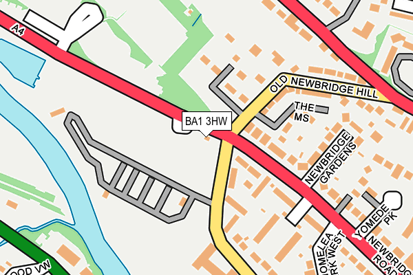
BA1 3HW is located in the Newbridge electoral ward, within the unitary authority of Bath and North East Somerset and the English Parliamentary constituency of Bath. The Sub Integrated Care Board (ICB) Location is NHS Bath and North East Somerset, Swindon and Wiltshire ICB - 92 and the police force is Avon and Somerset. This postcode has been in use since January 1980.


GetTheData
Source: OS OpenMap – Local (Ordnance Survey)
Source: OS VectorMap District (Ordnance Survey)
Licence: Open Government Licence (requires attribution)
| Easting | 372043 |
| Northing | 165617 |
| Latitude | 51.388897 |
| Longitude | -2.403164 |
GetTheData
Source: Open Postcode Geo
Licence: Open Government Licence
| Country | England |
| Postcode District | BA1 |
➜ See where BA1 is on a map ➜ Where is Bath? | |
GetTheData
Source: Land Registry Price Paid Data
Licence: Open Government Licence
Elevation or altitude of BA1 3HW as distance above sea level:
| Metres | Feet | |
|---|---|---|
| Elevation | 20m | 66ft |
Elevation is measured from the approximate centre of the postcode, to the nearest point on an OS contour line from OS Terrain 50, which has contour spacing of ten vertical metres.
➜ How high above sea level am I? Find the elevation of your current position using your device's GPS.
GetTheData
Source: Open Postcode Elevation
Licence: Open Government Licence
| Ward | Newbridge |
| Constituency | Bath |
GetTheData
Source: ONS Postcode Database
Licence: Open Government Licence
| Old Newbridge Hill (Newbridge Road) | Newbridge | 35m |
| Caravan Park (Brassmill Lane) | Newbridge | 58m |
| Newbridge Gardens (Newbridge Road) | Newbridge | 137m |
| Selbourne Close (Brassmill Lane) | Newbridge | 199m |
| Newbridge Gardens (Newbridge Road) | Newbridge | 214m |
| Oldfield Park Station | 1.9km |
| Bath Spa Station | 3.4km |
GetTheData
Source: NaPTAN
Licence: Open Government Licence
GetTheData
Source: ONS Postcode Database
Licence: Open Government Licence


➜ Get more ratings from the Food Standards Agency
GetTheData
Source: Food Standards Agency
Licence: FSA terms & conditions
| Last Collection | |||
|---|---|---|---|
| Location | Mon-Fri | Sat | Distance |
| Yeomede Park P.o. | 17:30 | 11:45 | 105m |
| Partis College | 17:30 | 12:00 | 352m |
| Penn Hill Road | 17:30 | 12:00 | 501m |
GetTheData
Source: Dracos
Licence: Creative Commons Attribution-ShareAlike
| Risk of BA1 3HW flooding from rivers and sea | Low |
| ➜ BA1 3HW flood map | |
GetTheData
Source: Open Flood Risk by Postcode
Licence: Open Government Licence
The below table lists the International Territorial Level (ITL) codes (formerly Nomenclature of Territorial Units for Statistics (NUTS) codes) and Local Administrative Units (LAU) codes for BA1 3HW:
| ITL 1 Code | Name |
|---|---|
| TLK | South West (England) |
| ITL 2 Code | Name |
| TLK1 | Gloucestershire, Wiltshire and Bath/Bristol area |
| ITL 3 Code | Name |
| TLK12 | Bath and North East Somerset, North Somerset and South Gloucestershire |
| LAU 1 Code | Name |
| E06000022 | Bath and North East Somerset |
GetTheData
Source: ONS Postcode Directory
Licence: Open Government Licence
The below table lists the Census Output Area (OA), Lower Layer Super Output Area (LSOA), and Middle Layer Super Output Area (MSOA) for BA1 3HW:
| Code | Name | |
|---|---|---|
| OA | E00072876 | |
| LSOA | E01014430 | Bath and North East Somerset 008D |
| MSOA | E02002992 | Bath and North East Somerset 008 |
GetTheData
Source: ONS Postcode Directory
Licence: Open Government Licence
| BA1 3HU | Selbourne Close | 97m |
| BA1 3LG | Newbridge Road | 99m |
| BA1 3LY | The Mews | 122m |
| BA1 3HN | Newbridge Road | 144m |
| BA1 3LU | Old Newbridge Hill | 158m |
| BA1 3LX | Old Newbridge Hill | 160m |
| BA1 3HS | Westfield Park | 165m |
| BA1 3LT | Newbridge Gardens | 184m |
| BA1 3HX | Brassmill Lane | 200m |
| BA1 3QH | Kelston Road | 207m |
GetTheData
Source: Open Postcode Geo; Land Registry Price Paid Data
Licence: Open Government Licence