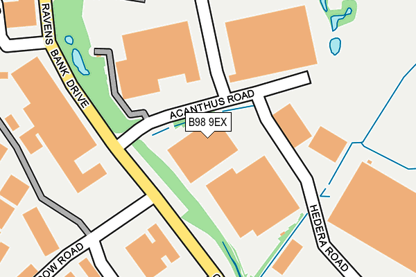
B98 9EX is located in the Alvechurch South electoral ward, within the local authority district of Bromsgrove and the English Parliamentary constituency of Bromsgrove. The Sub Integrated Care Board (ICB) Location is NHS Herefordshire and Worcestershire ICB - 18C and the police force is West Mercia. This postcode has been in use since July 1995.


GetTheData
Source: OS OpenMap – Local (Ordnance Survey)
Source: OS VectorMap District (Ordnance Survey)
Licence: Open Government Licence (requires attribution)
| Easting | 407791 |
| Northing | 268973 |
| Latitude | 52.318821 |
| Longitude | -1.887116 |
GetTheData
Source: Open Postcode Geo
Licence: Open Government Licence
| Country | England |
| Postcode District | B98 |
➜ See where B98 is on a map | |
GetTheData
Source: Land Registry Price Paid Data
Licence: Open Government Licence
Elevation or altitude of B98 9EX as distance above sea level:
| Metres | Feet | |
|---|---|---|
| Elevation | 100m | 328ft |
Elevation is measured from the approximate centre of the postcode, to the nearest point on an OS contour line from OS Terrain 50, which has contour spacing of ten vertical metres.
➜ How high above sea level am I? Find the elevation of your current position using your device's GPS.
GetTheData
Source: Open Postcode Elevation
Licence: Open Government Licence
| Ward | Alvechurch South |
| Constituency | Bromsgrove |
GetTheData
Source: ONS Postcode Database
Licence: Open Government Licence
| Burnt Meadow Road (Ravensbank Drive) | Moon's Moat | 266m |
| Thornhill Road (Ravens Bank Drive) | Moon's Moat | 277m |
| Burnt Meadow Road (Ravensbank Drive) | Moon's Moat | 287m |
| Fringe Meadow Road (Ravensbank Drive) | Moon's Moat | 358m |
| Fringe Meadow Road (Ravensbank Drive) | Moon's Moat | 379m |
| Wood End Station | 4km |
| Redditch Station | 4.2km |
| Danzey Station | 4.6km |
GetTheData
Source: NaPTAN
Licence: Open Government Licence
GetTheData
Source: ONS Postcode Database
Licence: Open Government Licence


➜ Get more ratings from the Food Standards Agency
GetTheData
Source: Food Standards Agency
Licence: FSA terms & conditions
| Last Collection | |||
|---|---|---|---|
| Location | Mon-Fri | Sat | Distance |
| Ridings Lane / Church Hill Nor | 18:15 | 11:30 | 507m |
| Impney Drive / Home Meadow Lan | 17:30 | 10:30 | 736m |
| Grangers Lane / Oakham Close | 17:45 | 10:30 | 1,091m |
GetTheData
Source: Dracos
Licence: Creative Commons Attribution-ShareAlike
The below table lists the International Territorial Level (ITL) codes (formerly Nomenclature of Territorial Units for Statistics (NUTS) codes) and Local Administrative Units (LAU) codes for B98 9EX:
| ITL 1 Code | Name |
|---|---|
| TLG | West Midlands (England) |
| ITL 2 Code | Name |
| TLG1 | Herefordshire, Worcestershire and Warwickshire |
| ITL 3 Code | Name |
| TLG12 | Worcestershire CC |
| LAU 1 Code | Name |
| E07000234 | Bromsgrove |
GetTheData
Source: ONS Postcode Directory
Licence: Open Government Licence
The below table lists the Census Output Area (OA), Lower Layer Super Output Area (LSOA), and Middle Layer Super Output Area (MSOA) for B98 9EX:
| Code | Name | |
|---|---|---|
| OA | E00163860 | |
| LSOA | E01032123 | Bromsgrove 009B |
| MSOA | E02006704 | Bromsgrove 009 |
GetTheData
Source: ONS Postcode Directory
Licence: Open Government Licence
| B98 9NR | Fringe Meadow Road | 430m |
| B98 9PA | Burnt Meadow Road | 466m |
| B98 9AW | The Glebe | 544m |
| B98 9AU | Moss Lane Close | 591m |
| B98 9LX | Hillmorton Close | 597m |
| B98 9LU | Fairford Close | 637m |
| B98 9AT | Holt Hill | 654m |
| B98 9NQ | Latchford Close | 692m |
| B98 9HE | Walkers Road | 696m |
| B98 9AN | Beoley Lane | 703m |
GetTheData
Source: Open Postcode Geo; Land Registry Price Paid Data
Licence: Open Government Licence