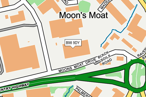
B98 9DY is located in the Church Hill electoral ward, within the local authority district of Redditch and the English Parliamentary constituency of Redditch. The Sub Integrated Care Board (ICB) Location is NHS Herefordshire and Worcestershire ICB - 18C and the police force is West Mercia. This postcode has been in use since June 2016.


GetTheData
Source: OS OpenMap – Local (Ordnance Survey)
Source: OS VectorMap District (Ordnance Survey)
Licence: Open Government Licence (requires attribution)
| Easting | 407620 |
| Northing | 268269 |
| Latitude | 52.312495 |
| Longitude | -1.889640 |
GetTheData
Source: Open Postcode Geo
Licence: Open Government Licence
| Country | England |
| Postcode District | B98 |
➜ See where B98 is on a map ➜ Where is Redditch? | |
GetTheData
Source: Land Registry Price Paid Data
Licence: Open Government Licence
Elevation or altitude of B98 9DY as distance above sea level:
| Metres | Feet | |
|---|---|---|
| Elevation | 90m | 295ft |
Elevation is measured from the approximate centre of the postcode, to the nearest point on an OS contour line from OS Terrain 50, which has contour spacing of ten vertical metres.
➜ How high above sea level am I? Find the elevation of your current position using your device's GPS.
GetTheData
Source: Open Postcode Elevation
Licence: Open Government Licence
| Ward | Church Hill |
| Constituency | Redditch |
GetTheData
Source: ONS Postcode Database
Licence: Open Government Licence
| Merse Road | Moon's Moat | 123m |
| Coventry Highway Island (Ravensbank Drive) | Moon's Moat | 302m |
| Coventry Highway Island (Ravensbank Drive) | Moon's Moat | 320m |
| Palmers Road (Alder's Drive) | Winyates Green | 325m |
| Far Moor Lane End (Far Moor Lane) | Winyates Green | 351m |
| Redditch Station | 3.9km |
| Wood End Station | 4.7km |
| Danzey Station | 4.9km |
GetTheData
Source: NaPTAN
Licence: Open Government Licence
GetTheData
Source: ONS Postcode Database
Licence: Open Government Licence


➜ Get more ratings from the Food Standards Agency
GetTheData
Source: Food Standards Agency
Licence: FSA terms & conditions
| Last Collection | |||
|---|---|---|---|
| Location | Mon-Fri | Sat | Distance |
| Grangers Lane / Oakham Close | 17:45 | 10:30 | 679m |
| Ibstock Close / Whitehouse Lan | 17:30 | 11:30 | 894m |
| Impney Drive / Home Meadow Lan | 17:30 | 10:30 | 905m |
GetTheData
Source: Dracos
Licence: Creative Commons Attribution-ShareAlike
The below table lists the International Territorial Level (ITL) codes (formerly Nomenclature of Territorial Units for Statistics (NUTS) codes) and Local Administrative Units (LAU) codes for B98 9DY:
| ITL 1 Code | Name |
|---|---|
| TLG | West Midlands (England) |
| ITL 2 Code | Name |
| TLG1 | Herefordshire, Worcestershire and Warwickshire |
| ITL 3 Code | Name |
| TLG12 | Worcestershire CC |
| LAU 1 Code | Name |
| E07000236 | Redditch |
GetTheData
Source: ONS Postcode Directory
Licence: Open Government Licence
The below table lists the Census Output Area (OA), Lower Layer Super Output Area (LSOA), and Middle Layer Super Output Area (MSOA) for B98 9DY:
| Code | Name | |
|---|---|---|
| OA | E00164465 | |
| LSOA | E01032241 | Redditch 002B |
| MSOA | E02006722 | Redditch 002 |
GetTheData
Source: ONS Postcode Directory
Licence: Open Government Licence
| B98 0RF | Palmers Road | 254m |
| B98 9NR | Fringe Meadow Road | 296m |
| B98 9PA | Burnt Meadow Road | 407m |
| B98 0RE | Oxleasow Road | 484m |
| B98 0PS | Foxcote Close | 538m |
| B98 0SB | Kingham Close | 550m |
| B98 9HE | Walkers Road | 556m |
| B98 0PR | Foxcote Close | 591m |
| B98 0SA | Kingham Close | 633m |
| B98 0PZ | Ibstock Close | 685m |
GetTheData
Source: Open Postcode Geo; Land Registry Price Paid Data
Licence: Open Government Licence