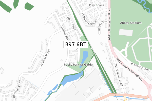
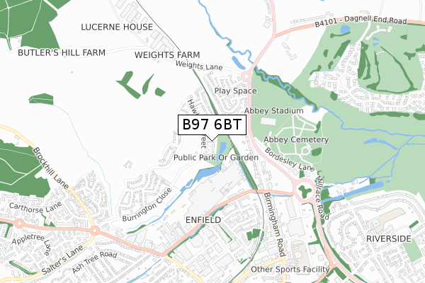
B97 6BT is located in the Batchley & Brockhill electoral ward, within the local authority district of Redditch and the English Parliamentary constituency of Redditch. The Sub Integrated Care Board (ICB) Location is NHS Herefordshire and Worcestershire ICB - 18C and the police force is West Mercia. This postcode has been in use since July 2018.


GetTheData
Source: OS Open Zoomstack (Ordnance Survey)
Licence: Open Government Licence (requires attribution)
Attribution: Contains OS data © Crown copyright and database right 2025
Source: Open Postcode Geo
Licence: Open Government Licence (requires attribution)
Attribution: Contains OS data © Crown copyright and database right 2025; Contains Royal Mail data © Royal Mail copyright and database right 2025; Source: Office for National Statistics licensed under the Open Government Licence v.3.0
| Easting | 403763 |
| Northing | 268833 |
| Latitude | 52.317604 |
| Longitude | -1.946210 |
GetTheData
Source: Open Postcode Geo
Licence: Open Government Licence
| Country | England |
| Postcode District | B97 |
➜ See where B97 is on a map ➜ Where is Redditch? | |
GetTheData
Source: Land Registry Price Paid Data
Licence: Open Government Licence
| Ward | Batchley & Brockhill |
| Constituency | Redditch |
GetTheData
Source: ONS Postcode Database
Licence: Open Government Licence
2023 30 JUN £360,000 |
2023 29 JUN £375,000 |
2023 31 MAY £362,000 |
2022 25 APR £345,000 |
2018 14 DEC £305,000 |
15, JACOB CLOSE, REDDITCH, B97 6BT 2018 23 NOV £305,000 |
17, JACOB CLOSE, REDDITCH, B97 6BT 2018 29 OCT £268,000 |
14, JACOB CLOSE, REDDITCH, B97 6BT 2018 28 SEP £265,000 |
11, JACOB CLOSE, REDDITCH, B97 6BT 2018 28 SEP £301,000 |
13, JACOB CLOSE, REDDITCH, B97 6BT 2018 28 SEP £305,000 |
GetTheData
Source: HM Land Registry Price Paid Data
Licence: Contains HM Land Registry data © Crown copyright and database right 2025. This data is licensed under the Open Government Licence v3.0.
| Abbey Stadium (Alvechurch Highway) | Bordesley | 262m |
| Abbey Stadium Grounds (Bordesley Lane) | Bordesley | 297m |
| Abbey Stadium (Alvechurch Highway) | Bordesley | 304m |
| Weights Lane (Birmingham Road) | Bordesley | 306m |
| Windsor Heights (Windsor Road) | Bordesley | 353m |
| Redditch Station | 1.3km |
| Alvechurch Station | 3.5km |
| Barnt Green Station | 5.8km |
GetTheData
Source: NaPTAN
Licence: Open Government Licence
| Percentage of properties with Next Generation Access | 0.0% |
| Percentage of properties with Superfast Broadband | 0.0% |
| Percentage of properties with Ultrafast Broadband | 0.0% |
| Percentage of properties with Full Fibre Broadband | 0.0% |
Superfast Broadband is between 30Mbps and 300Mbps
Ultrafast Broadband is > 300Mbps
| Percentage of properties unable to receive 2Mbps | 0.0% |
| Percentage of properties unable to receive 5Mbps | 0.0% |
| Percentage of properties unable to receive 10Mbps | 0.0% |
| Percentage of properties unable to receive 30Mbps | 100.0% |
GetTheData
Source: Ofcom
Licence: Ofcom Terms of Use (requires attribution)
GetTheData
Source: ONS Postcode Database
Licence: Open Government Licence


➜ Get more ratings from the Food Standards Agency
GetTheData
Source: Food Standards Agency
Licence: FSA terms & conditions
| Last Collection | |||
|---|---|---|---|
| Location | Mon-Fri | Sat | Distance |
| Bordesley Toll Lane | 16:00 | 08:00 | 819m |
| Redditch D O | 18:45 | 12:00 | 881m |
| Easemore Road | 17:30 | 11:30 | 1,139m |
GetTheData
Source: Dracos
Licence: Creative Commons Attribution-ShareAlike
The below table lists the International Territorial Level (ITL) codes (formerly Nomenclature of Territorial Units for Statistics (NUTS) codes) and Local Administrative Units (LAU) codes for B97 6BT:
| ITL 1 Code | Name |
|---|---|
| TLG | West Midlands (England) |
| ITL 2 Code | Name |
| TLG1 | Herefordshire, Worcestershire and Warwickshire |
| ITL 3 Code | Name |
| TLG12 | Worcestershire CC |
| LAU 1 Code | Name |
| E07000236 | Redditch |
GetTheData
Source: ONS Postcode Directory
Licence: Open Government Licence
The below table lists the Census Output Area (OA), Lower Layer Super Output Area (LSOA), and Middle Layer Super Output Area (MSOA) for B97 6BT:
| Code | Name | |
|---|---|---|
| OA | E00171592 | |
| LSOA | E01032233 | Redditch 003B |
| MSOA | E02006723 | Redditch 003 |
GetTheData
Source: ONS Postcode Directory
Licence: Open Government Licence
| B97 6EH | Birmingham Road | 282m |
| B97 6EL | Birmingham Road | 368m |
| B97 6AJ | Dixon Close | 428m |
| B97 6HQ | Elrington Close | 439m |
| B97 6AP | Dixon Close | 474m |
| B97 6HG | Dovecote Close | 501m |
| B97 6AD | Dixon Close | 522m |
| B97 6HE | Burrington Close | 528m |
| B97 6LE | Fairweather Close | 530m |
| B97 6EA | Birmingham Road | 546m |
GetTheData
Source: Open Postcode Geo; Land Registry Price Paid Data
Licence: Open Government Licence