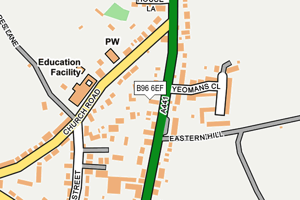
B96 6EF is located in the Astwood Bank and Feckenham electoral ward, within the local authority district of Redditch and the English Parliamentary constituency of Redditch. The Sub Integrated Care Board (ICB) Location is NHS Herefordshire and Worcestershire ICB - 18C and the police force is West Mercia. This postcode has been in use since July 2017.


GetTheData
Source: OS OpenMap – Local (Ordnance Survey)
Source: OS VectorMap District (Ordnance Survey)
Licence: Open Government Licence (requires attribution)
| Easting | 404329 |
| Northing | 262362 |
| Latitude | 52.259423 |
| Longitude | -1.937989 |
GetTheData
Source: Open Postcode Geo
Licence: Open Government Licence
| Country | England |
| Postcode District | B96 |
➜ See where B96 is on a map ➜ Where is Astwood Bank? | |
GetTheData
Source: Land Registry Price Paid Data
Licence: Open Government Licence
| Ward | Astwood Bank And Feckenham |
| Constituency | Redditch |
GetTheData
Source: ONS Postcode Database
Licence: Open Government Licence
1, WHITE LION COURT, ASTWOOD BANK, REDDITCH, B96 6EF 2022 28 NOV £360,000 |
1, WHITE LION COURT, ASTWOOD BANK, REDDITCH, B96 6EF 2018 27 FEB £292,500 |
GetTheData
Source: HM Land Registry Price Paid Data
Licence: Contains HM Land Registry data © Crown copyright and database right 2025. This data is licensed under the Open Government Licence v3.0.
| White Lion (Evesham Road) | Astwood Bank | 37m |
| White Lion (Evesham Road) | Astwood Bank | 50m |
| High Street | Astwood Bank | 147m |
| High Street | Astwood Bank | 165m |
| Eastern Hill (Evesham Road) | Astwood Bank | 263m |
GetTheData
Source: NaPTAN
Licence: Open Government Licence
| Percentage of properties with Next Generation Access | 100.0% |
| Percentage of properties with Superfast Broadband | 100.0% |
| Percentage of properties with Ultrafast Broadband | 0.0% |
| Percentage of properties with Full Fibre Broadband | 0.0% |
Superfast Broadband is between 30Mbps and 300Mbps
Ultrafast Broadband is > 300Mbps
| Percentage of properties unable to receive 2Mbps | 0.0% |
| Percentage of properties unable to receive 5Mbps | 0.0% |
| Percentage of properties unable to receive 10Mbps | 0.0% |
| Percentage of properties unable to receive 30Mbps | 0.0% |
GetTheData
Source: Ofcom
Licence: Ofcom Terms of Use (requires attribution)
GetTheData
Source: ONS Postcode Database
Licence: Open Government Licence


➜ Get more ratings from the Food Standards Agency
GetTheData
Source: Food Standards Agency
Licence: FSA terms & conditions
| Last Collection | |||
|---|---|---|---|
| Location | Mon-Fri | Sat | Distance |
| Astwood Bank Post Office | 18:15 | 12:00 | 168m |
| Edgioake Lane | 15:15 | 10:00 | 811m |
| Stonepits Lane | 17:30 | 10:30 | 1,675m |
GetTheData
Source: Dracos
Licence: Creative Commons Attribution-ShareAlike
The below table lists the International Territorial Level (ITL) codes (formerly Nomenclature of Territorial Units for Statistics (NUTS) codes) and Local Administrative Units (LAU) codes for B96 6EF:
| ITL 1 Code | Name |
|---|---|
| TLG | West Midlands (England) |
| ITL 2 Code | Name |
| TLG1 | Herefordshire, Worcestershire and Warwickshire |
| ITL 3 Code | Name |
| TLG12 | Worcestershire CC |
| LAU 1 Code | Name |
| E07000236 | Redditch |
GetTheData
Source: ONS Postcode Directory
Licence: Open Government Licence
The below table lists the Census Output Area (OA), Lower Layer Super Output Area (LSOA), and Middle Layer Super Output Area (MSOA) for B96 6EF:
| Code | Name | |
|---|---|---|
| OA | E00164397 | |
| LSOA | E01032231 | Redditch 013D |
| MSOA | E02006733 | Redditch 013 |
GetTheData
Source: ONS Postcode Directory
Licence: Open Government Licence
| B96 6BW | Foregate Street | 56m |
| B96 6AA | Evesham Road | 56m |
| B96 6BS | Butler Street | 88m |
| B96 6BT | Queen Street | 120m |
| B96 6AB | Evesham Road | 121m |
| B96 6DS | Feckenham Road | 124m |
| B96 6EU | Evesham Road | 132m |
| B96 6AD | Evesham Road | 162m |
| B96 6DX | Beverley Close | 168m |
| B96 6BU | High Street | 169m |
GetTheData
Source: Open Postcode Geo; Land Registry Price Paid Data
Licence: Open Government Licence