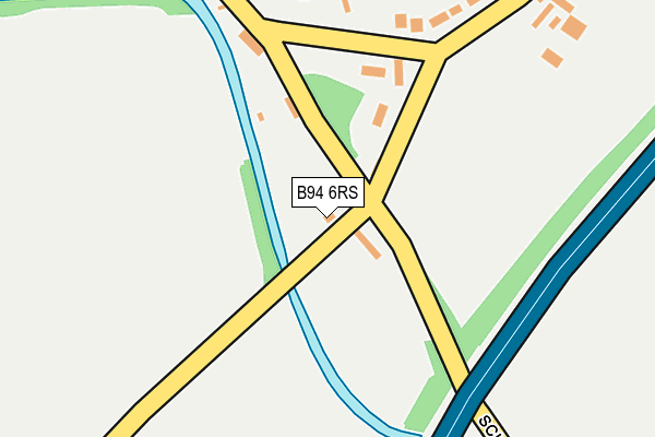
B94 6RS lies on Dyers Lane in Hockley Heath, Solihull. B94 6RS is located in the Blythe electoral ward, within the metropolitan district of Solihull and the English Parliamentary constituency of Meriden. The Sub Integrated Care Board (ICB) Location is NHS Birmingham and Solihull ICB - 15E and the police force is West Midlands. This postcode has been in use since January 1980.


GetTheData
Source: OS OpenMap – Local (Ordnance Survey)
Source: OS VectorMap District (Ordnance Survey)
Licence: Open Government Licence (requires attribution)
| Easting | 413322 |
| Northing | 274074 |
| Latitude | 52.364560 |
| Longitude | -1.805781 |
GetTheData
Source: Open Postcode Geo
Licence: Open Government Licence
| Street | Dyers Lane |
| Locality | Hockley Heath |
| Town/City | Solihull |
| Country | England |
| Postcode District | B94 |
➜ See where B94 is on a map ➜ Where is Illshaw Heath? | |
GetTheData
Source: Land Registry Price Paid Data
Licence: Open Government Licence
Elevation or altitude of B94 6RS as distance above sea level:
| Metres | Feet | |
|---|---|---|
| Elevation | 140m | 459ft |
Elevation is measured from the approximate centre of the postcode, to the nearest point on an OS contour line from OS Terrain 50, which has contour spacing of ten vertical metres.
➜ How high above sea level am I? Find the elevation of your current position using your device's GPS.
GetTheData
Source: Open Postcode Elevation
Licence: Open Government Licence
| Ward | Blythe |
| Constituency | Meriden |
GetTheData
Source: ONS Postcode Database
Licence: Open Government Licence
| Innovation Centre (Central Boulevard) | Illshaw Heath | 689m |
| Innovation Centre (Central Boulevard) | Illshaw Heath | 705m |
| St James Place (Central Boulevard) | Illshaw Heath | 884m |
| St James Place (Central Boulevard) | Illshaw Heath | 886m |
| Rotherhams Oak Lane (Cut Throat Lane) | Hockley Heath | 1,166m |
| The Lakes Station | 2.7km |
| Wood End Station | 3.5km |
| Dorridge Station | 3.7km |
GetTheData
Source: NaPTAN
Licence: Open Government Licence
| Percentage of properties with Next Generation Access | 100.0% |
| Percentage of properties with Superfast Broadband | 100.0% |
| Percentage of properties with Ultrafast Broadband | 100.0% |
| Percentage of properties with Full Fibre Broadband | 100.0% |
Superfast Broadband is between 30Mbps and 300Mbps
Ultrafast Broadband is > 300Mbps
| Percentage of properties unable to receive 2Mbps | 0.0% |
| Percentage of properties unable to receive 5Mbps | 0.0% |
| Percentage of properties unable to receive 10Mbps | 0.0% |
| Percentage of properties unable to receive 30Mbps | 0.0% |
GetTheData
Source: Ofcom
Licence: Ofcom Terms of Use (requires attribution)
GetTheData
Source: ONS Postcode Database
Licence: Open Government Licence


➜ Get more ratings from the Food Standards Agency
GetTheData
Source: Food Standards Agency
Licence: FSA terms & conditions
| Last Collection | |||
|---|---|---|---|
| Location | Mon-Fri | Sat | Distance |
| By Salter St School | 12:00 | 08:30 | 1,325m |
| Cheswick Green Post Office | 18:30 | 11:30 | 1,644m |
| Wood Lane | 16:00 | 08:15 | 2,304m |
GetTheData
Source: Dracos
Licence: Creative Commons Attribution-ShareAlike
The below table lists the International Territorial Level (ITL) codes (formerly Nomenclature of Territorial Units for Statistics (NUTS) codes) and Local Administrative Units (LAU) codes for B94 6RS:
| ITL 1 Code | Name |
|---|---|
| TLG | West Midlands (England) |
| ITL 2 Code | Name |
| TLG3 | West Midlands |
| ITL 3 Code | Name |
| TLG32 | Solihull |
| LAU 1 Code | Name |
| E08000029 | Solihull |
GetTheData
Source: ONS Postcode Directory
Licence: Open Government Licence
The below table lists the Census Output Area (OA), Lower Layer Super Output Area (LSOA), and Middle Layer Super Output Area (MSOA) for B94 6RS:
| Code | Name | |
|---|---|---|
| OA | E00051497 | |
| LSOA | E01010183 | Solihull 029D |
| MSOA | E02002109 | Solihull 029 |
GetTheData
Source: ONS Postcode Directory
Licence: Open Government Licence
| B94 6RP | School Road | 42m |
| B94 6RR | Dyers Lane | 67m |
| B94 6RT | Illshaw Heath Road | 115m |
| B94 6RU | Kineton Lane | 192m |
| B94 6RX | Kineton Lane | 276m |
| B94 6BH | Tinkers Lane | 512m |
| B94 6BS | Warings Green Road | 639m |
| B94 6DL | Illshaw Heath Road | 662m |
| B94 6BT | Warings Green Road | 760m |
| B94 6BL | Warings Green Road | 835m |
GetTheData
Source: Open Postcode Geo; Land Registry Price Paid Data
Licence: Open Government Licence