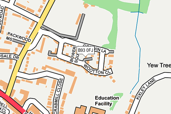
B93 0FJ is located in the Knowle electoral ward, within the metropolitan district of Solihull and the English Parliamentary constituency of Meriden. The Sub Integrated Care Board (ICB) Location is NHS Birmingham and Solihull ICB - 15E and the police force is West Midlands. This postcode has been in use since March 2017.


GetTheData
Source: OS OpenMap – Local (Ordnance Survey)
Source: OS VectorMap District (Ordnance Survey)
Licence: Open Government Licence (requires attribution)
| Easting | 418293 |
| Northing | 277091 |
| Latitude | 52.391555 |
| Longitude | -1.732608 |
GetTheData
Source: Open Postcode Geo
Licence: Open Government Licence
| Country | England |
| Postcode District | B93 |
➜ See where B93 is on a map | |
GetTheData
Source: Land Registry Price Paid Data
Licence: Open Government Licence
| Ward | Knowle |
| Constituency | Meriden |
GetTheData
Source: ONS Postcode Database
Licence: Open Government Licence
| Wilsons Arms (High St) | Knowle | 319m |
| Lodge Rd (Warwick Road) | Knowle | 329m |
| Knowle Green Church (High St) | Knowle | 390m |
| Knowle Green Church (High St) | Knowle | 396m |
| Knowle Green Terminus (Station Rd) | Knowle | 540m |
| Dorridge Station | 2.6km |
| Widney Manor Station | 2.9km |
| Solihull Station | 4.6km |
GetTheData
Source: NaPTAN
Licence: Open Government Licence
GetTheData
Source: ONS Postcode Database
Licence: Open Government Licence


➜ Get more ratings from the Food Standards Agency
GetTheData
Source: Food Standards Agency
Licence: FSA terms & conditions
| Last Collection | |||
|---|---|---|---|
| Location | Mon-Fri | Sat | Distance |
| Knowle Post Office | 17:15 | 12:00 | 340m |
| Knowle Delivery Office | 18:30 | 12:00 | 402m |
| Milverton Road / Warwick Road | 17:45 | 08:30 | 571m |
GetTheData
Source: Dracos
Licence: Creative Commons Attribution-ShareAlike
The below table lists the International Territorial Level (ITL) codes (formerly Nomenclature of Territorial Units for Statistics (NUTS) codes) and Local Administrative Units (LAU) codes for B93 0FJ:
| ITL 1 Code | Name |
|---|---|
| TLG | West Midlands (England) |
| ITL 2 Code | Name |
| TLG3 | West Midlands |
| ITL 3 Code | Name |
| TLG32 | Solihull |
| LAU 1 Code | Name |
| E08000029 | Solihull |
GetTheData
Source: ONS Postcode Directory
Licence: Open Government Licence
The below table lists the Census Output Area (OA), Lower Layer Super Output Area (LSOA), and Middle Layer Super Output Area (MSOA) for B93 0FJ:
| Code | Name | |
|---|---|---|
| OA | E00051338 | |
| LSOA | E01010155 | Solihull 026E |
| MSOA | E02002106 | Solihull 026 |
GetTheData
Source: ONS Postcode Directory
Licence: Open Government Licence
| B93 0FE | Bower Square | 0m |
| B93 0EJ | Wootton Close | 40m |
| B93 0FD | Godwin Lane | 47m |
| B93 0NP | Crabmill Close | 164m |
| B93 0NW | Crabmill Close | 179m |
| B93 0NT | Hampton Road | 205m |
| B93 0NR | Hampton Road | 225m |
| B93 0LL | High Street | 257m |
| B93 0NY | Packwood Mews | 272m |
| B93 9NE | Arden Vale Road | 275m |
GetTheData
Source: Open Postcode Geo; Land Registry Price Paid Data
Licence: Open Government Licence