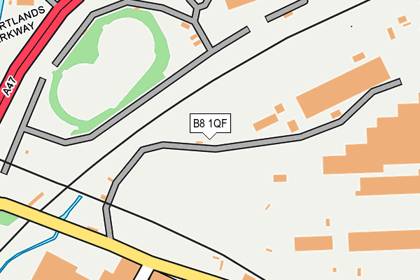
B8 1QF is located in the Alum Rock electoral ward, within the metropolitan district of Birmingham and the English Parliamentary constituency of Birmingham, Hodge Hill. The Sub Integrated Care Board (ICB) Location is NHS Birmingham and Solihull ICB - 15E and the police force is West Midlands. This postcode has been in use since January 1980.


GetTheData
Source: OS OpenMap – Local (Ordnance Survey)
Source: OS VectorMap District (Ordnance Survey)
Licence: Open Government Licence (requires attribution)
| Easting | 409767 |
| Northing | 288866 |
| Latitude | 52.497628 |
| Longitude | -1.857557 |
GetTheData
Source: Open Postcode Geo
Licence: Open Government Licence
| Country | England |
| Postcode District | B8 |
➜ See where B8 is on a map ➜ Where is Birmingham? | |
GetTheData
Source: Land Registry Price Paid Data
Licence: Open Government Licence
Elevation or altitude of B8 1QF as distance above sea level:
| Metres | Feet | |
|---|---|---|
| Elevation | 100m | 328ft |
Elevation is measured from the approximate centre of the postcode, to the nearest point on an OS contour line from OS Terrain 50, which has contour spacing of ten vertical metres.
➜ How high above sea level am I? Find the elevation of your current position using your device's GPS.
GetTheData
Source: Open Postcode Elevation
Licence: Open Government Licence
| Ward | Alum Rock |
| Constituency | Birmingham, Hodge Hill |
GetTheData
Source: ONS Postcode Database
Licence: Open Government Licence
| Sandway Gardens (Washwood Heath Rd) | Washwood Heath | 362m |
| Sandway Gardens (Washwood Heath Rd) | Washwood Heath | 378m |
| Hutton Rd (Washwood Heath Rd) | Washwood Heath | 435m |
| Hutton Rd (Washwood Heath Rd) | Washwood Heath | 461m |
| Wright Rd (Washwood Heath Rd) | Washwood Heath | 477m |
| Aston Station | 1.2km |
| Duddeston Station | 1.4km |
| Adderley Park Station | 1.6km |
GetTheData
Source: NaPTAN
Licence: Open Government Licence
GetTheData
Source: ONS Postcode Database
Licence: Open Government Licence


➜ Get more ratings from the Food Standards Agency
GetTheData
Source: Food Standards Agency
Licence: FSA terms & conditions
| Last Collection | |||
|---|---|---|---|
| Location | Mon-Fri | Sat | Distance |
| Washwood Heath Road Post Office | 17:45 | 11:30 | 449m |
| Saltley | 17:30 | 11:30 | 498m |
| Nechells Park Road Post Office | 18:30 | 12:30 | 623m |
GetTheData
Source: Dracos
Licence: Creative Commons Attribution-ShareAlike
The below table lists the International Territorial Level (ITL) codes (formerly Nomenclature of Territorial Units for Statistics (NUTS) codes) and Local Administrative Units (LAU) codes for B8 1QF:
| ITL 1 Code | Name |
|---|---|
| TLG | West Midlands (England) |
| ITL 2 Code | Name |
| TLG3 | West Midlands |
| ITL 3 Code | Name |
| TLG31 | Birmingham |
| LAU 1 Code | Name |
| E08000025 | Birmingham |
GetTheData
Source: ONS Postcode Directory
Licence: Open Government Licence
The below table lists the Census Output Area (OA), Lower Layer Super Output Area (LSOA), and Middle Layer Super Output Area (MSOA) for B8 1QF:
| Code | Name | |
|---|---|---|
| OA | E00047996 | |
| LSOA | E01009482 | Birmingham 048C |
| MSOA | E02001874 | Birmingham 048 |
GetTheData
Source: ONS Postcode Directory
Licence: Open Government Licence
| B8 1QW | Poplar Drive | 199m |
| B8 1QB | Chartist Road | 226m |
| B8 1QH | Bennetts Road | 236m |
| B8 1QD | Chartist Road | 240m |
| B8 1QJ | Bennetts Road | 246m |
| B8 1QL | Membury Road | 270m |
| B8 1QN | Membury Road | 279m |
| B8 1QU | Oak Tree Drive | 290m |
| B8 1RG | Sandway Gardens | 300m |
| B7 5RX | Aston Church Road | 314m |
GetTheData
Source: Open Postcode Geo; Land Registry Price Paid Data
Licence: Open Government Licence