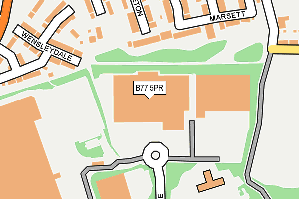
B77 5PR is located in the Stonydelph electoral ward, within the local authority district of Tamworth and the English Parliamentary constituency of Tamworth. The Sub Integrated Care Board (ICB) Location is NHS Staffordshire and Stoke-on-Trent ICB - 05Q and the police force is Staffordshire. This postcode has been in use since June 1997.


GetTheData
Source: OS OpenMap – Local (Ordnance Survey)
Source: OS VectorMap District (Ordnance Survey)
Licence: Open Government Licence (requires attribution)
| Easting | 424285 |
| Northing | 301369 |
| Latitude | 52.609579 |
| Longitude | -1.642795 |
GetTheData
Source: Open Postcode Geo
Licence: Open Government Licence
| Country | England |
| Postcode District | B77 |
➜ See where B77 is on a map ➜ Where is Tamworth? | |
GetTheData
Source: Land Registry Price Paid Data
Licence: Open Government Licence
Elevation or altitude of B77 5PR as distance above sea level:
| Metres | Feet | |
|---|---|---|
| Elevation | 100m | 328ft |
Elevation is measured from the approximate centre of the postcode, to the nearest point on an OS contour line from OS Terrain 50, which has contour spacing of ten vertical metres.
➜ How high above sea level am I? Find the elevation of your current position using your device's GPS.
GetTheData
Source: Open Postcode Elevation
Licence: Open Government Licence
| Ward | Stonydelph |
| Constituency | Tamworth |
GetTheData
Source: ONS Postcode Database
Licence: Open Government Licence
| Malham Road (Pennine Way) | Stonydelph | 362m |
| Mossdale (Malham Rd) | Stonydelph | 378m |
| Malham Road (Pennine Way) | Stonydelph | 385m |
| Rainscar (Pennymoor Rd) | Stonydelph | 398m |
| Milburn (Malham Rd) | Stonydelph | 402m |
| Wilnecote (Staffs) Station | 2.5km |
| Polesworth Station | 2.8km |
| Tamworth High Level Station | 4.3km |
GetTheData
Source: NaPTAN
Licence: Open Government Licence
GetTheData
Source: ONS Postcode Database
Licence: Open Government Licence


➜ Get more ratings from the Food Standards Agency
GetTheData
Source: Food Standards Agency
Licence: FSA terms & conditions
| Last Collection | |||
|---|---|---|---|
| Location | Mon-Fri | Sat | Distance |
| Granada Services | 17:30 | 11:00 | 255m |
| Malham Road / Lowforce | 18:00 | 11:30 | 700m |
| Birchmoor Post Office | 17:00 | 10:30 | 908m |
GetTheData
Source: Dracos
Licence: Creative Commons Attribution-ShareAlike
The below table lists the International Territorial Level (ITL) codes (formerly Nomenclature of Territorial Units for Statistics (NUTS) codes) and Local Administrative Units (LAU) codes for B77 5PR:
| ITL 1 Code | Name |
|---|---|
| TLG | West Midlands (England) |
| ITL 2 Code | Name |
| TLG2 | Shropshire and Staffordshire |
| ITL 3 Code | Name |
| TLG24 | Staffordshire CC |
| LAU 1 Code | Name |
| E07000199 | Tamworth |
GetTheData
Source: ONS Postcode Directory
Licence: Open Government Licence
The below table lists the Census Output Area (OA), Lower Layer Super Output Area (LSOA), and Middle Layer Super Output Area (MSOA) for B77 5PR:
| Code | Name | |
|---|---|---|
| OA | E00152146 | |
| LSOA | E01029855 | Tamworth 008A |
| MSOA | E02006224 | Tamworth 008 |
GetTheData
Source: ONS Postcode Directory
Licence: Open Government Licence
| B77 4QY | Mickleton | 141m |
| B77 4QU | Marsett | 213m |
| B77 4PS | Wensleydale | 251m |
| B77 4PJ | Mossdale | 253m |
| B77 4PN | Mayfield | 315m |
| B78 1AN | Green Lane | 323m |
| B77 4JF | Montley | 328m |
| B77 4PL | Middlesmoor | 376m |
| B78 1AL | Westfields | 395m |
| B78 1AW | Green Lane | 413m |
GetTheData
Source: Open Postcode Geo; Land Registry Price Paid Data
Licence: Open Government Licence