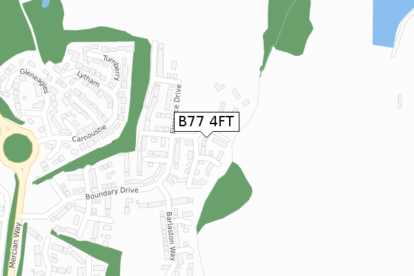
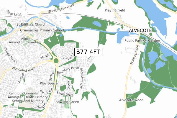
B77 4FT is located in the Amington electoral ward, within the local authority district of Tamworth and the English Parliamentary constituency of Tamworth. The Sub Integrated Care Board (ICB) Location is NHS Staffordshire and Stoke-on-Trent ICB - 05Q and the police force is Staffordshire. This postcode has been in use since July 2019.


GetTheData
Source: OS Open Zoomstack (Ordnance Survey)
Licence: Open Government Licence (requires attribution)
Attribution: Contains OS data © Crown copyright and database right 2024
Source: Open Postcode Geo
Licence: Open Government Licence (requires attribution)
Attribution: Contains OS data © Crown copyright and database right 2024; Contains Royal Mail data © Royal Mail copyright and database right 2024; Source: Office for National Statistics licensed under the Open Government Licence v.3.0
| Easting | 424344 |
| Northing | 304121 |
| Latitude | 52.634315 |
| Longitude | -1.641723 |
GetTheData
Source: Open Postcode Geo
Licence: Open Government Licence
| Country | England |
| Postcode District | B77 |
➜ See where B77 is on a map ➜ Where is Tamworth? | |
GetTheData
Source: Land Registry Price Paid Data
Licence: Open Government Licence
| Ward | Amington |
| Constituency | Tamworth |
GetTheData
Source: ONS Postcode Database
Licence: Open Government Licence
53, ELLASTONE WAY, AMINGTON, TAMWORTH, B77 4FT 2023 24 MAR £386,995 |
54, ELLASTONE WAY, AMINGTON, TAMWORTH, B77 4FT 2021 3 DEC £342,995 |
73, ELLASTONE WAY, AMINGTON, TAMWORTH, B77 4FT 2021 9 APR £310,995 |
67, ELLASTONE WAY, AMINGTON, TAMWORTH, B77 4FT 2021 11 MAR £319,995 |
61, ELLASTONE WAY, AMINGTON, TAMWORTH, B77 4FT 2021 19 FEB £327,995 |
55, ELLASTONE WAY, AMINGTON, TAMWORTH, B77 4FT 2021 12 FEB £316,995 |
57, ELLASTONE WAY, AMINGTON, TAMWORTH, B77 4FT 2021 12 FEB £327,995 |
59, ELLASTONE WAY, AMINGTON, TAMWORTH, B77 4FT 2021 29 JAN £299,995 |
46, ELLASTONE WAY, AMINGTON, TAMWORTH, B77 4FT 2020 18 DEC £299,995 |
44, ELLASTONE WAY, AMINGTON, TAMWORTH, B77 4FT 2020 18 DEC £316,995 |
GetTheData
Source: HM Land Registry Price Paid Data
Licence: Contains HM Land Registry data © Crown copyright and database right 2024. This data is licensed under the Open Government Licence v3.0.
| Woodland Road (Mercian Way) | Amington | 542m |
| Woodland Road (Mercian Way) | Amington | 550m |
| Spruce (Kerria Rd) | Amington | 597m |
| Sorbus (Kerria Rd) | Amington | 610m |
| Salbus (Kerria Rd) | Amington | 612m |
| Polesworth Station | 2.3km |
| Tamworth High Level Station | 3km |
| Tamworth Station | 3km |
GetTheData
Source: NaPTAN
Licence: Open Government Licence
| Percentage of properties with Next Generation Access | 100.0% |
| Percentage of properties with Superfast Broadband | 100.0% |
| Percentage of properties with Ultrafast Broadband | 63.6% |
| Percentage of properties with Full Fibre Broadband | 63.6% |
Superfast Broadband is between 30Mbps and 300Mbps
Ultrafast Broadband is > 300Mbps
| Percentage of properties unable to receive 2Mbps | 0.0% |
| Percentage of properties unable to receive 5Mbps | 0.0% |
| Percentage of properties unable to receive 10Mbps | 0.0% |
| Percentage of properties unable to receive 30Mbps | 0.0% |
GetTheData
Source: Ofcom
Licence: Ofcom Terms of Use (requires attribution)
GetTheData
Source: ONS Postcode Database
Licence: Open Government Licence


➜ Get more ratings from the Food Standards Agency
GetTheData
Source: Food Standards Agency
Licence: FSA terms & conditions
| Last Collection | |||
|---|---|---|---|
| Location | Mon-Fri | Sat | Distance |
| Pennymoor | 17:00 | 11:30 | 1,604m |
| Silver Link Post Office | 17:15 | 11:30 | 2,024m |
| Malham Road / Lowforce | 18:00 | 11:30 | 2,083m |
GetTheData
Source: Dracos
Licence: Creative Commons Attribution-ShareAlike
The below table lists the International Territorial Level (ITL) codes (formerly Nomenclature of Territorial Units for Statistics (NUTS) codes) and Local Administrative Units (LAU) codes for B77 4FT:
| ITL 1 Code | Name |
|---|---|
| TLG | West Midlands (England) |
| ITL 2 Code | Name |
| TLG2 | Shropshire and Staffordshire |
| ITL 3 Code | Name |
| TLG24 | Staffordshire CC |
| LAU 1 Code | Name |
| E07000199 | Tamworth |
GetTheData
Source: ONS Postcode Directory
Licence: Open Government Licence
The below table lists the Census Output Area (OA), Lower Layer Super Output Area (LSOA), and Middle Layer Super Output Area (MSOA) for B77 4FT:
| Code | Name | |
|---|---|---|
| OA | E00151966 | |
| LSOA | E01029820 | Tamworth 003A |
| MSOA | E02006219 | Tamworth 003 |
GetTheData
Source: ONS Postcode Directory
Licence: Open Government Licence
| B77 4NR | Turnberry | 258m |
| B77 4NN | Carnoustie | 296m |
| B77 4NW | Sunningdale | 307m |
| B77 4QA | Lytham | 335m |
| B77 4NP | Muirfield | 342m |
| B77 4NT | Hoylake | 418m |
| B77 4NS | Gleneagles | 424m |
| B77 4RA | St Andrews | 592m |
| B77 4RB | Troon | 592m |
| B77 4HD | Sorrel | 615m |
GetTheData
Source: Open Postcode Geo; Land Registry Price Paid Data
Licence: Open Government Licence