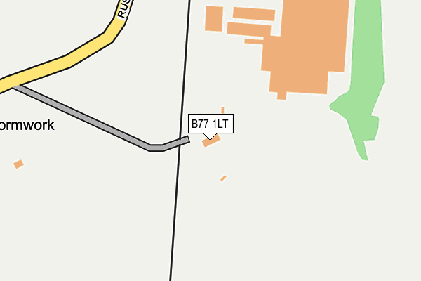
B77 1LT is located in the Hurley and Wood End electoral ward, within the local authority district of North Warwickshire and the English Parliamentary constituency of North Warwickshire. The Sub Integrated Care Board (ICB) Location is NHS Coventry and Warwickshire ICB - B2M3M and the police force is Warwickshire. This postcode has been in use since January 1980.


GetTheData
Source: OS OpenMap – Local (Ordnance Survey)
Source: OS VectorMap District (Ordnance Survey)
Licence: Open Government Licence (requires attribution)
| Easting | 421681 |
| Northing | 299161 |
| Latitude | 52.589839 |
| Longitude | -1.681395 |
GetTheData
Source: Open Postcode Geo
Licence: Open Government Licence
| Country | England |
| Postcode District | B77 |
➜ See where B77 is on a map | |
GetTheData
Source: Land Registry Price Paid Data
Licence: Open Government Licence
Elevation or altitude of B77 1LT as distance above sea level:
| Metres | Feet | |
|---|---|---|
| Elevation | 80m | 262ft |
Elevation is measured from the approximate centre of the postcode, to the nearest point on an OS contour line from OS Terrain 50, which has contour spacing of ten vertical metres.
➜ How high above sea level am I? Find the elevation of your current position using your device's GPS.
GetTheData
Source: Open Postcode Elevation
Licence: Open Government Licence
| Ward | Hurley And Wood End |
| Constituency | North Warwickshire |
GetTheData
Source: ONS Postcode Database
Licence: Open Government Licence
| Ascot Drive (High Street) | Dosthill | 504m |
| The Fox Inn (High St) | Dosthill | 739m |
| The Fox Inn (High St) | Dosthill | 748m |
| Skidmore Avenue (Park Road) | Dosthill | 993m |
| Orchard Close (High St) | Dosthill | 1,017m |
| Wilnecote (Staffs) Station | 2.3km |
| Polesworth Station | 6.3km |
GetTheData
Source: NaPTAN
Licence: Open Government Licence
GetTheData
Source: ONS Postcode Database
Licence: Open Government Licence


➜ Get more ratings from the Food Standards Agency
GetTheData
Source: Food Standards Agency
Licence: FSA terms & conditions
| Last Collection | |||
|---|---|---|---|
| Location | Mon-Fri | Sat | Distance |
| Sycamore Road Opposite Willow | 16:00 | 11:30 | 2,118m |
| Tamworth Road Kingsbury | 16:00 | 11:30 | 2,165m |
| Dosthill Post Office | 17:30 | 11:30 | 2,486m |
GetTheData
Source: Dracos
Licence: Creative Commons Attribution-ShareAlike
The below table lists the International Territorial Level (ITL) codes (formerly Nomenclature of Territorial Units for Statistics (NUTS) codes) and Local Administrative Units (LAU) codes for B77 1LT:
| ITL 1 Code | Name |
|---|---|
| TLG | West Midlands (England) |
| ITL 2 Code | Name |
| TLG1 | Herefordshire, Worcestershire and Warwickshire |
| ITL 3 Code | Name |
| TLG13 | Warwickshire CC |
| LAU 1 Code | Name |
| E07000218 | North Warwickshire |
GetTheData
Source: ONS Postcode Directory
Licence: Open Government Licence
The below table lists the Census Output Area (OA), Lower Layer Super Output Area (LSOA), and Middle Layer Super Output Area (MSOA) for B77 1LT:
| Code | Name | |
|---|---|---|
| OA | E00168278 | |
| LSOA | E01031031 | North Warwickshire 002D |
| MSOA | E02006469 | North Warwickshire 002 |
GetTheData
Source: ONS Postcode Directory
Licence: Open Government Licence
| B77 1QL | Ascot Drive | 366m |
| B77 1QR | Haydock Close | 403m |
| B77 1QT | Epsom Close | 416m |
| B77 1QP | Ascot Drive | 464m |
| B77 1QN | Kempton Drive | 502m |
| B77 1QB | Harwood Drive | 534m |
| B77 1QD | Felstead Close | 544m |
| B78 2DJ | Tamworth Road | 573m |
| B77 1QA | Lochsong Close | 574m |
| B77 1PN | Sefton Road | 601m |
GetTheData
Source: Open Postcode Geo; Land Registry Price Paid Data
Licence: Open Government Licence