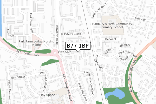
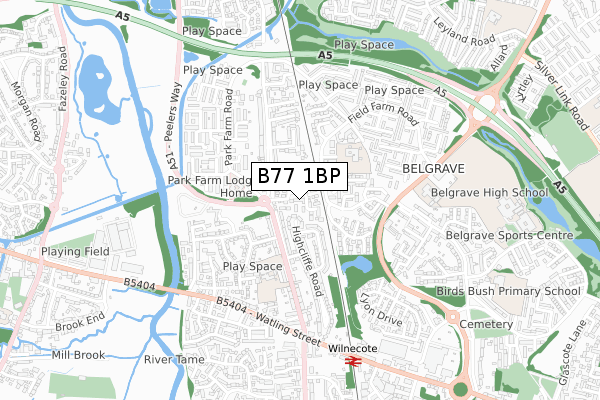
B77 1BP is located in the Belgrave electoral ward, within the local authority district of Tamworth and the English Parliamentary constituency of Tamworth. The Sub Integrated Care Board (ICB) Location is NHS Staffordshire and Stoke-on-Trent ICB - 05Q and the police force is Staffordshire. This postcode has been in use since April 2018.


GetTheData
Source: OS Open Zoomstack (Ordnance Survey)
Licence: Open Government Licence (requires attribution)
Attribution: Contains OS data © Crown copyright and database right 2025
Source: Open Postcode Geo
Licence: Open Government Licence (requires attribution)
Attribution: Contains OS data © Crown copyright and database right 2025; Contains Royal Mail data © Royal Mail copyright and database right 2025; Source: Office for National Statistics licensed under the Open Government Licence v.3.0
| Easting | 421561 |
| Northing | 302176 |
| Latitude | 52.616948 |
| Longitude | -1.682971 |
GetTheData
Source: Open Postcode Geo
Licence: Open Government Licence
| Country | England |
| Postcode District | B77 |
➜ See where B77 is on a map ➜ Where is Tamworth? | |
GetTheData
Source: Land Registry Price Paid Data
Licence: Open Government Licence
| Ward | Belgrave |
| Constituency | Tamworth |
GetTheData
Source: ONS Postcode Database
Licence: Open Government Licence
| Peelers Way (Tamworth Rd) | Two Gates | 124m |
| Parkfield Avenue (Tamworth Rd) | Two Gates | 161m |
| Park Farm Lodge (Park Farm Rd) | Two Gates | 221m |
| Park Farm Lodge (Park Farm Rd) | Two Gates | 222m |
| Cherwell (Field Farm Rd) | Belgrave | 229m |
| Wilnecote (Staffs) Station | 0.7km |
| Tamworth High Level Station | 2.3km |
| Tamworth Station | 2.3km |
GetTheData
Source: NaPTAN
Licence: Open Government Licence
| Percentage of properties with Next Generation Access | 100.0% |
| Percentage of properties with Superfast Broadband | 100.0% |
| Percentage of properties with Ultrafast Broadband | 0.0% |
| Percentage of properties with Full Fibre Broadband | 0.0% |
Superfast Broadband is between 30Mbps and 300Mbps
Ultrafast Broadband is > 300Mbps
| Median download speed | 39.8Mbps |
| Average download speed | 43.4Mbps |
| Maximum download speed | 76.92Mbps |
| Median upload speed | 10.0Mbps |
| Average upload speed | 10.0Mbps |
| Maximum upload speed | 19.82Mbps |
| Percentage of properties unable to receive 2Mbps | 0.0% |
| Percentage of properties unable to receive 5Mbps | 0.0% |
| Percentage of properties unable to receive 10Mbps | 0.0% |
| Percentage of properties unable to receive 30Mbps | 0.0% |
GetTheData
Source: Ofcom
Licence: Ofcom Terms of Use (requires attribution)
GetTheData
Source: ONS Postcode Database
Licence: Open Government Licence


➜ Get more ratings from the Food Standards Agency
GetTheData
Source: Food Standards Agency
Licence: FSA terms & conditions
| Last Collection | |||
|---|---|---|---|
| Location | Mon-Fri | Sat | Distance |
| Hamble | 16:00 | 11:30 | 346m |
| Belgrave Post Office | 18:00 | 11:30 | 475m |
| Dosthill Post Office | 17:30 | 11:30 | 686m |
GetTheData
Source: Dracos
Licence: Creative Commons Attribution-ShareAlike
The below table lists the International Territorial Level (ITL) codes (formerly Nomenclature of Territorial Units for Statistics (NUTS) codes) and Local Administrative Units (LAU) codes for B77 1BP:
| ITL 1 Code | Name |
|---|---|
| TLG | West Midlands (England) |
| ITL 2 Code | Name |
| TLG2 | Shropshire and Staffordshire |
| ITL 3 Code | Name |
| TLG24 | Staffordshire CC |
| LAU 1 Code | Name |
| E07000199 | Tamworth |
GetTheData
Source: ONS Postcode Directory
Licence: Open Government Licence
The below table lists the Census Output Area (OA), Lower Layer Super Output Area (LSOA), and Middle Layer Super Output Area (MSOA) for B77 1BP:
| Code | Name | |
|---|---|---|
| OA | E00151999 | |
| LSOA | E01029826 | Tamworth 006B |
| MSOA | E02006222 | Tamworth 006 |
GetTheData
Source: ONS Postcode Directory
Licence: Open Government Licence
| B77 1BX | St Peters Close | 138m |
| B77 1EA | Tamworth Road | 139m |
| B77 1BY | Tamworth Road | 141m |
| B77 1ED | Highcliffe Road | 163m |
| B77 1EW | Tamworth Road | 167m |
| B77 2LD | Derwent | 194m |
| B77 2LH | Colbrook | 200m |
| B77 1BU | Tamworth Road | 201m |
| B77 1EH | Lansdowne Crescent | 218m |
| B77 1EN | Tamworth Road | 225m |
GetTheData
Source: Open Postcode Geo; Land Registry Price Paid Data
Licence: Open Government Licence