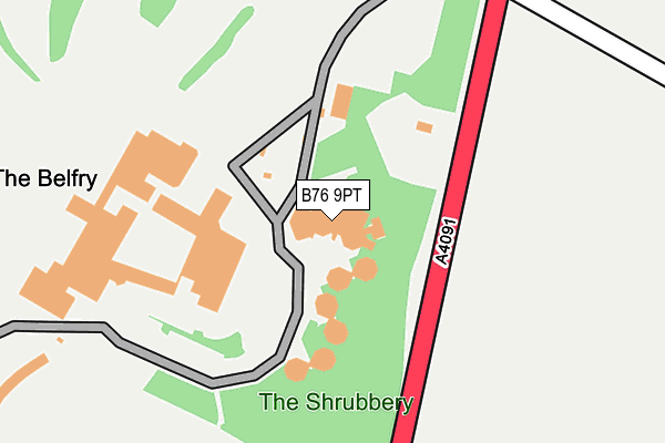
B76 9PT is located in the Curdworth electoral ward, within the local authority district of North Warwickshire and the English Parliamentary constituency of North Warwickshire. The Sub Integrated Care Board (ICB) Location is NHS Coventry and Warwickshire ICB - B2M3M and the police force is Warwickshire. This postcode has been in use since January 1980.


GetTheData
Source: OS OpenMap – Local (Ordnance Survey)
Source: OS VectorMap District (Ordnance Survey)
Licence: Open Government Licence (requires attribution)
| Easting | 418370 |
| Northing | 295250 |
| Latitude | 52.554801 |
| Longitude | -1.730482 |
GetTheData
Source: Open Postcode Geo
Licence: Open Government Licence
| Country | England |
| Postcode District | B76 |
➜ See where B76 is on a map | |
GetTheData
Source: Land Registry Price Paid Data
Licence: Open Government Licence
Elevation or altitude of B76 9PT as distance above sea level:
| Metres | Feet | |
|---|---|---|
| Elevation | 80m | 262ft |
Elevation is measured from the approximate centre of the postcode, to the nearest point on an OS contour line from OS Terrain 50, which has contour spacing of ten vertical metres.
➜ How high above sea level am I? Find the elevation of your current position using your device's GPS.
GetTheData
Source: Open Postcode Elevation
Licence: Open Government Licence
| Ward | Curdworth |
| Constituency | North Warwickshire |
GetTheData
Source: ONS Postcode Database
Licence: Open Government Licence
| The Belfry (Lichfield Road) | Wishaw | 216m |
| The Belfry (Lichfield Road) | Wishaw | 230m |
| The Belfry (Lichfield Road) | Wishaw | 559m |
| Water Orton Station | 4.1km |
| Coleshill Parkway Station | 4.5km |
GetTheData
Source: NaPTAN
Licence: Open Government Licence
GetTheData
Source: ONS Postcode Database
Licence: Open Government Licence


➜ Get more ratings from the Food Standards Agency
GetTheData
Source: Food Standards Agency
Licence: FSA terms & conditions
| Last Collection | |||
|---|---|---|---|
| Location | Mon-Fri | Sat | Distance |
| Overgreen / Grove Lane Wishaw | 12:00 | 10:30 | 1,838m |
| Bodymoor Heath | 15:30 | 10:00 | 1,880m |
| Curdworth Post Office | 16:30 | 09:00 | 2,405m |
GetTheData
Source: Dracos
Licence: Creative Commons Attribution-ShareAlike
The below table lists the International Territorial Level (ITL) codes (formerly Nomenclature of Territorial Units for Statistics (NUTS) codes) and Local Administrative Units (LAU) codes for B76 9PT:
| ITL 1 Code | Name |
|---|---|
| TLG | West Midlands (England) |
| ITL 2 Code | Name |
| TLG1 | Herefordshire, Worcestershire and Warwickshire |
| ITL 3 Code | Name |
| TLG13 | Warwickshire CC |
| LAU 1 Code | Name |
| E07000218 | North Warwickshire |
GetTheData
Source: ONS Postcode Directory
Licence: Open Government Licence
The below table lists the Census Output Area (OA), Lower Layer Super Output Area (LSOA), and Middle Layer Super Output Area (MSOA) for B76 9PT:
| Code | Name | |
|---|---|---|
| OA | E00158156 | |
| LSOA | E01031023 | North Warwickshire 004A |
| MSOA | E02006471 | North Warwickshire 004 |
GetTheData
Source: ONS Postcode Directory
Licence: Open Government Licence
| B76 9PS | Tamworth Road | 119m |
| B76 9PP | Lichfield Road | 585m |
| B76 9PU | Cuttle Mill Lane | 696m |
| B76 9PL | Lichfield Road | 746m |
| B76 9PY | Ryefield Lane | 838m |
| B76 9QB | The Gravel | 974m |
| B78 2BE | Wishaw Lane | 989m |
| B76 9PJ | Grove Lane | 1107m |
| B76 9QD | Church Lane | 1281m |
| B76 9PH | Grove Lane | 1574m |
GetTheData
Source: Open Postcode Geo; Land Registry Price Paid Data
Licence: Open Government Licence