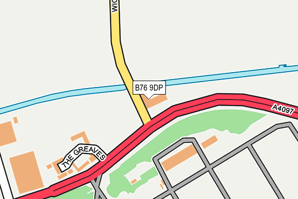
B76 9DP is located in the Sutton Walmley & Minworth electoral ward, within the metropolitan district of Birmingham and the English Parliamentary constituency of Sutton Coldfield. The Sub Integrated Care Board (ICB) Location is NHS Birmingham and Solihull ICB - 15E and the police force is West Midlands. This postcode has been in use since January 1980.


GetTheData
Source: OS OpenMap – Local (Ordnance Survey)
Source: OS VectorMap District (Ordnance Survey)
Licence: Open Government Licence (requires attribution)
| Easting | 416798 |
| Northing | 292686 |
| Latitude | 52.531801 |
| Longitude | -1.753797 |
GetTheData
Source: Open Postcode Geo
Licence: Open Government Licence
| Country | England |
| Postcode District | B76 |
➜ See where B76 is on a map ➜ Where is Birmingham? | |
GetTheData
Source: Land Registry Price Paid Data
Licence: Open Government Licence
Elevation or altitude of B76 9DP as distance above sea level:
| Metres | Feet | |
|---|---|---|
| Elevation | 90m | 295ft |
Elevation is measured from the approximate centre of the postcode, to the nearest point on an OS contour line from OS Terrain 50, which has contour spacing of ten vertical metres.
➜ How high above sea level am I? Find the elevation of your current position using your device's GPS.
GetTheData
Source: Open Postcode Elevation
Licence: Open Government Licence
| Ward | Sutton Walmley & Minworth |
| Constituency | Sutton Coldfield |
GetTheData
Source: ONS Postcode Database
Licence: Open Government Licence
| Wiggins Hill Rd (Kingsbury Rd) | Minworth | 34m |
| Wiggins Hill Rd (Kingsbury Rd) | Minworth | 78m |
| Kings Oak Development (Kingsbury Rd) | Minworth | 260m |
| Kings Oak Development (Kingsbury Rd) | Minworth | 262m |
| Sutton Square (Kingsbury Rd) | Minworth | 449m |
| Water Orton Station | 1.6km |
| Coleshill Parkway Station | 3.5km |
| Sutton Coldfield Station | 6.1km |
GetTheData
Source: NaPTAN
Licence: Open Government Licence
GetTheData
Source: ONS Postcode Database
Licence: Open Government Licence


➜ Get more ratings from the Food Standards Agency
GetTheData
Source: Food Standards Agency
Licence: FSA terms & conditions
| Last Collection | |||
|---|---|---|---|
| Location | Mon-Fri | Sat | Distance |
| Minworth | 17:00 | 12:00 | 1,071m |
| Curdworth Post Office | 16:30 | 09:00 | 1,131m |
| Kingsbury Road / Outside 86 Cole | 16:30 | 10:00 | 1,173m |
GetTheData
Source: Dracos
Licence: Creative Commons Attribution-ShareAlike
The below table lists the International Territorial Level (ITL) codes (formerly Nomenclature of Territorial Units for Statistics (NUTS) codes) and Local Administrative Units (LAU) codes for B76 9DP:
| ITL 1 Code | Name |
|---|---|
| TLG | West Midlands (England) |
| ITL 2 Code | Name |
| TLG3 | West Midlands |
| ITL 3 Code | Name |
| TLG31 | Birmingham |
| LAU 1 Code | Name |
| E08000025 | Birmingham |
GetTheData
Source: ONS Postcode Directory
Licence: Open Government Licence
The below table lists the Census Output Area (OA), Lower Layer Super Output Area (LSOA), and Middle Layer Super Output Area (MSOA) for B76 9DP:
| Code | Name | |
|---|---|---|
| OA | E00047854 | |
| LSOA | E01009441 | Birmingham 021B |
| MSOA | E02001847 | Birmingham 021 |
GetTheData
Source: ONS Postcode Directory
Licence: Open Government Licence
| B76 9DJ | Kingsbury Road | 195m |
| B76 9DN | Sutton Square | 401m |
| B76 9DR | Kingsbury Road | 428m |
| B76 9QE | Wiggins Hill Road | 645m |
| B76 9DD | Kingsbury Road | 736m |
| B76 9DX | Orchard Close | 906m |
| B76 9DY | Wishaw Lane | 927m |
| B76 9ES | Glebe Fields | 933m |
| B76 9DU | Holt Villas | 969m |
| B76 9AR | Wishaw Lane | 976m |
GetTheData
Source: Open Postcode Geo; Land Registry Price Paid Data
Licence: Open Government Licence