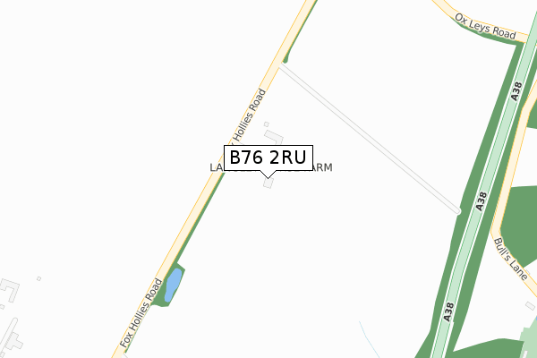
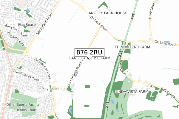
B76 2RU is located in the Sutton Walmley & Minworth electoral ward, within the metropolitan district of Birmingham and the English Parliamentary constituency of Sutton Coldfield. The Sub Integrated Care Board (ICB) Location is NHS Birmingham and Solihull ICB - 15E and the police force is West Midlands. This postcode has been in use since August 1993.


GetTheData
Source: OS Open Zoomstack (Ordnance Survey)
Licence: Open Government Licence (requires attribution)
Attribution: Contains OS data © Crown copyright and database right 2025
Source: Open Postcode Geo
Licence: Open Government Licence (requires attribution)
Attribution: Contains OS data © Crown copyright and database right 2025; Contains Royal Mail data © Royal Mail copyright and database right 2025; Source: Office for National Statistics licensed under the Open Government Licence v.3.0
| Easting | 414933 |
| Northing | 294874 |
| Latitude | 52.551509 |
| Longitude | -1.781199 |
GetTheData
Source: Open Postcode Geo
Licence: Open Government Licence
| Country | England |
| Postcode District | B76 |
➜ See where B76 is on a map | |
GetTheData
Source: Land Registry Price Paid Data
Licence: Open Government Licence
Elevation or altitude of B76 2RU as distance above sea level:
| Metres | Feet | |
|---|---|---|
| Elevation | 120m | 394ft |
Elevation is measured from the approximate centre of the postcode, to the nearest point on an OS contour line from OS Terrain 50, which has contour spacing of ten vertical metres.
➜ How high above sea level am I? Find the elevation of your current position using your device's GPS.
GetTheData
Source: Open Postcode Elevation
Licence: Open Government Licence
| Ward | Sutton Walmley & Minworth |
| Constituency | Sutton Coldfield |
GetTheData
Source: ONS Postcode Database
Licence: Open Government Licence
| Signal Hayes Rd (Thimble End Rd) | Walmley | 686m |
| Signal Hayes Rd (Thimble End Rd) | Walmley | 695m |
| Berryfields Rd (Springfield Rd) | Reddicap Heath | 819m |
| Wimbourne Rd (Springfield Rd) | Falcon Lodge | 821m |
| Wimbourne Rd (Springfield Rd) | Falcon Lodge | 826m |
| Sutton Coldfield Station | 3.3km |
| Wylde Green Station | 3.5km |
| Chester Road Station | 3.9km |
GetTheData
Source: NaPTAN
Licence: Open Government Licence
GetTheData
Source: ONS Postcode Database
Licence: Open Government Licence


➜ Get more ratings from the Food Standards Agency
GetTheData
Source: Food Standards Agency
Licence: FSA terms & conditions
| Last Collection | |||
|---|---|---|---|
| Location | Mon-Fri | Sat | Distance |
| Thimble End Road / Weaver Clos | 17:15 | 11:45 | 672m |
| Berryfields Road / Springfield R | 17:15 | 12:00 | 884m |
| Springfield Crescent | 17:15 | 11:30 | 1,044m |
GetTheData
Source: Dracos
Licence: Creative Commons Attribution-ShareAlike
The below table lists the International Territorial Level (ITL) codes (formerly Nomenclature of Territorial Units for Statistics (NUTS) codes) and Local Administrative Units (LAU) codes for B76 2RU:
| ITL 1 Code | Name |
|---|---|
| TLG | West Midlands (England) |
| ITL 2 Code | Name |
| TLG3 | West Midlands |
| ITL 3 Code | Name |
| TLG31 | Birmingham |
| LAU 1 Code | Name |
| E08000025 | Birmingham |
GetTheData
Source: ONS Postcode Directory
Licence: Open Government Licence
The below table lists the Census Output Area (OA), Lower Layer Super Output Area (LSOA), and Middle Layer Super Output Area (MSOA) for B76 2RU:
| Code | Name | |
|---|---|---|
| OA | E00047803 | |
| LSOA | E01009450 | Birmingham 012E |
| MSOA | E02001838 | Birmingham 012 |
GetTheData
Source: ONS Postcode Directory
Licence: Open Government Licence
| B76 2RT | Fox Hollies Road | 436m |
| B76 9QW | Bulls Lane | 629m |
| B76 2RZ | Thimble End Court | 633m |
| B76 2RH | Woodberry Drive | 664m |
| B75 7HP | Ox Leys Road | 670m |
| B76 2RR | Signal Hayes Road | 688m |
| B76 2RQ | Squirrel Hollow | 699m |
| B76 2RG | Welton Close | 710m |
| B76 2RB | Hatherden Drive | 746m |
| B76 2RF | Littleton Close | 760m |
GetTheData
Source: Open Postcode Geo; Land Registry Price Paid Data
Licence: Open Government Licence