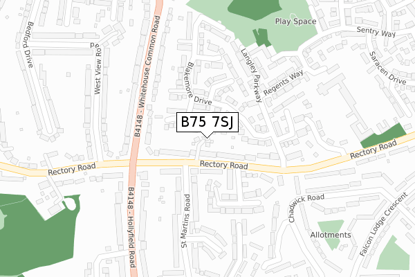
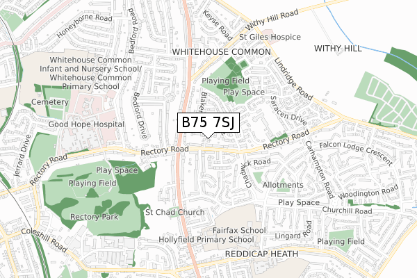
B75 7SJ is located in the Sutton Reddicap electoral ward, within the metropolitan district of Birmingham and the English Parliamentary constituency of Sutton Coldfield. The Sub Integrated Care Board (ICB) Location is NHS Birmingham and Solihull ICB - 15E and the police force is West Midlands. This postcode has been in use since August 2018.


GetTheData
Source: OS Open Zoomstack (Ordnance Survey)
Licence: Open Government Licence (requires attribution)
Attribution: Contains OS data © Crown copyright and database right 2025
Source: Open Postcode Geo
Licence: Open Government Licence (requires attribution)
Attribution: Contains OS data © Crown copyright and database right 2025; Contains Royal Mail data © Royal Mail copyright and database right 2025; Source: Office for National Statistics licensed under the Open Government Licence v.3.0
| Easting | 413581 |
| Northing | 296614 |
| Latitude | 52.567202 |
| Longitude | -1.801060 |
GetTheData
Source: Open Postcode Geo
Licence: Open Government Licence
| Country | England |
| Postcode District | B75 |
➜ See where B75 is on a map ➜ Where is Royal Sutton Coldfield? | |
GetTheData
Source: Land Registry Price Paid Data
Licence: Open Government Licence
| Ward | Sutton Reddicap |
| Constituency | Sutton Coldfield |
GetTheData
Source: ONS Postcode Database
Licence: Open Government Licence
2, APPLE GARDENS, SUTTON COLDFIELD, B75 7SJ 2019 12 SEP £635,000 |
3, APPLE GARDENS, SUTTON COLDFIELD, B75 7SJ 2018 31 AUG £610,000 |
1, APPLE GARDENS, SUTTON COLDFIELD, B75 7SJ 2018 8 AUG £690,000 |
➜ Royal Sutton Coldfield house prices
GetTheData
Source: HM Land Registry Price Paid Data
Licence: Contains HM Land Registry data © Crown copyright and database right 2025. This data is licensed under the Open Government Licence v3.0.
| Whitehouse Common Rd (Rectory Rd) | Whitehouse Common | 124m |
| Blakemore Drive (Rectory Rd) | Whitehouse Common | 145m |
| Rectory Rd (Whitehouse Common Rd) | Whitehouse Common | 177m |
| Rectory Rd (Hollyfield Road) | Whitehouse Common | 207m |
| Blakemore Drive (Rectory Rd) | Whitehouse Common | 210m |
| Sutton Coldfield Station | 1.6km |
| Four Oaks Station | 2.3km |
| Wylde Green Station | 3.2km |
GetTheData
Source: NaPTAN
Licence: Open Government Licence
| Percentage of properties with Next Generation Access | 100.0% |
| Percentage of properties with Superfast Broadband | 100.0% |
| Percentage of properties with Ultrafast Broadband | 0.0% |
| Percentage of properties with Full Fibre Broadband | 0.0% |
Superfast Broadband is between 30Mbps and 300Mbps
Ultrafast Broadband is > 300Mbps
| Percentage of properties unable to receive 2Mbps | 0.0% |
| Percentage of properties unable to receive 5Mbps | 0.0% |
| Percentage of properties unable to receive 10Mbps | 0.0% |
| Percentage of properties unable to receive 30Mbps | 0.0% |
GetTheData
Source: Ofcom
Licence: Ofcom Terms of Use (requires attribution)
GetTheData
Source: ONS Postcode Database
Licence: Open Government Licence


➜ Get more ratings from the Food Standards Agency
GetTheData
Source: Food Standards Agency
Licence: FSA terms & conditions
| Last Collection | |||
|---|---|---|---|
| Location | Mon-Fri | Sat | Distance |
| 96/98 Hollyfield Road / Nr. Re | 17:30 | 11:30 | 257m |
| Rectory Grove | 17:00 | 11:30 | 485m |
| Whitehouse Common Post Office | 18:30 | 12:00 | 511m |
GetTheData
Source: Dracos
Licence: Creative Commons Attribution-ShareAlike
The below table lists the International Territorial Level (ITL) codes (formerly Nomenclature of Territorial Units for Statistics (NUTS) codes) and Local Administrative Units (LAU) codes for B75 7SJ:
| ITL 1 Code | Name |
|---|---|
| TLG | West Midlands (England) |
| ITL 2 Code | Name |
| TLG3 | West Midlands |
| ITL 3 Code | Name |
| TLG31 | Birmingham |
| LAU 1 Code | Name |
| E08000025 | Birmingham |
GetTheData
Source: ONS Postcode Directory
Licence: Open Government Licence
The below table lists the Census Output Area (OA), Lower Layer Super Output Area (LSOA), and Middle Layer Super Output Area (MSOA) for B75 7SJ:
| Code | Name | |
|---|---|---|
| OA | E00047870 | |
| LSOA | E01009446 | Birmingham 005B |
| MSOA | E02001831 | Birmingham 005 |
GetTheData
Source: ONS Postcode Directory
Licence: Open Government Licence
| B75 7SP | Wollerton Grove | 51m |
| B75 7SR | Golson Close | 64m |
| B75 7RN | Blakemore Drive | 72m |
| B75 7RY | Rectory Road | 83m |
| B75 7SA | Rectory Road | 93m |
| B75 7SU | St Judes Close | 132m |
| B75 7ST | St Simons Close | 134m |
| B75 7RZ | Myring Drive | 151m |
| B75 7QH | St Martins Road | 171m |
| B75 7SD | Rectory Road | 180m |
GetTheData
Source: Open Postcode Geo; Land Registry Price Paid Data
Licence: Open Government Licence