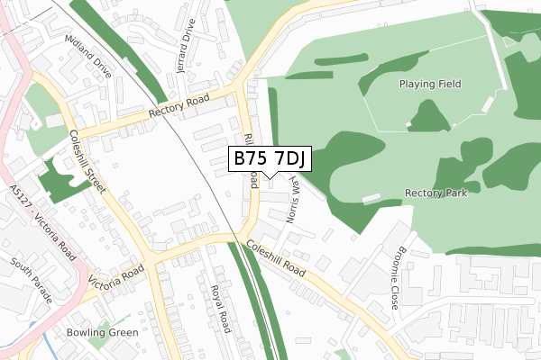
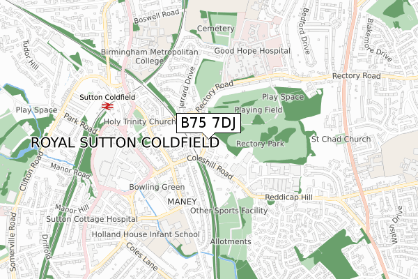
B75 7DJ is located in the Sutton Reddicap electoral ward, within the metropolitan district of Birmingham and the English Parliamentary constituency of Sutton Coldfield. The Sub Integrated Care Board (ICB) Location is NHS Birmingham and Solihull ICB - 15E and the police force is West Midlands. This postcode has been in use since October 2017.


GetTheData
Source: OS Open Zoomstack (Ordnance Survey)
Licence: Open Government Licence (requires attribution)
Attribution: Contains OS data © Crown copyright and database right 2024
Source: Open Postcode Geo
Licence: Open Government Licence (requires attribution)
Attribution: Contains OS data © Crown copyright and database right 2024; Contains Royal Mail data © Royal Mail copyright and database right 2024; Source: Office for National Statistics licensed under the Open Government Licence v.3.0
| Easting | 412589 |
| Northing | 296172 |
| Latitude | 52.563252 |
| Longitude | -1.815712 |
GetTheData
Source: Open Postcode Geo
Licence: Open Government Licence
| Country | England |
| Postcode District | B75 |
➜ See where B75 is on a map ➜ Where is Royal Sutton Coldfield? | |
GetTheData
Source: Land Registry Price Paid Data
Licence: Open Government Licence
| Ward | Sutton Reddicap |
| Constituency | Sutton Coldfield |
GetTheData
Source: ONS Postcode Database
Licence: Open Government Licence
| Coleshill Rd (Riland Rd) | Sutton Coldfield | 42m |
| Coleshill Rd (Riland Rd) | Sutton Coldfield | 54m |
| Riland Rd (Coleshill Rd) | Sutton Coldfield | 125m |
| Rectory Rd (Riland Rd) | Sutton Coldfield | 140m |
| Riland Rd (Coleshill Rd) | Sutton Coldfield | 151m |
| Sutton Coldfield Station | 0.6km |
| Four Oaks Station | 2km |
| Wylde Green Station | 2.2km |
GetTheData
Source: NaPTAN
Licence: Open Government Licence
GetTheData
Source: ONS Postcode Database
Licence: Open Government Licence


➜ Get more ratings from the Food Standards Agency
GetTheData
Source: Food Standards Agency
Licence: FSA terms & conditions
| Last Collection | |||
|---|---|---|---|
| Location | Mon-Fri | Sat | Distance |
| Riland Road / Rectory Road | 17:30 | 12:00 | 156m |
| Coleshill Street | 17:15 | 12:00 | 286m |
| Reddicap Trading Estate | 17:15 | 12:00 | 366m |
GetTheData
Source: Dracos
Licence: Creative Commons Attribution-ShareAlike
The below table lists the International Territorial Level (ITL) codes (formerly Nomenclature of Territorial Units for Statistics (NUTS) codes) and Local Administrative Units (LAU) codes for B75 7DJ:
| ITL 1 Code | Name |
|---|---|
| TLG | West Midlands (England) |
| ITL 2 Code | Name |
| TLG3 | West Midlands |
| ITL 3 Code | Name |
| TLG31 | Birmingham |
| LAU 1 Code | Name |
| E08000025 | Birmingham |
GetTheData
Source: ONS Postcode Directory
Licence: Open Government Licence
The below table lists the Census Output Area (OA), Lower Layer Super Output Area (LSOA), and Middle Layer Super Output Area (MSOA) for B75 7DJ:
| Code | Name | |
|---|---|---|
| OA | E00047760 | |
| LSOA | E01009424 | Birmingham 004B |
| MSOA | E02001830 | Birmingham 004 |
GetTheData
Source: ONS Postcode Directory
Licence: Open Government Licence
| B75 7AU | Riland Road | 35m |
| B75 7AQ | Riland Road | 50m |
| B75 7AG | Riland Avenue | 95m |
| B75 7AN | Riland Road | 100m |
| B75 7AT | Riland Road | 116m |
| B75 7AW | Riland Grove | 142m |
| B75 7AX | Coleshill Road | 160m |
| B75 7AA | Coleshill Road | 174m |
| B75 7AS | Rectory Road | 182m |
| B75 7AR | Rectory Road | 210m |
GetTheData
Source: Open Postcode Geo; Land Registry Price Paid Data
Licence: Open Government Licence