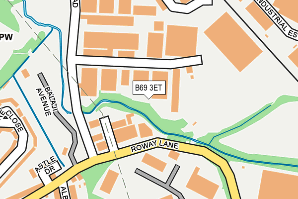
B69 3ET is located in the Oldbury electoral ward, within the metropolitan district of Sandwell and the English Parliamentary constituency of West Bromwich West. The Sub Integrated Care Board (ICB) Location is NHS Black Country ICB - D2P2L and the police force is West Midlands. This postcode has been in use since July 2017.


GetTheData
Source: OS OpenMap – Local (Ordnance Survey)
Source: OS VectorMap District (Ordnance Survey)
Licence: Open Government Licence (requires attribution)
| Easting | 398459 |
| Northing | 289729 |
| Latitude | 52.505470 |
| Longitude | -2.024127 |
GetTheData
Source: Open Postcode Geo
Licence: Open Government Licence
| Country | England |
| Postcode District | B69 |
➜ See where B69 is on a map ➜ Where is Oldbury? | |
GetTheData
Source: Land Registry Price Paid Data
Licence: Open Government Licence
| Ward | Oldbury |
| Constituency | West Bromwich West |
GetTheData
Source: ONS Postcode Database
Licence: Open Government Licence
| Newfield Rd (Dudley Rd) | Oldbury | 202m |
| Albion St (Dudley Rd) | Brades Village | 276m |
| Newfield Rd (Dudley Rd) | Oldbury | 280m |
| Oldbury Retail Park (Oldbury Ringway) | Oldbury | 295m |
| Oldbury Retail Park (Oldbury Ringway) | Oldbury | 314m |
| Sandwell & Dudley Station | 0.9km |
| Langley Green Station | 1.8km |
| Dudley Port Station | 2.7km |
GetTheData
Source: NaPTAN
Licence: Open Government Licence
GetTheData
Source: ONS Postcode Database
Licence: Open Government Licence


➜ Get more ratings from the Food Standards Agency
GetTheData
Source: Food Standards Agency
Licence: FSA terms & conditions
| Last Collection | |||
|---|---|---|---|
| Location | Mon-Fri | Sat | Distance |
| 6 Simpson St Birmingham St | 17:30 | 12:00 | 811m |
| West Bromwich St | 17:30 | 12:00 | 974m |
| Lower City Road / Ashtree Road | 17:15 | 12:00 | 1,057m |
GetTheData
Source: Dracos
Licence: Creative Commons Attribution-ShareAlike
The below table lists the International Territorial Level (ITL) codes (formerly Nomenclature of Territorial Units for Statistics (NUTS) codes) and Local Administrative Units (LAU) codes for B69 3ET:
| ITL 1 Code | Name |
|---|---|
| TLG | West Midlands (England) |
| ITL 2 Code | Name |
| TLG3 | West Midlands |
| ITL 3 Code | Name |
| TLG37 | Sandwell |
| LAU 1 Code | Name |
| E08000028 | Sandwell |
GetTheData
Source: ONS Postcode Directory
Licence: Open Government Licence
The below table lists the Census Output Area (OA), Lower Layer Super Output Area (LSOA), and Middle Layer Super Output Area (MSOA) for B69 3ET:
| Code | Name | |
|---|---|---|
| OA | E00050665 | |
| LSOA | E01010018 | Sandwell 021C |
| MSOA | E02002063 | Sandwell 021 |
GetTheData
Source: ONS Postcode Directory
Licence: Open Government Licence
| B69 3DN | Dudley Road | 242m |
| B69 2QS | Waterways Drive | 253m |
| B69 2DD | The Moorings | 272m |
| B69 2EX | Waterways Drive | 272m |
| B69 2RA | Pearsall Drive | 277m |
| B69 2EB | Brades Road | 282m |
| B69 3DH | Dudley Road | 288m |
| B69 2DB | Quayside Close | 306m |
| B69 2ET | Brades Road | 321m |
| B69 3DW | Dudley Road | 335m |
GetTheData
Source: Open Postcode Geo; Land Registry Price Paid Data
Licence: Open Government Licence