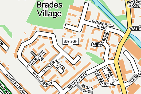
B69 2GH is located in the Oldbury electoral ward, within the metropolitan district of Sandwell and the English Parliamentary constituency of West Bromwich West. The Sub Integrated Care Board (ICB) Location is NHS Black Country ICB - D2P2L and the police force is West Midlands. This postcode has been in use since June 2017.


GetTheData
Source: OS OpenMap – Local (Ordnance Survey)
Source: OS VectorMap District (Ordnance Survey)
Licence: Open Government Licence (requires attribution)
| Easting | 397918 |
| Northing | 289923 |
| Latitude | 52.507213 |
| Longitude | -2.032098 |
GetTheData
Source: Open Postcode Geo
Licence: Open Government Licence
| Country | England |
| Postcode District | B69 |
➜ See where B69 is on a map ➜ Where is Rowley Regis? | |
GetTheData
Source: Land Registry Price Paid Data
Licence: Open Government Licence
| Ward | Oldbury |
| Constituency | West Bromwich West |
GetTheData
Source: ONS Postcode Database
Licence: Open Government Licence
| Brades Rise (Brades Rd) | Rounds Green | 204m |
| Brades Rise (Brades Rd) | Rounds Green | 215m |
| Payton Close (Brades Rd) | Brades Village | 299m |
| Payton Close (Brades Rd) | Brades Village | 315m |
| Hilton Rd (New Birmingham Rd) | Rounds Green | 350m |
| Sandwell & Dudley Station | 1.4km |
| Dudley Port Station | 2.3km |
| Langley Green Station | 2.4km |
GetTheData
Source: NaPTAN
Licence: Open Government Licence
| Percentage of properties with Next Generation Access | 100.0% |
| Percentage of properties with Superfast Broadband | 100.0% |
| Percentage of properties with Ultrafast Broadband | 0.0% |
| Percentage of properties with Full Fibre Broadband | 0.0% |
Superfast Broadband is between 30Mbps and 300Mbps
Ultrafast Broadband is > 300Mbps
| Median download speed | 39.1Mbps |
| Average download speed | 31.7Mbps |
| Maximum download speed | 68.28Mbps |
| Median upload speed | 9.8Mbps |
| Average upload speed | 8.2Mbps |
| Maximum upload speed | 20.00Mbps |
| Percentage of properties unable to receive 2Mbps | 0.0% |
| Percentage of properties unable to receive 5Mbps | 0.0% |
| Percentage of properties unable to receive 10Mbps | 0.0% |
| Percentage of properties unable to receive 30Mbps | 0.0% |
GetTheData
Source: Ofcom
Licence: Ofcom Terms of Use (requires attribution)
GetTheData
Source: ONS Postcode Database
Licence: Open Government Licence


➜ Get more ratings from the Food Standards Agency
GetTheData
Source: Food Standards Agency
Licence: FSA terms & conditions
| Last Collection | |||
|---|---|---|---|
| Location | Mon-Fri | Sat | Distance |
| Lower City Road / Ashtree Road | 17:15 | 12:00 | 482m |
| Tower Road | 17:30 | 12:00 | 1,040m |
| Hamilton Drive | 17:30 | 12:00 | 1,137m |
GetTheData
Source: Dracos
Licence: Creative Commons Attribution-ShareAlike
The below table lists the International Territorial Level (ITL) codes (formerly Nomenclature of Territorial Units for Statistics (NUTS) codes) and Local Administrative Units (LAU) codes for B69 2GH:
| ITL 1 Code | Name |
|---|---|
| TLG | West Midlands (England) |
| ITL 2 Code | Name |
| TLG3 | West Midlands |
| ITL 3 Code | Name |
| TLG37 | Sandwell |
| LAU 1 Code | Name |
| E08000028 | Sandwell |
GetTheData
Source: ONS Postcode Directory
Licence: Open Government Licence
The below table lists the Census Output Area (OA), Lower Layer Super Output Area (LSOA), and Middle Layer Super Output Area (MSOA) for B69 2GH:
| Code | Name | |
|---|---|---|
| OA | E00168220 | |
| LSOA | E01010018 | Sandwell 021C |
| MSOA | E02002063 | Sandwell 021 |
GetTheData
Source: ONS Postcode Directory
Licence: Open Government Licence
| B69 2GJ | Bhullar Way | 61m |
| B69 2GL | Bhullar Way | 62m |
| B69 2GQ | Mayfly Close | 90m |
| B69 2GG | George Wood Avenue | 100m |
| B69 2GF | Summerton Road | 109m |
| B69 2GE | Mehdi Road | 112m |
| B69 2GN | Ditta Drive | 122m |
| B69 2HG | Brades Rise | 124m |
| B69 2GP | Silverlight Grove | 146m |
| B69 2FD | Brades Road | 190m |
GetTheData
Source: Open Postcode Geo; Land Registry Price Paid Data
Licence: Open Government Licence