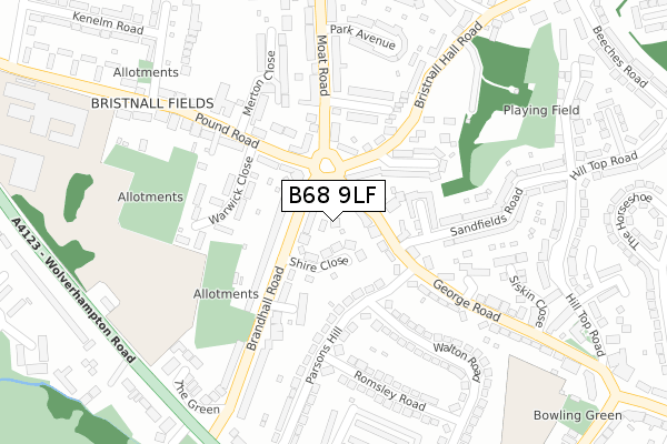
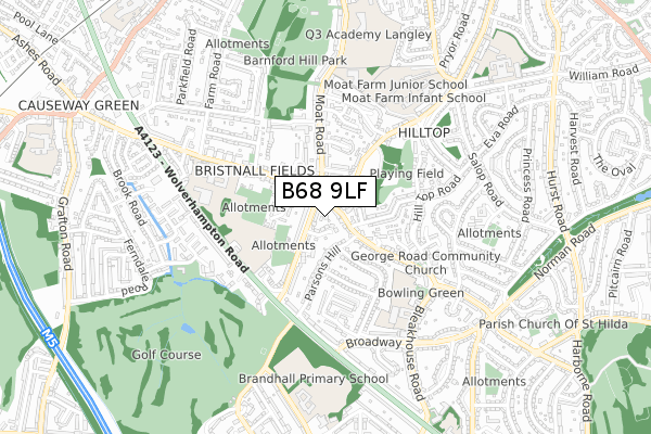
B68 9LF lies on Hanover Gardens in Oldbury. B68 9LF is located in the Bristnall electoral ward, within the metropolitan district of Sandwell and the English Parliamentary constituency of Warley. The Sub Integrated Care Board (ICB) Location is NHS Black Country ICB - D2P2L and the police force is West Midlands. This postcode has been in use since November 2005.


GetTheData
Source: OS Open Zoomstack (Ordnance Survey)
Licence: Open Government Licence (requires attribution)
Attribution: Contains OS data © Crown copyright and database right 2025
Source: Open Postcode Geo
Licence: Open Government Licence (requires attribution)
Attribution: Contains OS data © Crown copyright and database right 2025; Contains Royal Mail data © Royal Mail copyright and database right 2025; Source: Office for National Statistics licensed under the Open Government Licence v.3.0
| Easting | 399856 |
| Northing | 286763 |
| Latitude | 52.478793 |
| Longitude | -2.003549 |
GetTheData
Source: Open Postcode Geo
Licence: Open Government Licence
| Street | Hanover Gardens |
| Town/City | Oldbury |
| Country | England |
| Postcode District | B68 |
➜ See where B68 is on a map ➜ Where is Oldbury? | |
GetTheData
Source: Land Registry Price Paid Data
Licence: Open Government Licence
Elevation or altitude of B68 9LF as distance above sea level:
| Metres | Feet | |
|---|---|---|
| Elevation | 200m | 656ft |
Elevation is measured from the approximate centre of the postcode, to the nearest point on an OS contour line from OS Terrain 50, which has contour spacing of ten vertical metres.
➜ How high above sea level am I? Find the elevation of your current position using your device's GPS.
GetTheData
Source: Open Postcode Elevation
Licence: Open Government Licence
| Ward | Bristnall |
| Constituency | Warley |
GetTheData
Source: ONS Postcode Database
Licence: Open Government Licence
2020 25 JUN £235,000 |
2006 17 OCT £192,500 |
GetTheData
Source: HM Land Registry Price Paid Data
Licence: Contains HM Land Registry data © Crown copyright and database right 2025. This data is licensed under the Open Government Licence v3.0.
| Bristnall Fields (George Rd) | Bristnall Fields | 44m |
| Bristnall Fields (George Rd) | Bristnall Fields | 56m |
| Bristnall Fields (Pound Rd) | Bristnall Fields | 130m |
| Bristnall Fields (Pound Rd) | Bristnall Fields | 133m |
| Hill Top Rd (George Rd) | Warley | 239m |
| Langley Green Station | 1.7km |
| Rowley Regis Station | 1.9km |
| Smethwick Rolfe Street Station | 3km |
GetTheData
Source: NaPTAN
Licence: Open Government Licence
| Percentage of properties with Next Generation Access | 100.0% |
| Percentage of properties with Superfast Broadband | 100.0% |
| Percentage of properties with Ultrafast Broadband | 0.0% |
| Percentage of properties with Full Fibre Broadband | 0.0% |
Superfast Broadband is between 30Mbps and 300Mbps
Ultrafast Broadband is > 300Mbps
| Percentage of properties unable to receive 2Mbps | 0.0% |
| Percentage of properties unable to receive 5Mbps | 0.0% |
| Percentage of properties unable to receive 10Mbps | 0.0% |
| Percentage of properties unable to receive 30Mbps | 0.0% |
GetTheData
Source: Ofcom
Licence: Ofcom Terms of Use (requires attribution)
GetTheData
Source: ONS Postcode Database
Licence: Open Government Licence


➜ Get more ratings from the Food Standards Agency
GetTheData
Source: Food Standards Agency
Licence: FSA terms & conditions
| Last Collection | |||
|---|---|---|---|
| Location | Mon-Fri | Sat | Distance |
| Bristnall Fields Post Office | 17:15 | 12:00 | 100m |
| Parsons Hill / Wolverhamptonrd | 17:15 | 12:00 | 396m |
| George Road Opp George House | 17:30 | 11:30 | 507m |
GetTheData
Source: Dracos
Licence: Creative Commons Attribution-ShareAlike
The below table lists the International Territorial Level (ITL) codes (formerly Nomenclature of Territorial Units for Statistics (NUTS) codes) and Local Administrative Units (LAU) codes for B68 9LF:
| ITL 1 Code | Name |
|---|---|
| TLG | West Midlands (England) |
| ITL 2 Code | Name |
| TLG3 | West Midlands |
| ITL 3 Code | Name |
| TLG37 | Sandwell |
| LAU 1 Code | Name |
| E08000028 | Sandwell |
GetTheData
Source: ONS Postcode Directory
Licence: Open Government Licence
The below table lists the Census Output Area (OA), Lower Layer Super Output Area (LSOA), and Middle Layer Super Output Area (MSOA) for B68 9LF:
| Code | Name | |
|---|---|---|
| OA | E00050299 | |
| LSOA | E01009939 | Sandwell 032B |
| MSOA | E02002074 | Sandwell 032 |
GetTheData
Source: ONS Postcode Directory
Licence: Open Government Licence
| B68 8DR | Shire Close | 40m |
| B68 9LH | George Road | 58m |
| B68 8DP | Brandhall Road | 81m |
| B68 9BY | Parsons Hill | 115m |
| B68 8EL | Moat Road | 125m |
| B68 8NQ | Pound Road | 127m |
| B68 8DJ | The Constables | 140m |
| B68 8EJ | Moat Road | 142m |
| B68 9TS | Bristnall Hall Road | 142m |
| B68 9TT | St Katherines Road | 142m |
GetTheData
Source: Open Postcode Geo; Land Registry Price Paid Data
Licence: Open Government Licence