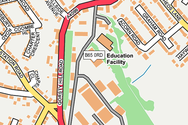
B65 0RD is located in the Halesowen North electoral ward, within the metropolitan district of Dudley and the English Parliamentary constituency of Halesowen and Rowley Regis. The Sub Integrated Care Board (ICB) Location is NHS Black Country ICB - D2P2L and the police force is West Midlands. This postcode has been in use since January 1980.


GetTheData
Source: OS OpenMap – Local (Ordnance Survey)
Source: OS VectorMap District (Ordnance Survey)
Licence: Open Government Licence (requires attribution)
| Easting | 396983 |
| Northing | 285647 |
| Latitude | 52.468752 |
| Longitude | -2.045839 |
GetTheData
Source: Open Postcode Geo
Licence: Open Government Licence
| Country | England |
| Postcode District | B65 |
➜ See where B65 is on a map ➜ Where is Halesowen? | |
GetTheData
Source: Land Registry Price Paid Data
Licence: Open Government Licence
Elevation or altitude of B65 0RD as distance above sea level:
| Metres | Feet | |
|---|---|---|
| Elevation | 160m | 525ft |
Elevation is measured from the approximate centre of the postcode, to the nearest point on an OS contour line from OS Terrain 50, which has contour spacing of ten vertical metres.
➜ How high above sea level am I? Find the elevation of your current position using your device's GPS.
GetTheData
Source: Open Postcode Elevation
Licence: Open Government Licence
| Ward | Halesowen North |
| Constituency | Halesowen And Rowley Regis |
GetTheData
Source: ONS Postcode Database
Licence: Open Government Licence
| Gorsty Hill Road (Gorsty Hill Rd) | Old Hill | 122m |
| Gorsty Hill Road (Gorsty Hill Rd) | Old Hill | 127m |
| Station Rd (Coombs Rd) | Coombeswood | 176m |
| Lodgefield Rd (Station Rd) | Coombeswood | 209m |
| Coombs Rd (Station Rd) | Old Hill | 212m |
| Old Hill Station | 0.7km |
| Rowley Regis Station | 1.4km |
| Cradley Heath Station | 3km |
GetTheData
Source: NaPTAN
Licence: Open Government Licence
GetTheData
Source: ONS Postcode Database
Licence: Open Government Licence


➜ Get more ratings from the Food Standards Agency
GetTheData
Source: Food Standards Agency
Licence: FSA terms & conditions
| Last Collection | |||
|---|---|---|---|
| Location | Mon-Fri | Sat | Distance |
| Coombs Wood D/O | 18:00 | 44m | |
| Coombswood Do | 18:00 | 12:00 | 46m |
| Gorsty Hill Post Office | 17:30 | 12:00 | 172m |
GetTheData
Source: Dracos
Licence: Creative Commons Attribution-ShareAlike
The below table lists the International Territorial Level (ITL) codes (formerly Nomenclature of Territorial Units for Statistics (NUTS) codes) and Local Administrative Units (LAU) codes for B65 0RD:
| ITL 1 Code | Name |
|---|---|
| TLG | West Midlands (England) |
| ITL 2 Code | Name |
| TLG3 | West Midlands |
| ITL 3 Code | Name |
| TLG36 | Dudley |
| LAU 1 Code | Name |
| E08000027 | Dudley |
GetTheData
Source: ONS Postcode Directory
Licence: Open Government Licence
The below table lists the Census Output Area (OA), Lower Layer Super Output Area (LSOA), and Middle Layer Super Output Area (MSOA) for B65 0RD:
| Code | Name | |
|---|---|---|
| OA | E00049574 | |
| LSOA | E01009792 | Dudley 026B |
| MSOA | E02002025 | Dudley 026 |
GetTheData
Source: ONS Postcode Directory
Licence: Open Government Licence
| B65 0HA | Gorsty Hill Road | 123m |
| B65 0LB | St Ambrose Close | 126m |
| B65 0HB | Gorsty Hill Road | 151m |
| B62 8LW | Acorn Road | 165m |
| B62 8LN | Acorn Road | 166m |
| B64 7PR | Station Road | 193m |
| B65 0EY | Gorsty Hill Road | 195m |
| B65 0HD | Gorsty Hill Road | 211m |
| B64 7PS | Chapel Close | 213m |
| B64 7QG | Coombe Hill | 216m |
GetTheData
Source: Open Postcode Geo; Land Registry Price Paid Data
Licence: Open Government Licence