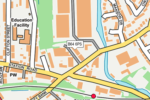
B64 6PS is located in the Cradley Heath and Old Hill electoral ward, within the metropolitan district of Sandwell and the English Parliamentary constituency of Halesowen and Rowley Regis. The Sub Integrated Care Board (ICB) Location is NHS Black Country ICB - D2P2L and the police force is West Midlands. This postcode has been in use since January 1980.


GetTheData
Source: OS OpenMap – Local (Ordnance Survey)
Source: OS VectorMap District (Ordnance Survey)
Licence: Open Government Licence (requires attribution)
| Easting | 396203 |
| Northing | 286059 |
| Latitude | 52.472451 |
| Longitude | -2.057326 |
GetTheData
Source: Open Postcode Geo
Licence: Open Government Licence
| Country | England |
| Postcode District | B64 |
➜ See where B64 is on a map ➜ Where is Old Hill? | |
GetTheData
Source: Land Registry Price Paid Data
Licence: Open Government Licence
Elevation or altitude of B64 6PS as distance above sea level:
| Metres | Feet | |
|---|---|---|
| Elevation | 140m | 459ft |
Elevation is measured from the approximate centre of the postcode, to the nearest point on an OS contour line from OS Terrain 50, which has contour spacing of ten vertical metres.
➜ How high above sea level am I? Find the elevation of your current position using your device's GPS.
GetTheData
Source: Open Postcode Elevation
Licence: Open Government Licence
| Ward | Cradley Heath And Old Hill |
| Constituency | Halesowen And Rowley Regis |
GetTheData
Source: ONS Postcode Database
Licence: Open Government Licence
| Old Hill Station (Station Rd) | Old Hill | 118m |
| Beauty Bank (Station Rd) | Old Hill | 154m |
| Old Hill Station (Beauty Bank) | Old Hill | 158m |
| Old Hill Station (Station Rd) | Old Hill | 163m |
| Beauty Bank (Station Rd) | Old Hill | 181m |
| Old Hill Station | 0.2km |
| Rowley Regis Station | 1.9km |
| Cradley Heath Station | 2.3km |
GetTheData
Source: NaPTAN
Licence: Open Government Licence
Estimated total energy consumption in B64 6PS by fuel type, 2015.
| Consumption (kWh) | 56,869 |
|---|---|
| Meter count | 8 |
| Mean (kWh/meter) | 7,109 |
| Median (kWh/meter) | 1 |
GetTheData
Source: Postcode level gas estimates: 2015 (experimental)
Source: Postcode level electricity estimates: 2015 (experimental)
Licence: Open Government Licence
GetTheData
Source: ONS Postcode Database
Licence: Open Government Licence


➜ Get more ratings from the Food Standards Agency
GetTheData
Source: Food Standards Agency
Licence: FSA terms & conditions
| Last Collection | |||
|---|---|---|---|
| Location | Mon-Fri | Sat | Distance |
| Waterfall Lane / Station Road | 17:30 | 12:00 | 79m |
| Station Road / Penn St | 17:30 | 12:00 | 181m |
| Halesowen Road / Harcourt Road | 17:30 | 12:00 | 368m |
GetTheData
Source: Dracos
Licence: Creative Commons Attribution-ShareAlike
The below table lists the International Territorial Level (ITL) codes (formerly Nomenclature of Territorial Units for Statistics (NUTS) codes) and Local Administrative Units (LAU) codes for B64 6PS:
| ITL 1 Code | Name |
|---|---|
| TLG | West Midlands (England) |
| ITL 2 Code | Name |
| TLG3 | West Midlands |
| ITL 3 Code | Name |
| TLG37 | Sandwell |
| LAU 1 Code | Name |
| E08000028 | Sandwell |
GetTheData
Source: ONS Postcode Directory
Licence: Open Government Licence
The below table lists the Census Output Area (OA), Lower Layer Super Output Area (LSOA), and Middle Layer Super Output Area (MSOA) for B64 6PS:
| Code | Name | |
|---|---|---|
| OA | E00050378 | |
| LSOA | E01009956 | Sandwell 035D |
| MSOA | E02002077 | Sandwell 035 |
GetTheData
Source: ONS Postcode Directory
Licence: Open Government Licence
| B64 6RJ | Waterfall Lane | 81m |
| B64 6PL | Station Road | 107m |
| B64 6NW | Great Western Drive | 123m |
| B64 6SH | Luanne Close | 140m |
| B64 6PJ | Beauty Bank | 150m |
| B64 6NS | Station Road | 154m |
| B64 6NU | Station Road | 177m |
| B64 6RH | Wrights Lane | 182m |
| B64 6SJ | Kererwin Close | 190m |
| B64 6NR | Station Road | 234m |
GetTheData
Source: Open Postcode Geo; Land Registry Price Paid Data
Licence: Open Government Licence