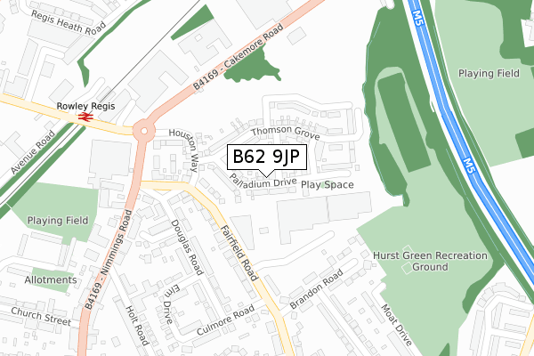
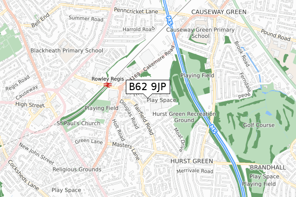
B62 9JP is located in the Halesowen North electoral ward, within the metropolitan district of Dudley and the English Parliamentary constituency of Halesowen and Rowley Regis. The Sub Integrated Care Board (ICB) Location is NHS Black Country ICB - D2P2L and the police force is West Midlands. This postcode has been in use since August 2019.


GetTheData
Source: OS Open Zoomstack (Ordnance Survey)
Licence: Open Government Licence (requires attribution)
Attribution: Contains OS data © Crown copyright and database right 2024
Source: Open Postcode Geo
Licence: Open Government Licence (requires attribution)
Attribution: Contains OS data © Crown copyright and database right 2024; Contains Royal Mail data © Royal Mail copyright and database right 2024; Source: Office for National Statistics licensed under the Open Government Licence v.3.0
| Easting | 398322 |
| Northing | 286459 |
| Latitude | 52.476073 |
| Longitude | -2.026127 |
GetTheData
Source: Open Postcode Geo
Licence: Open Government Licence
| Country | England |
| Postcode District | B62 |
➜ See where B62 is on a map ➜ Where is Halesowen? | |
GetTheData
Source: Land Registry Price Paid Data
Licence: Open Government Licence
| Ward | Halesowen North |
| Constituency | Halesowen And Rowley Regis |
GetTheData
Source: ONS Postcode Database
Licence: Open Government Licence
2023 18 APR £390,000 |
2022 26 MAY £360,000 |
27, PALLADIUM DRIVE, HALESOWEN, B62 9JP 2021 29 JAN £327,330 |
31, PALLADIUM DRIVE, HALESOWEN, B62 9JP 2020 30 OCT £279,950 |
35, PALLADIUM DRIVE, HALESOWEN, B62 9JP 2020 23 OCT £362,995 |
33, PALLADIUM DRIVE, HALESOWEN, B62 9JP 2020 23 OCT £329,450 |
25, PALLADIUM DRIVE, HALESOWEN, B62 9JP 2020 20 OCT £355,335 |
37, PALLADIUM DRIVE, HALESOWEN, B62 9JP 2020 16 OCT £290,696 |
14, PALLADIUM DRIVE, HALESOWEN, B62 9JP 2020 25 SEP £332,906 |
29, PALLADIUM DRIVE, HALESOWEN, B62 9JP 2020 15 SEP £329,950 |
GetTheData
Source: HM Land Registry Price Paid Data
Licence: Contains HM Land Registry data © Crown copyright and database right 2024. This data is licensed under the Open Government Licence v3.0.
| Nimmings Rd (Fairfield Rd) | Hurst Green | 128m |
| Brandon Rd (Fairfield Rd) | Hurst Green | 159m |
| Nimmings Rd (Fairfield Rd) | Hurst Green | 205m |
| Brandon Rd (Fairfield Rd) | Hurst Green | 264m |
| Rowley Regis Station (Station Rd) | Rowley Regis | 357m |
| Rowley Regis Station | 0.4km |
| Old Hill Station | 2.1km |
| Langley Green Station | 2.4km |
GetTheData
Source: NaPTAN
Licence: Open Government Licence
| Percentage of properties with Next Generation Access | 42.9% |
| Percentage of properties with Superfast Broadband | 42.9% |
| Percentage of properties with Ultrafast Broadband | 42.9% |
| Percentage of properties with Full Fibre Broadband | 42.9% |
Superfast Broadband is between 30Mbps and 300Mbps
Ultrafast Broadband is > 300Mbps
| Percentage of properties unable to receive 2Mbps | 0.0% |
| Percentage of properties unable to receive 5Mbps | 0.0% |
| Percentage of properties unable to receive 10Mbps | 0.0% |
| Percentage of properties unable to receive 30Mbps | 0.0% |
GetTheData
Source: Ofcom
Licence: Ofcom Terms of Use (requires attribution)
GetTheData
Source: ONS Postcode Database
Licence: Open Government Licence


➜ Get more ratings from the Food Standards Agency
GetTheData
Source: Food Standards Agency
Licence: FSA terms & conditions
| Last Collection | |||
|---|---|---|---|
| Location | Mon-Fri | Sat | Distance |
| Blackheath Station | 17:15 | 12:00 | 408m |
| Hurst Green Post Office | 17:15 | 12:00 | 420m |
| Boundary Avenue / Oldbury Road | 17:15 | 12:00 | 646m |
GetTheData
Source: Dracos
Licence: Creative Commons Attribution-ShareAlike
The below table lists the International Territorial Level (ITL) codes (formerly Nomenclature of Territorial Units for Statistics (NUTS) codes) and Local Administrative Units (LAU) codes for B62 9JP:
| ITL 1 Code | Name |
|---|---|
| TLG | West Midlands (England) |
| ITL 2 Code | Name |
| TLG3 | West Midlands |
| ITL 3 Code | Name |
| TLG36 | Dudley |
| LAU 1 Code | Name |
| E08000027 | Dudley |
GetTheData
Source: ONS Postcode Directory
Licence: Open Government Licence
The below table lists the Census Output Area (OA), Lower Layer Super Output Area (LSOA), and Middle Layer Super Output Area (MSOA) for B62 9JP:
| Code | Name | |
|---|---|---|
| OA | E00049555 | |
| LSOA | E01009798 | Dudley 026E |
| MSOA | E02002025 | Dudley 026 |
GetTheData
Source: ONS Postcode Directory
Licence: Open Government Licence
| B62 9HY | Fairfield Road | 143m |
| B62 9HS | Douglas Road | 200m |
| B62 9JD | Fairfield Road | 202m |
| B62 9QD | Brandon Road | 202m |
| B62 9HX | Douglas Road | 223m |
| B62 9HR | Douglas Road | 250m |
| B62 9HU | Birch Drive | 251m |
| B62 9QB | Westfield Road | 305m |
| B62 9PZ | Moat Drive | 308m |
| B62 9HP | Culmore Road | 310m |
GetTheData
Source: Open Postcode Geo; Land Registry Price Paid Data
Licence: Open Government Licence