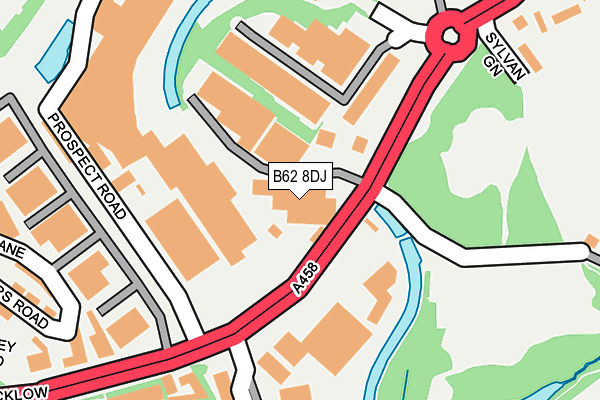
B62 8DJ is located in the Halesowen North electoral ward, within the metropolitan district of Dudley and the English Parliamentary constituency of Halesowen and Rowley Regis. The Sub Integrated Care Board (ICB) Location is NHS Black Country ICB - D2P2L and the police force is West Midlands. This postcode has been in use since June 2001.


GetTheData
Source: OS OpenMap – Local (Ordnance Survey)
Source: OS VectorMap District (Ordnance Survey)
Licence: Open Government Licence (requires attribution)
| Easting | 397389 |
| Northing | 284096 |
| Latitude | 52.454810 |
| Longitude | -2.039850 |
GetTheData
Source: Open Postcode Geo
Licence: Open Government Licence
| Country | England |
| Postcode District | B62 |
➜ See where B62 is on a map ➜ Where is Halesowen? | |
GetTheData
Source: Land Registry Price Paid Data
Licence: Open Government Licence
Elevation or altitude of B62 8DJ as distance above sea level:
| Metres | Feet | |
|---|---|---|
| Elevation | 140m | 459ft |
Elevation is measured from the approximate centre of the postcode, to the nearest point on an OS contour line from OS Terrain 50, which has contour spacing of ten vertical metres.
➜ How high above sea level am I? Find the elevation of your current position using your device's GPS.
GetTheData
Source: Open Postcode Elevation
Licence: Open Government Licence
| Ward | Halesowen North |
| Constituency | Halesowen And Rowley Regis |
GetTheData
Source: ONS Postcode Database
Licence: Open Government Licence
| Sylvan Green (Mucklow Hill) | Halesowen | 137m |
| Sylvan Green (Mucklow Hill) | Halesowen | 151m |
| Shenstone Island (Mucklow Hill) | Halesowen | 257m |
| Shenstone Island (Mucklow Hill) | Halesowen | 342m |
| Shenstone Island (Dudley Rd) | Halesowen | 414m |
| Old Hill Station | 2.1km |
| Rowley Regis Station | 2.6km |
| Cradley Heath Station | 3.8km |
GetTheData
Source: NaPTAN
Licence: Open Government Licence
GetTheData
Source: ONS Postcode Database
Licence: Open Government Licence


➜ Get more ratings from the Food Standards Agency
GetTheData
Source: Food Standards Agency
Licence: FSA terms & conditions
| Last Collection | |||
|---|---|---|---|
| Location | Mon-Fri | Sat | Distance |
| Mucklow Hill | 17:45 | 12:00 | 168m |
| Dudley Road | 17:45 | 12:00 | 427m |
| Cobham Road/Wright Street | 17:30 | 12:00 | 642m |
GetTheData
Source: Dracos
Licence: Creative Commons Attribution-ShareAlike
The below table lists the International Territorial Level (ITL) codes (formerly Nomenclature of Territorial Units for Statistics (NUTS) codes) and Local Administrative Units (LAU) codes for B62 8DJ:
| ITL 1 Code | Name |
|---|---|
| TLG | West Midlands (England) |
| ITL 2 Code | Name |
| TLG3 | West Midlands |
| ITL 3 Code | Name |
| TLG36 | Dudley |
| LAU 1 Code | Name |
| E08000027 | Dudley |
GetTheData
Source: ONS Postcode Directory
Licence: Open Government Licence
The below table lists the Census Output Area (OA), Lower Layer Super Output Area (LSOA), and Middle Layer Super Output Area (MSOA) for B62 8DJ:
| Code | Name | |
|---|---|---|
| OA | E00049275 | |
| LSOA | E01009734 | Dudley 034A |
| MSOA | E02002033 | Dudley 034 |
GetTheData
Source: ONS Postcode Directory
Licence: Open Government Licence
| B62 8DD | Mucklow Hill | 7m |
| B62 8ER | Sylvan Green | 269m |
| B62 8EN | Somers Road | 330m |
| B62 8DX | The Queens Drive | 351m |
| B62 8BS | Mucklow Hill | 390m |
| B63 3JE | Bromsgrove Street | 447m |
| B63 3LS | Dudley Road | 469m |
| B62 8SE | Halesowen Industrial Park | 489m |
| B62 8AN | Hereward Rise | 494m |
| B63 3LP | Dudley Road | 496m |
GetTheData
Source: Open Postcode Geo; Land Registry Price Paid Data
Licence: Open Government Licence