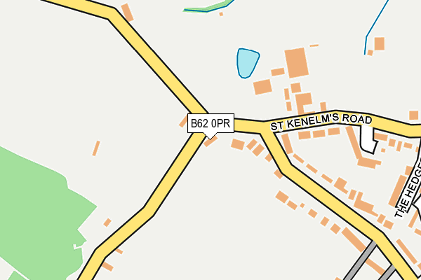
B62 0PR is located in the Belbroughton & Romsley electoral ward, within the local authority district of Bromsgrove and the English Parliamentary constituency of Bromsgrove. The Sub Integrated Care Board (ICB) Location is NHS Herefordshire and Worcestershire ICB - 18C and the police force is West Mercia. This postcode has been in use since January 1980.


GetTheData
Source: OS OpenMap – Local (Ordnance Survey)
Source: OS VectorMap District (Ordnance Survey)
Licence: Open Government Licence (requires attribution)
| Easting | 395596 |
| Northing | 279874 |
| Latitude | 52.416857 |
| Longitude | -2.066172 |
GetTheData
Source: Open Postcode Geo
Licence: Open Government Licence
| Country | England |
| Postcode District | B62 |
➜ See where B62 is on a map ➜ Where is Romsley? | |
GetTheData
Source: Land Registry Price Paid Data
Licence: Open Government Licence
Elevation or altitude of B62 0PR as distance above sea level:
| Metres | Feet | |
|---|---|---|
| Elevation | 220m | 722ft |
Elevation is measured from the approximate centre of the postcode, to the nearest point on an OS contour line from OS Terrain 50, which has contour spacing of ten vertical metres.
➜ How high above sea level am I? Find the elevation of your current position using your device's GPS.
GetTheData
Source: Open Postcode Elevation
Licence: Open Government Licence
| Ward | Belbroughton & Romsley |
| Constituency | Bromsgrove |
GetTheData
Source: ONS Postcode Database
Licence: Open Government Licence
| Dark Lane | Romsley | 139m |
| Dark Lane | Romsley | 159m |
| The Hedgerows (St Kenelms Road) | Romsley | 275m |
| The Hedgerows (St Kenelms Road) | Romsley | 290m |
| Hillcrest Road (Dark Lane) | Romsley | 400m |
| Stourbridge Junction Station | 5.7km |
| Lye (West Midlands) Station | 5.9km |
GetTheData
Source: NaPTAN
Licence: Open Government Licence
| Percentage of properties with Next Generation Access | 100.0% |
| Percentage of properties with Superfast Broadband | 100.0% |
| Percentage of properties with Ultrafast Broadband | 0.0% |
| Percentage of properties with Full Fibre Broadband | 0.0% |
Superfast Broadband is between 30Mbps and 300Mbps
Ultrafast Broadband is > 300Mbps
| Percentage of properties unable to receive 2Mbps | 0.0% |
| Percentage of properties unable to receive 5Mbps | 0.0% |
| Percentage of properties unable to receive 10Mbps | 0.0% |
| Percentage of properties unable to receive 30Mbps | 0.0% |
GetTheData
Source: Ofcom
Licence: Ofcom Terms of Use (requires attribution)
GetTheData
Source: ONS Postcode Database
Licence: Open Government Licence


➜ Get more ratings from the Food Standards Agency
GetTheData
Source: Food Standards Agency
Licence: FSA terms & conditions
| Last Collection | |||
|---|---|---|---|
| Location | Mon-Fri | Sat | Distance |
| St Kenelms Road / Back Lane Roms | 16:00 | 08:00 | 135m |
| Bromsgrove Road | 16:00 | 12:00 | 434m |
| Romsley Post Office | 17:15 | 12:00 | 659m |
GetTheData
Source: Dracos
Licence: Creative Commons Attribution-ShareAlike
The below table lists the International Territorial Level (ITL) codes (formerly Nomenclature of Territorial Units for Statistics (NUTS) codes) and Local Administrative Units (LAU) codes for B62 0PR:
| ITL 1 Code | Name |
|---|---|
| TLG | West Midlands (England) |
| ITL 2 Code | Name |
| TLG1 | Herefordshire, Worcestershire and Warwickshire |
| ITL 3 Code | Name |
| TLG12 | Worcestershire CC |
| LAU 1 Code | Name |
| E07000234 | Bromsgrove |
GetTheData
Source: ONS Postcode Directory
Licence: Open Government Licence
The below table lists the Census Output Area (OA), Lower Layer Super Output Area (LSOA), and Middle Layer Super Output Area (MSOA) for B62 0PR:
| Code | Name | |
|---|---|---|
| OA | E00164081 | |
| LSOA | E01032168 | Bromsgrove 002C |
| MSOA | E02006697 | Bromsgrove 002 |
GetTheData
Source: ONS Postcode Directory
Licence: Open Government Licence
| B62 0PQ | St Kenelms Road | 44m |
| B62 0PJ | Dark Lane | 179m |
| B62 0PT | The Alders | 209m |
| B62 0NH | Fieldhouse Lane | 267m |
| B62 0PS | The Hedgerows | 279m |
| B62 0PG | St Kenelms Road | 292m |
| B62 0PL | Dark Lane | 358m |
| B62 0NY | Waverley Crescent | 370m |
| B62 0NX | Yew Tree Place | 416m |
| B62 0NZ | Waverley Crescent | 438m |
GetTheData
Source: Open Postcode Geo; Land Registry Price Paid Data
Licence: Open Government Licence