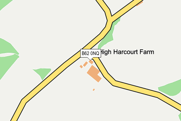
B62 0NQ is located in the Belbroughton & Romsley electoral ward, within the local authority district of Bromsgrove and the English Parliamentary constituency of Bromsgrove. The Sub Integrated Care Board (ICB) Location is NHS Herefordshire and Worcestershire ICB - 18C and the police force is West Mercia. This postcode has been in use since January 1980.


GetTheData
Source: OS OpenMap – Local (Ordnance Survey)
Source: OS VectorMap District (Ordnance Survey)
Licence: Open Government Licence (requires attribution)
| Easting | 394028 |
| Northing | 280403 |
| Latitude | 52.421583 |
| Longitude | -2.089242 |
GetTheData
Source: Open Postcode Geo
Licence: Open Government Licence
| Country | England |
| Postcode District | B62 |
➜ See where B62 is on a map | |
GetTheData
Source: Land Registry Price Paid Data
Licence: Open Government Licence
Elevation or altitude of B62 0NQ as distance above sea level:
| Metres | Feet | |
|---|---|---|
| Elevation | 260m | 853ft |
Elevation is measured from the approximate centre of the postcode, to the nearest point on an OS contour line from OS Terrain 50, which has contour spacing of ten vertical metres.
➜ How high above sea level am I? Find the elevation of your current position using your device's GPS.
GetTheData
Source: Open Postcode Elevation
Licence: Open Government Licence
| Ward | Belbroughton & Romsley |
| Constituency | Bromsgrove |
GetTheData
Source: ONS Postcode Database
Licence: Open Government Licence
| Nimmings Turn (Hagley Wood Lane) | Uffmoor Wood | 154m |
| Hagley Golf Course (Hagley Causeway) | Hagley | 1,361m |
| Hagley Wood Lane (Hagley Road) | Hagley | 1,440m |
| Lutley Lane (Hagley Rd) | Hayley Green | 1,511m |
| Church Farm (Odnall Lane) | Clent | 1,641m |
| Hagley Station | 3.9km |
| Stourbridge Junction Station | 4.2km |
| Lye (West Midlands) Station | 4.6km |
GetTheData
Source: NaPTAN
Licence: Open Government Licence
GetTheData
Source: ONS Postcode Database
Licence: Open Government Licence


➜ Get more ratings from the Food Standards Agency
GetTheData
Source: Food Standards Agency
Licence: FSA terms & conditions
| Last Collection | |||
|---|---|---|---|
| Location | Mon-Fri | Sat | Distance |
| St Kenelms Church Romsley | 12:00 | 10:30 | 537m |
| Shut Mill / Lane To Walton Hil | 11:30 | 10:00 | 1,475m |
| St Kenelms Road / Back Lane Roms | 16:00 | 08:00 | 1,770m |
GetTheData
Source: Dracos
Licence: Creative Commons Attribution-ShareAlike
The below table lists the International Territorial Level (ITL) codes (formerly Nomenclature of Territorial Units for Statistics (NUTS) codes) and Local Administrative Units (LAU) codes for B62 0NQ:
| ITL 1 Code | Name |
|---|---|
| TLG | West Midlands (England) |
| ITL 2 Code | Name |
| TLG1 | Herefordshire, Worcestershire and Warwickshire |
| ITL 3 Code | Name |
| TLG12 | Worcestershire CC |
| LAU 1 Code | Name |
| E07000234 | Bromsgrove |
GetTheData
Source: ONS Postcode Directory
Licence: Open Government Licence
The below table lists the Census Output Area (OA), Lower Layer Super Output Area (LSOA), and Middle Layer Super Output Area (MSOA) for B62 0NQ:
| Code | Name | |
|---|---|---|
| OA | E00163931 | |
| LSOA | E01032136 | Bromsgrove 002A |
| MSOA | E02006697 | Bromsgrove 002 |
GetTheData
Source: ONS Postcode Directory
Licence: Open Government Licence
| B62 0NG | Chapel Lane | 548m |
| B62 0NF | St Kenelms Road | 630m |
| B62 0NB | Walton Hill | 740m |
| B62 0NJ | Ivy Lane | 795m |
| DY9 9PE | St Kenelms Pass | 1007m |
| DY9 9PG | Clatterbach | 1088m |
| B62 0NA | Spring Lane | 1113m |
| B62 0ND | Holt Lane | 1140m |
| B62 0NE | St Kenelms Road | 1146m |
| DY9 9JR | Hagley Wood Lane | 1168m |
GetTheData
Source: Open Postcode Geo; Land Registry Price Paid Data
Licence: Open Government Licence