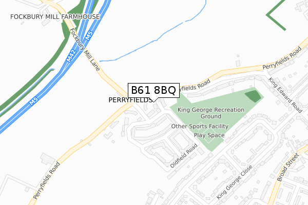
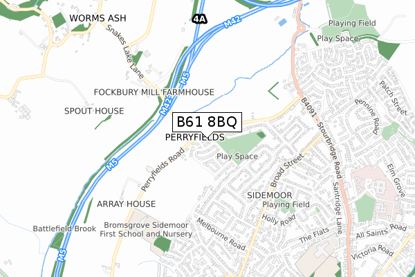
B61 8BQ is located in the Perryfields electoral ward, within the local authority district of Bromsgrove and the English Parliamentary constituency of Bromsgrove. The Sub Integrated Care Board (ICB) Location is NHS Herefordshire and Worcestershire ICB - 18C and the police force is West Mercia. This postcode has been in use since January 2019.


GetTheData
Source: OS Open Zoomstack (Ordnance Survey)
Licence: Open Government Licence (requires attribution)
Attribution: Contains OS data © Crown copyright and database right 2025
Source: Open Postcode Geo
Licence: Open Government Licence (requires attribution)
Attribution: Contains OS data © Crown copyright and database right 2025; Contains Royal Mail data © Royal Mail copyright and database right 2025; Source: Office for National Statistics licensed under the Open Government Licence v.3.0
| Easting | 395102 |
| Northing | 271920 |
| Latitude | 52.345345 |
| Longitude | -2.073317 |
GetTheData
Source: Open Postcode Geo
Licence: Open Government Licence
| Country | England |
| Postcode District | B61 |
➜ See where B61 is on a map ➜ Where is Perryfields? | |
GetTheData
Source: Land Registry Price Paid Data
Licence: Open Government Licence
| Ward | Perryfields |
| Constituency | Bromsgrove |
GetTheData
Source: ONS Postcode Database
Licence: Open Government Licence
| King George Close | Sidemoor | 311m |
| King George Close | Sidemoor | 397m |
| King George Avenue (King George Close) | Sidemoor | 485m |
| Broad Street | Sidemoor | 577m |
| Broad Street | Sidemoor | 593m |
| Bromsgrove Station | 3.1km |
GetTheData
Source: NaPTAN
Licence: Open Government Licence
GetTheData
Source: ONS Postcode Database
Licence: Open Government Licence


➜ Get more ratings from the Food Standards Agency
GetTheData
Source: Food Standards Agency
Licence: FSA terms & conditions
| Last Collection | |||
|---|---|---|---|
| Location | Mon-Fri | Sat | Distance |
| Sidemoor Post Office | 17:30 | 12:00 | 654m |
| Stourbridge Road / Broad St | 17:30 | 12:00 | 908m |
| Newtown | 17:30 | 12:00 | 1,077m |
GetTheData
Source: Dracos
Licence: Creative Commons Attribution-ShareAlike
The below table lists the International Territorial Level (ITL) codes (formerly Nomenclature of Territorial Units for Statistics (NUTS) codes) and Local Administrative Units (LAU) codes for B61 8BQ:
| ITL 1 Code | Name |
|---|---|
| TLG | West Midlands (England) |
| ITL 2 Code | Name |
| TLG1 | Herefordshire, Worcestershire and Warwickshire |
| ITL 3 Code | Name |
| TLG12 | Worcestershire CC |
| LAU 1 Code | Name |
| E07000234 | Bromsgrove |
GetTheData
Source: ONS Postcode Directory
Licence: Open Government Licence
The below table lists the Census Output Area (OA), Lower Layer Super Output Area (LSOA), and Middle Layer Super Output Area (MSOA) for B61 8BQ:
| Code | Name | |
|---|---|---|
| OA | E00164032 | |
| LSOA | E01032159 | Bromsgrove 010B |
| MSOA | E02006705 | Bromsgrove 010 |
GetTheData
Source: ONS Postcode Directory
Licence: Open Government Licence
| B61 8TH | Perryfields Road | 53m |
| B61 8BB | Oldfield Road | 138m |
| B61 8BD | Oldfield Road | 163m |
| B61 8AP | Arlingham Avenue | 200m |
| B61 8TD | Fockbury Mill Lane | 206m |
| B61 8AY | Red Pear Drive | 228m |
| B61 8PH | Crabtree Lane | 242m |
| B61 8BA | Oldfield Road | 253m |
| B61 8AX | Arlingham Avenue | 265m |
| B61 8AD | Oldfield Road | 281m |
GetTheData
Source: Open Postcode Geo; Land Registry Price Paid Data
Licence: Open Government Licence