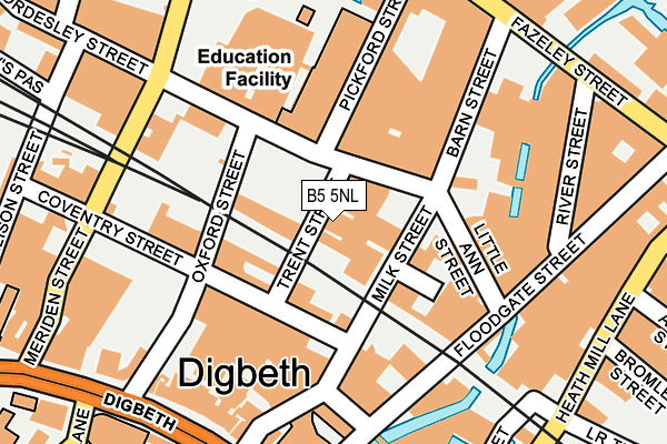
B5 5NL is located in the Bordesley & Highgate electoral ward, within the metropolitan district of Birmingham and the English Parliamentary constituency of Birmingham, Ladywood. The Sub Integrated Care Board (ICB) Location is NHS Birmingham and Solihull ICB - 15E and the police force is West Midlands. This postcode has been in use since January 1980.


GetTheData
Source: OS OpenMap – Local (Ordnance Survey)
Source: OS VectorMap District (Ordnance Survey)
Licence: Open Government Licence (requires attribution)
| Easting | 407848 |
| Northing | 286587 |
| Latitude | 52.477171 |
| Longitude | -1.885876 |
GetTheData
Source: Open Postcode Geo
Licence: Open Government Licence
| Country | England |
| Postcode District | B5 |
➜ See where B5 is on a map ➜ Where is Birmingham? | |
GetTheData
Source: Land Registry Price Paid Data
Licence: Open Government Licence
Elevation or altitude of B5 5NL as distance above sea level:
| Metres | Feet | |
|---|---|---|
| Elevation | 100m | 328ft |
Elevation is measured from the approximate centre of the postcode, to the nearest point on an OS contour line from OS Terrain 50, which has contour spacing of ten vertical metres.
➜ How high above sea level am I? Find the elevation of your current position using your device's GPS.
GetTheData
Source: Open Postcode Elevation
Licence: Open Government Licence
| Ward | Bordesley & Highgate |
| Constituency | Birmingham, Ladywood |
GetTheData
Source: ONS Postcode Database
Licence: Open Government Licence
| Birmingham Coach Station (Digbeth) | Digbeth | 216m |
| Birmingham Coach Station (Digbeth) | Digbeth | 226m |
| Birmingham Coach Station (Digbeth) | Digbeth | 245m |
| Birmingham Coach Station (Digbeth) | Digbeth | 250m |
| Fazeley St (Heath Mill Lane) | Deritend | 263m |
| Corporation Street (Midland Metro Stop) (Corporation Street) | Birmingham | 824m |
| Bull Street (Midland Metro Stop) (Bull Street) | Birmingham | 881m |
| Grand Central New Street (Midland Metro Stop) (Stephenson Street) | Birmingham | 926m |
| Snow Hill (Midland Metro Stop) (Colmore Row) | Birmingham | 1,151m |
| St Paul's (Midland Metro Stop) (Livery Street) | Jewellery Quarter | 1,618m |
| Birmingham Moor Street Station | 0.5km |
| Bordesley Station | 0.8km |
| Birmingham New Street Station | 1km |
GetTheData
Source: NaPTAN
Licence: Open Government Licence
GetTheData
Source: ONS Postcode Database
Licence: Open Government Licence

➜ Get more ratings from the Food Standards Agency
GetTheData
Source: Food Standards Agency
Licence: FSA terms & conditions
| Last Collection | |||
|---|---|---|---|
| Location | Mon-Fri | Sat | Distance |
| Meriden St / Bordsley St | 17:30 | 12:00 | 208m |
| Oxford St / Digbeth | 17:30 | 12:00 | 228m |
| 178 High St Deritend | 17:30 | 12:30 | 335m |
GetTheData
Source: Dracos
Licence: Creative Commons Attribution-ShareAlike
| Risk of B5 5NL flooding from rivers and sea | Medium |
| ➜ B5 5NL flood map | |
GetTheData
Source: Open Flood Risk by Postcode
Licence: Open Government Licence
The below table lists the International Territorial Level (ITL) codes (formerly Nomenclature of Territorial Units for Statistics (NUTS) codes) and Local Administrative Units (LAU) codes for B5 5NL:
| ITL 1 Code | Name |
|---|---|
| TLG | West Midlands (England) |
| ITL 2 Code | Name |
| TLG3 | West Midlands |
| ITL 3 Code | Name |
| TLG31 | Birmingham |
| LAU 1 Code | Name |
| E08000025 | Birmingham |
GetTheData
Source: ONS Postcode Directory
Licence: Open Government Licence
The below table lists the Census Output Area (OA), Lower Layer Super Output Area (LSOA), and Middle Layer Super Output Area (MSOA) for B5 5NL:
| Code | Name | |
|---|---|---|
| OA | E00046660 | |
| LSOA | E01009200 | Birmingham 139A |
| MSOA | E02006900 | Birmingham 139 |
GetTheData
Source: ONS Postcode Directory
Licence: Open Government Licence
| B5 5NR | Oxford Street | 98m |
| B5 5NH | Coventry Street | 118m |
| B5 5QB | Barn Street | 163m |
| B5 5LR | Meriden Street | 180m |
| B5 5SA | River Street | 182m |
| B5 6DY | Digbeth | 193m |
| B5 5LY | Meriden Street | 212m |
| B5 6HA | Rea Street | 261m |
| B5 5SE | Fazeley Street | 295m |
| B5 5PG | Bordesley Street | 301m |
GetTheData
Source: Open Postcode Geo; Land Registry Price Paid Data
Licence: Open Government Licence