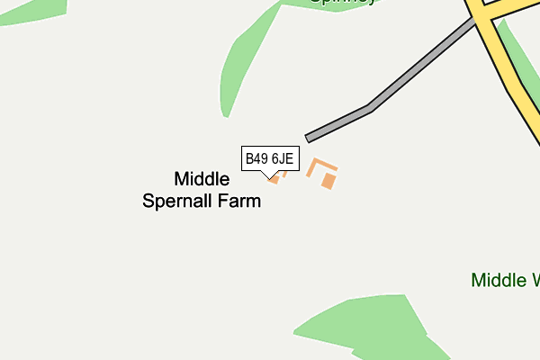
B49 6JE is located in the Wootton Wawen electoral ward, within the local authority district of Stratford-on-Avon and the English Parliamentary constituency of Stratford-on-Avon. The Sub Integrated Care Board (ICB) Location is NHS Coventry and Warwickshire ICB - B2M3M and the police force is Warwickshire. This postcode has been in use since January 1980.


GetTheData
Source: OS OpenMap – Local (Ordnance Survey)
Source: OS VectorMap District (Ordnance Survey)
Licence: Open Government Licence (requires attribution)
| Easting | 409561 |
| Northing | 261630 |
| Latitude | 52.252777 |
| Longitude | -1.861355 |
GetTheData
Source: Open Postcode Geo
Licence: Open Government Licence
| Country | England |
| Postcode District | B49 |
➜ See where B49 is on a map | |
GetTheData
Source: Land Registry Price Paid Data
Licence: Open Government Licence
Elevation or altitude of B49 6JE as distance above sea level:
| Metres | Feet | |
|---|---|---|
| Elevation | 80m | 262ft |
Elevation is measured from the approximate centre of the postcode, to the nearest point on an OS contour line from OS Terrain 50, which has contour spacing of ten vertical metres.
➜ How high above sea level am I? Find the elevation of your current position using your device's GPS.
GetTheData
Source: Open Postcode Elevation
Licence: Open Government Licence
| Ward | Wootton Wawen |
| Constituency | Stratford-on-avon |
GetTheData
Source: ONS Postcode Database
Licence: Open Government Licence
GetTheData
Source: ONS Postcode Database
Licence: Open Government Licence


➜ Get more ratings from the Food Standards Agency
GetTheData
Source: Food Standards Agency
Licence: FSA terms & conditions
| Last Collection | |||
|---|---|---|---|
| Location | Mon-Fri | Sat | Distance |
| Spernal Lane 2 Miles From Junc | 16:15 | 08:00 | 969m |
| Coughton Fields, Coughton | 16:00 | 07:00 | 1,719m |
| Alcester Rd, Coughton | 16:30 | 07:30 | 2,016m |
GetTheData
Source: Dracos
Licence: Creative Commons Attribution-ShareAlike
The below table lists the International Territorial Level (ITL) codes (formerly Nomenclature of Territorial Units for Statistics (NUTS) codes) and Local Administrative Units (LAU) codes for B49 6JE:
| ITL 1 Code | Name |
|---|---|
| TLG | West Midlands (England) |
| ITL 2 Code | Name |
| TLG1 | Herefordshire, Worcestershire and Warwickshire |
| ITL 3 Code | Name |
| TLG13 | Warwickshire CC |
| LAU 1 Code | Name |
| E07000221 | Stratford-on-Avon |
GetTheData
Source: ONS Postcode Directory
Licence: Open Government Licence
The below table lists the Census Output Area (OA), Lower Layer Super Output Area (LSOA), and Middle Layer Super Output Area (MSOA) for B49 6JE:
| Code | Name | |
|---|---|---|
| OA | E00172288 | |
| LSOA | E01031213 | Stratford-on-Avon 001A |
| MSOA | E02006504 | Stratford-on-Avon 001 |
GetTheData
Source: ONS Postcode Directory
Licence: Open Government Licence
| B80 7ES | Spernal Lane | 766m |
| B80 7EX | Spernal Lane | 850m |
| B80 7ET | Spernal Lane | 1257m |
| B49 6JD | Spernal Lane | 1432m |
| B49 6JU | Alne Hills | 1472m |
| B49 6BS | Coughton Fields Lane | 1677m |
| B49 6JT | Alne Hills | 1681m |
| B49 6JH | Burford Lane | 1747m |
| B49 5HZ | Haydon Way | 1751m |
| B49 5HX | Coughton Hill | 1832m |
GetTheData
Source: Open Postcode Geo; Land Registry Price Paid Data
Licence: Open Government Licence